Category:1997 maps of Canada
Countries of North America: Canada · Mexico · United States of America‡
‡: partly located in North America
‡: partly located in North America
| 1990 1994 1996 1997 1998 1999 → |
English: Maps of Canada from 1997 or related to Canada in 1997
Français : Les cartes du Canada de 1997 ou se rapportant au Canada en 1997
Media in category "1997 maps of Canada"
The following 3 files are in this category, out of 3 total.
-
 1997 election results.png 1,390 × 769; 96 KB
-
 Canada - DPLA - 76571277b6e47577dabd38f2e5e527dd.jpg 2,550 × 3,278; 5.33 MB
-
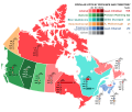 Canada 1997 Federal Election.svg 1,084 × 920; 466 KB


