Category:1998 maps of Canada
| 1990 1994 1996 1997 1998 1999 → |
English: Maps of Canada from 1998 or related to Canada in 1998
Français : Les cartes du Canada de 1998 ou se rapportant au Canada en 1998
Media in category "1998 maps of Canada"
The following 10 files are in this category, out of 10 total.
-
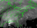
 1998 Ice Storm GOES8-ir-1998-01-09-0015TU.png 800 × 600; 179 KB
-
 1998 Ice Storm map.png 1,500 × 772; 519 KB
-
 1998 North American ice storm Jetstream 1998-01-08 12UTC.png 923 × 552; 351 KB
-
 Boucle GOES8-1998-01 07-09.gif 400 × 300; 1.01 MB
-
 Ice storm Wv loop.gif 602 × 400; 1.79 MB
-
 ManitobaBoundaries1998.png 758 × 747; 26 KB
-
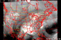
 NWS Surface map 1998-01-06.gif 1,247 × 818; 691 KB
-
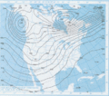 NWS Upper air map 500mb 1998-01-05.gif 752 × 662; 315 KB
-
 Situation pluie verglacante.png 706 × 648; 57 KB
-
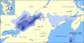
 Verglas massif 1998 trajectoire humidité.png 545 × 381; 21 KB


