Category:19th-century maps of Honduras
Media in category "19th-century maps of Honduras"
The following 7 files are in this category, out of 7 total.
-

-
 Admiralty Chart No 2425 River Hueson to False Cape, Published 1900.jpg 8,431 × 12,315; 25.2 MB
-
 Admiralty Chart No 587 Burica Point to Mangrove Bluff, Published 1882.jpg 16,213 × 11,076; 47.89 MB
-
 Antiguo Mapa de Honduras.JPG 910 × 716; 168 KB
-
 Explorations and adventures in Honduras (1857) (14765624495).jpg 1,825 × 3,315; 756 KB
-
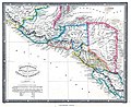 Guatemala or United States of Central America.jpg 3,927 × 3,204; 11.06 MB
-


_(14765624495).jpg)

