Category:2006 in the London Borough of Bromley
Boroughs of London: City of London · City of Westminster · Barking and Dagenham · Barnet · Bexley · Brent · Bromley · Camden · Croydon · Ealing · Enfield · Greenwich · Hackney · Hammersmith and Fulham · Haringey · Harrow · Havering · Hillingdon · Hounslow · Islington · Kensington and Chelsea · Kingston · Lambeth · Lewisham · Merton · Newham · Redbridge · Richmond · Southwark · Sutton · Tower Hamlets · Waltham Forest · Wandsworth
Media in category "2006 in the London Borough of Bromley"
The following 65 files are in this category, out of 65 total.
-
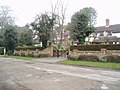 'One Chimney', Bickley, Kent - geograph.org.uk - 137095.jpg 640 × 480; 109 KB
-
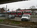 Tramlink-Tram2536-07.jpg 1,600 × 1,200; 871 KB
-
 Tramlink-Tram2536-interior.jpg 1,600 × 1,200; 878 KB
-
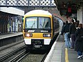
 465004 at Beckenham Junction 01.jpg 1,600 × 1,200; 888 KB
-
 465004 at Beckenham Junction 02.jpg 1,600 × 1,200; 875 KB
-
 465004 at Beckenham Junction 03.jpg 1,600 × 1,200; 851 KB
-
 465004 at Beckenham Junction 04.jpg 1,600 × 1,200; 960 KB
-
 Petts Wood station, Kent - geograph.org.uk - 137103.jpg 640 × 480; 97 KB
-
 Chelsfield Railway Station.jpg 1,600 × 1,200; 412 KB
-
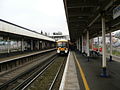
 Bromley North Railway Station.jpg 1,024 × 768; 428 KB
-
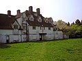
 A house in ruins^ - geograph.org.uk - 159001.jpg 640 × 480; 71 KB
-
 A London Tram - geograph.org.uk - 226612.jpg 640 × 520; 81 KB
-
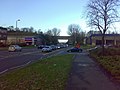
 A21 in Autumn - geograph.org.uk - 870021.jpg 640 × 480; 118 KB
-
 All Saints Cemetery, Orpington - geograph.org.uk - 873507.jpg 640 × 480; 134 KB
-

-
 Anerley Hill, London SE19 - geograph.org.uk - 391172.jpg 640 × 479; 115 KB
-
 Anerley Town Hall.jpg 2,789 × 2,058; 907 KB
-
 Avenue Road tram stop.jpg 2,304 × 1,728; 1.58 MB
-
 Beckenham Crematorium - geograph.org.uk - 306752.jpg 640 × 427; 83 KB
-
 Beckenham Junction tram stop.jpg 2,304 × 1,728; 1.64 MB
-
 Beckenham Road tram stop.jpg 2,304 × 1,728; 1.37 MB
-
 BelishaBeacon2750Canthusus.jpg 1,155 × 1,750; 495 KB
-
 Biggin Hill - geograph.org.uk - 224124.jpg 640 × 480; 92 KB
-
 Birkbeck station on the Croydon TramLink.jpg 950 × 728; 198 KB
-
 Birkbeck tram stop.jpg 2,304 × 1,728; 1.34 MB
-
 The 'Bo-Peep', near Chelsfield - geograph.org.uk - 163480.jpg 640 × 480; 93 KB
-
 Bromley Common, The Five Bells - geograph.org.uk - 240710.jpg 640 × 480; 88 KB
-
 Bromley High School, Kent - geograph.org.uk - 137093.jpg 640 × 480; 94 KB
-
 Bromley, St Mark's Church - geograph.org.uk - 240687.jpg 460 × 640; 110 KB
-
 Buckston Browne Farm, Downe, Kent - geograph.org.uk - 874390.jpg 640 × 480; 87 KB
-
 Chelsfield Parish Church - geograph.org.uk - 151128.jpg 640 × 480; 126 KB
-
 Cray Avenue - geograph.org.uk - 650153.jpg 640 × 480; 72 KB
-
 Elmers End tram stop.jpg 2,304 × 1,728; 1.39 MB
-
 Farm buildings, Cudham Grange, Kent - geograph.org.uk - 167743.jpg 640 × 480; 113 KB
-
 Goddington Park - geograph.org.uk - 151131.jpg 640 × 480; 116 KB
-
 Hockenden House, Kent - geograph.org.uk - 154770.jpg 640 × 480; 102 KB
-

-
 Julian Brimstone - geograph.org.uk - 151123.jpg 640 × 474; 68 KB
-

-

-

-
 Orpington High Street - geograph.org.uk - 658394.jpg 640 × 512; 85 KB
-

-
 Petts Wood, Kent - geograph.org.uk - 137110.jpg 640 × 480; 159 KB
-

-
 Pratts Bottom, near Orpington, Kent - geograph.org.uk - 873532.jpg 640 × 480; 92 KB
-
 Priory Gardens, Orpington, Kent - geograph.org.uk - 159075.jpg 640 × 480; 110 KB
-

-
 Ravens Bourne in Bromley Common - geograph.org.uk - 240761.jpg 640 × 480; 133 KB
-
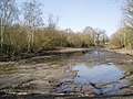 Rush Pond, Chislehurst, Kent - geograph.org.uk - 141089.jpg 640 × 480; 114 KB
-
 St. Joseph's RC Church, St. Mary Cray - geograph.org.uk - 873479.jpg 640 × 480; 101 KB
-
 Saving the planet in New Eltham - geograph.org.uk - 141101.jpg 640 × 480; 97 KB
-
 Sparrow Wood, Bromley, Kent - geograph.org.uk - 137191.jpg 640 × 480; 171 KB
-

-
 St. Luke's Cemetery, Bromley, Kent - geograph.org.uk - 137081.jpg 640 × 480; 123 KB
-
 Star Lane, near Hockenden, Kent - geograph.org.uk - 154772.jpg 640 × 480; 141 KB
-

-
 The 'Five Bells', Chelsfield, Kent - geograph.org.uk - 163497.jpg 640 × 480; 85 KB
-

-

-
 Tram at Beckenham Junction station - geograph.org.uk - 937883.jpg 640 × 480; 74 KB
-
 Twelfth fairway, West Kent Golf Club - geograph.org.uk - 167200.jpg 640 × 480; 88 KB
-
 Village Pond, Chislehurst, Kent - geograph.org.uk - 141079.jpg 640 × 480; 107 KB
-
 Watermans Square, High Street, Penge - geograph.org.uk - 494709.jpg 610 × 640; 147 KB
-
 Whitehead's Nursery - geograph.org.uk - 151133.jpg 640 × 449; 26 KB


.jpg)


