Category:2009 in the London Borough of Bromley
Boroughs of London: City of London · City of Westminster · Barking and Dagenham · Barnet · Bexley · Brent · Bromley · Camden · Croydon · Ealing · Enfield · Greenwich · Hackney · Hammersmith and Fulham · Haringey · Harrow · Havering · Hillingdon · Hounslow · Islington · Kensington and Chelsea · Kingston · Lambeth · Lewisham · Merton · Newham · Redbridge · Richmond · Southwark · Sutton · Tower Hamlets · Waltham Forest · Wandsworth
Subcategories
This category has the following 3 subcategories, out of 3 total.
Media in category "2009 in the London Borough of Bromley"
The following 200 files are in this category, out of 266 total.
(previous page) (next page)-
 "The Broadway", High Street - geograph.org.uk - 1598745.jpg 640 × 426; 83 KB
-
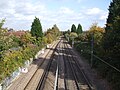
 Elmers End station - geograph.org.uk - 1203728.jpg 640 × 480; 167 KB
-
 Hugh llewelyn 456 005 (6453225583).jpg 597 × 400; 93 KB
-
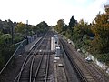
 Class 377 passing Penge West.JPG 3,664 × 2,748; 1.76 MB
-
 7th Bromley Scouts - geograph.org.uk - 1426277.jpg 640 × 480; 115 KB
-
 A20 past Swanley - geograph.org.uk - 1211074.jpg 640 × 427; 49 KB
-
 All Saints Church - geograph.org.uk - 1232337.jpg 640 × 426; 80 KB
-
 All Saints Church - geograph.org.uk - 1232365.jpg 434 × 640; 95 KB
-
 All Saints Church - geograph.org.uk - 1232369.jpg 426 × 640; 90 KB
-
 All Saints' Church - geograph.org.uk - 1340618.jpg 640 × 428; 111 KB
-
-
 Avenue Road tramstop entrance proper.JPG 2,592 × 1,944; 1.22 MB
-
 Avenue Road tramstop entrance.JPG 2,592 × 1,944; 1.21 MB
-
 Avenue Road tramstop high eastbound.JPG 2,592 × 1,944; 1.24 MB
-
 Avenue Road tramstop high westbound.JPG 2,592 × 1,944; 1.26 MB
-
 Avenue Road tramstop look east.JPG 2,592 × 1,944; 1.21 MB
-
 Avenue Road tramstop look west.JPG 2,592 × 1,944; 1.23 MB
-
 Avenue Road tramstop signage.JPG 1,944 × 2,592; 1.17 MB
-
-
 Back of Darwin's laboratory - geograph.org.uk - 1200512.jpg 474 × 640; 120 KB
-
 Barclays Bank - geograph.org.uk - 1232292.jpg 640 × 480; 102 KB
-
 Beadon Road, Bromley in the snow - geograph.org.uk - 1504095.jpg 640 × 480; 138 KB
-
 Beckenham Junction tramstop look west with Tram 2543.JPG 2,592 × 1,944; 1.21 MB
-
 Beckenham Road tram stop - geograph.org.uk - 1633975.jpg 640 × 480; 46 KB
-
 Bedford Road - geograph.org.uk - 1195628.jpg 640 × 480; 65 KB
-
 Bee on Hedge Woundwort - geograph.org.uk - 1359916.jpg 480 × 640; 57 KB
-
 Bridleway in Pratt's Bottom - geograph.org.uk - 1575516.jpg 640 × 427; 137 KB
-

-
 Bromley Tesco View - geograph.org.uk - 1358406.jpg 640 × 480; 87 KB
-
 St Peter and St Paul - geograph.org.uk - 1353679.jpg 640 × 480; 107 KB
-
 St Peter and St Paul Lych Gate - geograph.org.uk - 1353691.jpg 640 × 480; 66 KB
-
 St Peter and St Paul Tower - geograph.org.uk - 1353696.jpg 480 × 640; 83 KB
-
 Building construction, Orpington - geograph.org.uk - 1632264.jpg 640 × 480; 81 KB
-
 Bungalows - geograph.org.uk - 1161300.jpg 640 × 480; 94 KB
-
 Car Dealer, Beckenham, Kent - geograph.org.uk - 1234522.jpg 640 × 480; 70 KB
-
 Car Dealer, Bromley Common, Kent - geograph.org.uk - 1100922.jpg 640 × 480; 57 KB
-
 Car Dealer, Station Approach, Orpington - geograph.org.uk - 1145884.jpg 640 × 480; 109 KB
-
 Car Dealer, Sundridge Park, Bromley - geograph.org.uk - 1240596.jpg 640 × 480; 63 KB
-
 Carousel, Homefield Rise - geograph.org.uk - 1387217.jpg 640 × 480; 118 KB
-

-
 Central Tyre and Exhaust - geograph.org.uk - 1623775.jpg 640 × 426; 121 KB
-
 Chesil House, St Paul's Cray Road - geograph.org.uk - 1715846.jpg 640 × 426; 115 KB
-

-
 Chislehurst Common - geograph.org.uk - 1716063.jpg 640 × 426; 133 KB
-
 Chislehurst village sign - geograph.org.uk - 1715920.jpg 429 × 640; 155 KB
-
 Coal Tax Post no 186 - geograph.org.uk - 1729783.jpg 426 × 640; 146 KB
-
 Cotmandene Crescent, St Paul's Cray - geograph.org.uk - 1135469.jpg 640 × 480; 66 KB
-
 Cottage, Sevenoaks Road - geograph.org.uk - 1162638.jpg 640 × 426; 92 KB
-
 Cottages, Broom Hill - geograph.org.uk - 1195601.jpg 640 × 480; 169 KB
-
 Cray Avenue, Orpington - geograph.org.uk - 1627854.jpg 640 × 480; 55 KB
-
 Crown Inn - geograph.org.uk - 1729807.jpg 640 × 426; 89 KB
-
 Crystal Palace Athletics Stadium - geograph.org.uk - 1352835.jpg 640 × 480; 104 KB
-
 Crystal Palace Low Level station (6440811559).jpg 597 × 400; 103 KB
-
 Crystal Palace Low Level station (6453226405).jpg 597 × 400; 92 KB
-
 Crystal Palace Low Level station (6453227525).jpg 597 × 400; 115 KB
-
 Crystal Palace Park 2.jpg 3,264 × 2,448; 2.67 MB
-
 Crystal Palace station.jpg 480 × 640; 152 KB
-
 Crystal Palace transmitter - geograph.org.uk - 1744881.jpg 1,200 × 1,600; 602 KB
-
 Crystal Palace Transmitting Station at Night.jpg 2,848 × 4,272; 1.3 MB
-
 Cudham Workhouse - geograph.org.uk - 1728622.jpg 640 × 426; 77 KB
-
 Cycle path, Lower Sydenham - geograph.org.uk - 1633883.jpg 640 × 480; 79 KB
-
 Darwin's greenhouse, Down House - geograph.org.uk - 1200495.jpg 640 × 480; 125 KB
-
 Darwin's Mulberry Tree, Down House - geograph.org.uk - 1196056.jpg 425 × 640; 84 KB
-
 Derry Downs - geograph.org.uk - 1219877.jpg 640 × 480; 96 KB
-
 Derry Downs - geograph.org.uk - 1219878.jpg 640 × 480; 87 KB
-
 Derry Downs - geograph.org.uk - 1219881.jpg 640 × 480; 76 KB
-
 Down House, Downe, Kent, England -greenhouse-28March2009.jpg 3,200 × 1,948; 3.21 MB
-
 Downe, High Street - geograph.org.uk - 1398870.jpg 480 × 640; 96 KB
-
 DownHouse.jpg 10,746 × 1,996; 3.73 MB
-
 Edgehill House, Pratt's Bottom - geograph.org.uk - 1575524.jpg 640 × 427; 104 KB
-
 Eldred Drive, Orpington - geograph.org.uk - 1227620.jpg 640 × 480; 73 KB
-
 Elmers End stn Tramlink signage.JPG 1,944 × 2,592; 886 KB
-
 End of High Street, Orpington - geograph.org.uk - 1396322.jpg 640 × 416; 75 KB
-
 End of Warren Drive - geograph.org.uk - 1194965.jpg 640 × 425; 51 KB
-
 Entrance to Priory Gardens - geograph.org.uk - 1234219.jpg 640 × 426; 126 KB
-
 Entrance to Priory Gardens - geograph.org.uk - 1266668.jpg 640 × 480; 113 KB
-
 Field near Cuckoo Woods, High Elms - geograph.org.uk - 1195165.jpg 640 × 425; 74 KB
-
 Fiesta Mexicana - geograph.org.uk - 1218757.jpg 640 × 480; 98 KB
-
-
 Footpath - geograph.org.uk - 1195595.jpg 640 × 480; 91 KB
-
 Former Orpington engine shed - geograph.org.uk - 1195611.jpg 640 × 480; 139 KB
-
 Former Post Office, Bromley, Kent - geograph.org.uk - 1162221.jpg 640 × 480; 74 KB
-
 Glassmill Lane - Steep Hill 12^ - geograph.org.uk - 1436028.jpg 640 × 400; 71 KB
-
 Gorse Road - geograph.org.uk - 1593808.jpg 640 × 480; 42 KB
-
 Green Street Green Roundabout - geograph.org.uk - 1605918.jpg 640 × 426; 90 KB
-
 Green Street Green shops - geograph.org.uk - 1607411.jpg 640 × 426; 80 KB
-
 Green Street Green village sign - geograph.org.uk - 1162625.jpg 426 × 640; 100 KB
-
 Hayes Convenience - geograph.org.uk - 1337200.jpg 546 × 640; 104 KB
-
 Hayes Shops - geograph.org.uk - 1333753.jpg 640 × 480; 90 KB
-
 Hayes Village Sign - geograph.org.uk - 1335802.jpg 640 × 480; 48 KB
-
 Haywood Rise - geograph.org.uk - 1271781.jpg 640 × 480; 109 KB
-
 Hewitts Farm - geograph.org.uk - 1339903.jpg 640 × 426; 119 KB
-
 High Street, Bromley - geograph.org.uk - 1628396.jpg 640 × 480; 70 KB
-
 High Street, Bromley - geograph.org.uk - 1630866.jpg 640 × 480; 44 KB
-
 High Street, Orpington - geograph.org.uk - 1628347.jpg 640 × 480; 95 KB
-
 High Street, West Wickham - geograph.org.uk - 1628762.jpg 640 × 480; 86 KB
-

-
-
 Hodsoll Court - geograph.org.uk - 1219903.jpg 640 × 480; 84 KB
-
 Horse Pasture near Pratt's Bottom - geograph.org.uk - 1575522.jpg 640 × 427; 53 KB
-
 Housing diversity (Lucerne Road) - geograph.org.uk - 1580120.jpg 640 × 426; 98 KB
-
 Hunter Trial Course - geograph.org.uk - 1339913.jpg 640 × 426; 128 KB
-
 Jackson Road, Bromley Common - geograph.org.uk - 1556967.jpg 640 × 480; 39 KB
-

-

-
-
 Kangles Wood - geograph.org.uk - 1871474.jpg 640 × 480; 64 KB
-
 Keston Ponds - geograph.org.uk - 1101815.jpg 640 × 480; 89 KB
-
 Keston Ponds - geograph.org.uk - 1101824.jpg 480 × 640; 122 KB
-
 Keverne Road, Mottingham, London SE9 - geograph.org.uk - 1219689.jpg 640 × 480; 69 KB
-
 Killewarren Way - geograph.org.uk - 1266307.jpg 640 × 480; 77 KB
-
 Knoll Rise - geograph.org.uk - 1580142.jpg 640 × 426; 103 KB
-
 Knoll Rise - geograph.org.uk - 1580144.jpg 640 × 426; 81 KB
-
 Lakeswood Hall - geograph.org.uk - 1111000.jpg 640 × 480; 113 KB
-
 Lancing Road-Spur Road - geograph.org.uk - 1528043.jpg 640 × 480; 119 KB
-
 Leamington Avenue Playground - geograph.org.uk - 1273843.jpg 640 × 480; 92 KB
-
 Leaves Green - geograph.org.uk - 1729708.jpg 640 × 426; 103 KB
-
 Leaves Green - geograph.org.uk - 1729744.jpg 640 × 433; 88 KB
-
 Leaves Green Crescent - geograph.org.uk - 1729793.jpg 640 × 426; 87 KB
-
 Leaves Green Crescent - geograph.org.uk - 1729798.jpg 640 × 426; 96 KB
-
 Marion Crescent shops - geograph.org.uk - 1563392.jpg 640 × 480; 102 KB
-
 Market Square, Bromley - geograph.org.uk - 1162719.jpg 640 × 480; 78 KB
-

-
 Mortuary Shed, St Nicholas' Churchyard - geograph.org.uk - 1716038.jpg 640 × 426; 129 KB
-
 Mottingham War Memorial - geograph.org.uk - 1572375.jpg 640 × 480; 87 KB
-
 NatWest Bank - geograph.org.uk - 1232299.jpg 640 × 480; 84 KB
-
 Newlyn Close - geograph.org.uk - 1162601.jpg 640 × 480; 109 KB
-
 North Drive - geograph.org.uk - 1271777.jpg 640 × 480; 96 KB
-
 North end of Royal Parade - geograph.org.uk - 1530849.jpg 640 × 426; 85 KB
-
 Oakhurst - geograph.org.uk - 1276824.jpg 480 × 640; 102 KB
-
 Ode to a Grecian whatsit^ - geograph.org.uk - 1175323.jpg 365 × 640; 72 KB
-

-
 Old Hill houses - geograph.org.uk - 1606256.jpg 640 × 426; 90 KB
-
 Old House Farmhouse - geograph.org.uk - 1729738.jpg 640 × 426; 120 KB
-
 Old Woolworths signage - geograph.org.uk - 1527778.jpg 640 × 484; 88 KB
-
-
 Open space, Hayes, Kent - geograph.org.uk - 1581918.jpg 640 × 480; 88 KB
-
 Orchard Green - geograph.org.uk - 1260442.jpg 640 × 428; 93 KB
-

-
 Holy Innocents Roman Catholic Church - geograph.org.uk - 1162604.jpg 640 × 480; 64 KB
-
 Holy Innocents Roman Catholic Church - geograph.org.uk - 1162605.jpg 480 × 640; 70 KB
-
 PA31 (3694772732).jpg 3,872 × 2,592; 5.13 MB
-
 Palace Superbowl - geograph.org.uk - 1162613.jpg 480 × 640; 99 KB
-
 Papaver rhoeas - geograph.org.uk - 1340565.jpg 640 × 426; 116 KB
-

-
 Park Avenue - geograph.org.uk - 1275348.jpg 640 × 480; 95 KB
-
 Park Avenue - geograph.org.uk - 1275374.jpg 640 × 480; 134 KB
-

-
 Penfold postbox, Royal Parade - geograph.org.uk - 1530879.jpg 426 × 640; 135 KB
-
 Penge West rail station building.jpg 3,664 × 2,748; 2.28 MB
-
 Petrol Station, Croydon Road, Keston - geograph.org.uk - 1271336.jpg 640 × 480; 69 KB
-
 Petts Wood Road, Petts Wood - geograph.org.uk - 1137918.jpg 640 × 480; 81 KB
-
 St James the Great RC Church - geograph.org.uk - 1110399.jpg 640 × 480; 97 KB
-
 Pickhurst Lane, Hayes - geograph.org.uk - 1628603.jpg 640 × 480; 107 KB
-
 Piquet Road, London SE20 - geograph.org.uk - 1321793.jpg 640 × 480; 68 KB
-
 Pizza Express, High Street, Orpington - geograph.org.uk - 1218759.jpg 640 × 480; 100 KB
-
 Plawsfield Road, Beckenham - geograph.org.uk - 1581956.jpg 640 × 480; 86 KB
-

-
 Police View - geograph.org.uk - 1202881.jpg 640 × 480; 75 KB
-
 Poppies - geograph.org.uk - 1340564.jpg 640 × 426; 86 KB
-
 Poppies - geograph.org.uk - 1340595.jpg 640 × 426; 131 KB
-
 Poverest Park - geograph.org.uk - 1396315.jpg 640 × 421; 75 KB
-
 Pratt's Bottom Village Sign - geograph.org.uk - 1575550.jpg 427 × 640; 102 KB
-
 Priory Gardens - geograph.org.uk - 1234212.jpg 640 × 426; 90 KB
-
 Priory Gardens - geograph.org.uk - 1234218.jpg 640 × 426; 95 KB
-
 Public conveniences, Leaves Green - geograph.org.uk - 1729802.jpg 640 × 436; 110 KB
-

-
 Ramsden Road - geograph.org.uk - 1352063.jpg 640 × 490; 87 KB
-
 Ramsden Road - geograph.org.uk - 1352067.jpg 640 × 480; 103 KB
-

-
 Ravensbury Road, St Paul's Cray - geograph.org.uk - 1627778.jpg 640 × 480; 54 KB
-
 Ravensbury Road, St Paul's Cray - geograph.org.uk - 1627858.jpg 640 × 480; 55 KB
-
 Ravensbury Road, St Paul's Cray - geograph.org.uk - 1628028.jpg 640 × 480; 70 KB
-
 Ravensbury Road, St Paul's Cray - geograph.org.uk - 1628029.jpg 640 × 480; 110 KB
-
 RBS Offices, Bromley - geograph.org.uk - 1202954.jpg 640 × 480; 77 KB
-
 Removed signage of former Woolworths - geograph.org.uk - 1527774.jpg 480 × 640; 105 KB
-
 Repton Road - geograph.org.uk - 1606282.jpg 640 × 426; 89 KB
-
 Ridgeway Crescent Gardens - geograph.org.uk - 1273940.jpg 640 × 480; 144 KB
-
 Rowlands Manor - geograph.org.uk - 1221101.jpg 640 × 480; 144 KB
-
 Royal Oak, old and new - geograph.org.uk - 1605892.jpg 640 × 426; 69 KB
-
 Royal Parade - geograph.org.uk - 1530906.jpg 640 × 426; 100 KB
-
-
 Rutland Way - geograph.org.uk - 1266305.jpg 640 × 480; 71 KB
-
 Saltwood Close - geograph.org.uk - 1161304.jpg 640 × 480; 111 KB
-
 Salón Down House.jpg 6,328 × 2,508; 2.41 MB
-
 Sanderstead Road - geograph.org.uk - 1218761.jpg 640 × 480; 85 KB
-
 Scout Hut, Goddington Lane - geograph.org.uk - 1273963.jpg 640 × 480; 142 KB
-
 Sevenoaks Road (A21), Pratts Bottom - geograph.org.uk - 1245579.jpg 640 × 480; 67 KB
-
 Sheepcote Farm - geograph.org.uk - 1272379.jpg 640 × 480; 92 KB
-
 Sheepcote Farm - geograph.org.uk - 1272389.jpg 640 × 480; 101 KB
-

-
 Sherlies Avenue - geograph.org.uk - 1260353.jpg 640 × 426; 87 KB
-
 Shops, Beckenham Road, Beckenham - geograph.org.uk - 1581947.jpg 640 × 480; 71 KB
-

-
 Skeet Hill Lane, Well Hill - geograph.org.uk - 1593810.jpg 640 × 480; 64 KB
-
 Somerset Road - geograph.org.uk - 1528226.jpg 640 × 480; 129 KB
-
 St George's Road - geograph.org.uk - 1113948.jpg 640 × 480; 82 KB
-
 St Leonards Rise - geograph.org.uk - 1273723.jpg 640 × 480; 163 KB
-
 St Leonards Rise - geograph.org.uk - 1273739.jpg 640 × 480; 112 KB
-
 St Mary's Church Hall - geograph.org.uk - 1426283.jpg 640 × 480; 139 KB


.jpg)


_Church_of_England_Voluntary_Aided_Primary_School_-_geograph.org.uk_-_1715952.jpg)


.jpg)
.jpg)
.jpg)


_-_geograph.org.uk_-_1580120.jpg)


.jpg)


_-_geograph.org.uk_-_2260311.jpg)


,_Pratts_Bottom_-_geograph.org.uk_-_1245579.jpg)


