Category:2009 in the London Borough of Havering
Boroughs of London: City of London · City of Westminster · Barking and Dagenham · Barnet · Bexley · Brent · Bromley · Camden · Croydon · Ealing · Enfield · Greenwich · Hackney · Hammersmith and Fulham · Haringey · Harrow · Havering · Hillingdon · Hounslow · Islington · Kensington and Chelsea · Kingston · Lambeth · Lewisham · Merton · Newham · Redbridge · Richmond · Southwark · Sutton · Tower Hamlets · Waltham Forest · Wandsworth
Subcategories
This category has only the following subcategory.
Media in category "2009 in the London Borough of Havering"
The following 108 files are in this category, out of 108 total.
-
 Upminster railway station 013.jpg 3,648 × 2,736; 4.34 MB
-
 A naughty shot, perhaps... - geograph.org.uk - 1466223.jpg 640 × 480; 102 KB
-
 A zebra-toucan hybrid crossing - geograph.org.uk - 1479956.jpg 640 × 480; 48 KB
-
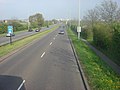
 A12 Eastern Avenue West - geograph.org.uk - 1257180.jpg 640 × 480; 61 KB
-
 A12 Eastern Avenue West - geograph.org.uk - 1257199.jpg 640 × 480; 56 KB
-
 A12 Eastern Avenue West - geograph.org.uk - 1257212.jpg 640 × 480; 56 KB
-
 A12 Eastern Avenue West - geograph.org.uk - 1265389.jpg 640 × 480; 67 KB
-

-
 Ambulance entrance, Rainham - geograph.org.uk - 1602353.jpg 640 × 430; 79 KB
-
 Archibald Road Allotments - geograph.org.uk - 1623011.jpg 640 × 480; 101 KB
-
 Aveley Marshes - geograph.org.uk - 1601640.jpg 640 × 430; 110 KB
-
 Aveley Marshes - geograph.org.uk - 1601645.jpg 640 × 430; 112 KB
-
 Bedfords Park Deer - geograph.org.uk - 1320187.jpg 640 × 428; 91 KB
-
 BP Connect, Corbets Tey Road - geograph.org.uk - 1222247.jpg 640 × 480; 75 KB
-
-

-
 Compactors on the Rainham Landfill - geograph.org.uk - 1601681.jpg 387 × 640; 65 KB
-
 Cornwell Cottages, Hornchurch - geograph.org.uk - 1254847.jpg 640 × 406; 83 KB
-
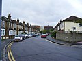 Cotleigh Road Romford - geograph.org.uk - 1280085.jpg 640 × 480; 64 KB
-
 All Saints Church, Cranham - geograph.org.uk - 1101265.jpg 425 × 640; 84 KB
-
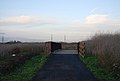
 Cycleway 13, Coldharbour Lane - geograph.org.uk - 1601697.jpg 640 × 430; 67 KB
-
 Cycleway 13, Wennington Marshes - geograph.org.uk - 1601673.jpg 640 × 430; 103 KB
-
 Cycleway 13, Wennington Marshes - geograph.org.uk - 1601675.jpg 640 × 430; 110 KB
-

-

-
 Drainage ditches, Wennington Marshes - geograph.org.uk - 1601661.jpg 640 × 430; 104 KB
-
-
 Entrance to Harrow Lodge Park - geograph.org.uk - 1136157.jpg 640 × 426; 69 KB
-
 Essex Yeoman - geograph.org.uk - 1218004.jpg 640 × 480; 70 KB
-

-

-

-
-
 Gelsthorpe Road, Collier Row - geograph.org.uk - 1131070.jpg 640 × 426; 54 KB
-
 Industrial Estate, Rainham - geograph.org.uk - 1602237.jpg 640 × 430; 108 KB
-
 Industrial Estate, Rainham - geograph.org.uk - 1602238.jpg 640 × 430; 104 KB
-
 Is it a boat^ - geograph.org.uk - 1471878.jpg 640 × 480; 65 KB
-
 Junction of Popular Street and Mawney Road - geograph.org.uk - 1626297.jpg 3,689 × 2,978; 2.72 MB
-

-
 Let's all go to the yellow house - geograph.org.uk - 1623331.jpg 640 × 480; 113 KB
-
 London bus in Upminster 016.jpg 3,648 × 2,736; 3.59 MB
-
 London bus in Upminster 045.jpg 3,648 × 2,736; 3.83 MB
-
 London to Southend railway - geograph.org.uk - 1278430.jpg 640 × 461; 82 KB
-

-
 Looking up Shepherds Hill - geograph.org.uk - 1623318.jpg 640 × 480; 122 KB
-
 Main Road, Gidea Park - geograph.org.uk - 1557553.jpg 640 × 426; 100 KB
-
 Masons Arms, Upminster, RM14 (3766601961).jpg 3,250 × 2,166; 2.33 MB
-

-
 Optimist Tavern, Upminster, RM14 (3766594735).jpg 3,339 × 2,226; 2.68 MB
-

-
 Pettits Lane in Romford in the snow.jpg 3,072 × 2,304; 1.22 MB
-
 Pipeline Bridge near Coldharbour Lane - geograph.org.uk - 1601685.jpg 640 × 430; 108 KB
-
 Pipeline carried over Coldharbour Lane - geograph.org.uk - 1601737.jpg 640 × 430; 105 KB
-
 Platform one - geograph.org.uk - 1205447.jpg 640 × 428; 69 KB
-
 Pylon on the edge of Rainham - geograph.org.uk - 1602199.jpg 640 × 430; 109 KB
-
 Pylon on the edge of Rainham - geograph.org.uk - 1602212.jpg 640 × 430; 94 KB
-
 Pylon on the edge of Rainham - geograph.org.uk - 1602218.jpg 640 × 430; 104 KB
-
 Pylon on the edge of Rainham - geograph.org.uk - 1602243.jpg 367 × 640; 89 KB
-
 Pylon on the edge of Rainham Marshes - geograph.org.uk - 1602208.jpg 430 × 640; 70 KB
-
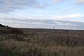
 Pylons crossing Rainham Marshes - geograph.org.uk - 1602215.jpg 640 × 430; 99 KB
-
 Rainham Clock Tower and War Memorial - geograph.org.uk - 1602336.jpg 640 × 507; 94 KB
-
 Rainham Clock Tower and War Memorial - geograph.org.uk - 1602339.jpg 640 × 430; 130 KB
-
 Rainham Hall - geograph.org.uk - 1602306.jpg 640 × 420; 136 KB
-
 Rainham Library - geograph.org.uk - 1602313.jpg 640 × 430; 126 KB
-
 Gravestones, Rainham Church - geograph.org.uk - 1602350.jpg 640 × 430; 160 KB
-
 Romford hornchurch boundary marker.JPG 768 × 1,024; 200 KB
-
 Romford Ice Rink - geograph.org.uk - 1461994.jpg 640 × 480; 49 KB
-
 Sailing Lake at Stubbers - geograph.org.uk - 1601384.jpg 640 × 428; 96 KB
-
 Severn Avenue, Gidea Park - geograph.org.uk - 1557544.jpg 640 × 425; 115 KB
-

-
 Shops, Station Lane, Hornchurch - geograph.org.uk - 1472638.jpg 640 × 480; 74 KB
-
 Shut up shop - geograph.org.uk - 1263612.jpg 640 × 428; 83 KB
-
 Skateboard Park London Road Romford - geograph.org.uk - 1280092.jpg 3,264 × 2,448; 2.77 MB
-
 Sluice on a ditch, Coldharbour Lane - geograph.org.uk - 1601688.jpg 640 × 430; 128 KB
-
-
 South Street Romford.jpg 3,072 × 2,304; 1.38 MB
-

-

-

-

-
 Terraced housing at Queens Park Road - geograph.org.uk - 1623300.jpg 640 × 480; 74 KB
-
 Thatching Straw^ - geograph.org.uk - 1417287.jpg 640 × 428; 66 KB
-
 The Broadway, Elm Park - geograph.org.uk - 1472598.jpg 640 × 480; 71 KB
-
 The New Angel Inn, Rainham - geograph.org.uk - 1602326.jpg 640 × 430; 121 KB
-
 The Parish Church of Saint Laurence - geograph.org.uk - 1222210.jpg 640 × 480; 58 KB
-
 The sunset 20 minutes later - geograph.org.uk - 1299510.jpg 640 × 480; 48 KB
-
 Time Tees Cars - geograph.org.uk - 1218024.jpg 640 × 480; 84 KB
-
-

-
-
 Tylers Wood - geograph.org.uk - 1205080.jpg 426 × 640; 95 KB
-
 Tylers Wood Path - geograph.org.uk - 1205067.jpg 426 × 640; 110 KB
-
 Upminster Methodist Church - geograph.org.uk - 1101099.jpg 640 × 425; 65 KB
-
 View across the Wennington Marshes - geograph.org.uk - 1601648.jpg 640 × 411; 64 KB
-
 View from Cockabourne Bridge - geograph.org.uk - 1623311.jpg 640 × 480; 110 KB
-

-

-

-

-
 Warehouses, Coldharbour Lane - geograph.org.uk - 1601786.jpg 640 × 430; 96 KB
-

-
 Windmill, Upminster, RM14 (3767391864).jpg 3,382 × 1,902; 2.59 MB
-
 Winifred Road, Hornchurch - geograph.org.uk - 1472662.jpg 640 × 480; 64 KB
-
 Woodland in Bedfords Park - geograph.org.uk - 1557740.jpg 640 × 426; 100 KB
-
 Woolies no more - geograph.org.uk - 1205442.jpg 640 × 428; 81 KB
-
 Yin Court, Upminster, London (3766522069).jpg 3,776 × 2,520; 4.08 MB
-
 Yin Court, Upminster, London (3767323260).jpg 3,968 × 2,232; 3.73 MB
-
 Yin Court, Upminster, London (3767325956).jpg 3,968 × 2,232; 3.74 MB


.jpg)

.jpg)


.jpg)


.jpg)
.jpg)
.jpg)