Category:2009 in the London Borough of Barnet
Boroughs of London: City of London · City of Westminster · Barking and Dagenham · Barnet · Bexley · Brent · Bromley · Camden · Croydon · Ealing · Enfield · Greenwich · Hackney · Hammersmith and Fulham · Haringey · Harrow · Havering · Hillingdon · Hounslow · Islington · Kensington and Chelsea · Kingston · Lambeth · Lewisham · Merton · Newham · Redbridge · Richmond · Southwark · Sutton · Tower Hamlets · Waltham Forest · Wandsworth
Subcategories
This category has the following 3 subcategories, out of 3 total.
Media in category "2009 in the London Borough of Barnet"
The following 194 files are in this category, out of 194 total.
-
 'The Dell' Orchard Avenue, Finchley - geograph.org.uk - 1583328.jpg 640 × 480; 66 KB
-
 1995 stock at West Finchley.JPG 2,272 × 1,704; 826 KB
-
 1995 stock manufactures plate.JPG 2,272 × 1,704; 1.24 MB
-
 New Southgate Station - geograph.org.uk - 1507188.jpg 458 × 640; 198 KB
-
 82 Bus on Finchley Road - geograph.org.uk - 1579059.jpg 640 × 480; 73 KB
-
 83 bus North End Road - geograph.org.uk - 1103219.jpg 640 × 480; 85 KB
-
-

-
 A407, Cricklewood Lane - geograph.org.uk - 1386115.jpg 427 × 640; 142 KB
-
 Abbots Gardens - geograph.org.uk - 1140895.jpg 640 × 427; 188 KB
-
 Amberden Avenue Bus Stop - geograph.org.uk - 1357008.jpg 640 × 451; 203 KB
-

-

-
 Artwork, Golders Hill Park NW11 - geograph.org.uk - 1597351.jpg 480 × 640; 80 KB
-
 Back From Swimming - geograph.org.uk - 1178621.jpg 640 × 427; 144 KB
-
 Back to The Station - geograph.org.uk - 1577962.jpg 640 × 429; 190 KB
-
 Back To Work - geograph.org.uk - 1499183.jpg 640 × 428; 146 KB
-
 Barnet Court House - geograph.org.uk - 1255615.jpg 640 × 422; 130 KB
-
 Barnet Hill, Barnet - geograph.org.uk - 1637222.jpg 640 × 480; 51 KB
-

-

-
 Blues and Twos on the High Road - geograph.org.uk - 1349135.jpg 640 × 414; 195 KB
-
 BP Connect, Dollis Hill - geograph.org.uk - 1130628.jpg 640 × 427; 146 KB
-
 Bridge Inspection - geograph.org.uk - 1602903.jpg 640 × 450; 204 KB
-
 Bulwer Road, Barnet - geograph.org.uk - 1706548.jpg 1,600 × 1,200; 686 KB
-
 Burnt oak library.JPG 2,048 × 1,536; 813 KB
-
 Bus Stop Beside Hendon Way - geograph.org.uk - 1357139.jpg 640 × 408; 191 KB
-
 Cherry tree woods finchley.JPG 2,442 × 1,857; 1.61 MB
-
 Christchurch Avenue - geograph.org.uk - 1140765.jpg 640 × 480; 74 KB
-
 Church End Library.JPG 2,048 × 1,536; 812 KB
-
 Clitterhouse Road - geograph.org.uk - 1537427.jpg 640 × 398; 119 KB
-
 Closed Furniture-Land - geograph.org.uk - 1478481.jpg 640 × 381; 140 KB
-
 Coe's Alley - geograph.org.uk - 1579273.jpg 374 × 640; 114 KB
-
 College Farm2009.JPG 2,816 × 2,112; 2.86 MB
-
 Coming Through - geograph.org.uk - 1499188.jpg 640 × 402; 188 KB
-
 Corbel at Copthall - geograph.org.uk - 1130038.jpg 640 × 427; 138 KB
-
 Dawn on Ballards Lane - geograph.org.uk - 1567979.jpg 640 × 410; 133 KB
-
 Dawn on Station Road - geograph.org.uk - 1567939.jpg 640 × 427; 150 KB
-
 Doggie Amenities - geograph.org.uk - 1317905.jpg 640 × 451; 239 KB
-
 Dollis brook viaduct.JPG 2,048 × 1,536; 793 KB
-

-
 East Finchley stn roundel.JPG 1,600 × 1,200; 264 KB
-
 Ecolectric - geograph.org.uk - 1480055.jpg 360 × 640; 141 KB
-
 Edgware bus station 055.jpg 3,648 × 2,736; 4.42 MB
-
 Edgware station high southbound.JPG 2,048 × 1,536; 761 KB
-
 Edgware station platform 2 looking north.JPG 2,592 × 1,944; 1.12 MB
-
 Edgware station platform 2 looking south.JPG 2,048 × 1,536; 793 KB
-
 Edgware station platform 3 looking north.JPG 1,600 × 1,200; 575 KB
-
 Edgware station platform 3 looking south.JPG 1,600 × 1,200; 600 KB
-
 Edgware station platform 3 looking south2.JPG 2,592 × 1,944; 1.08 MB
-
 Edgware station roundel2.JPG 1,944 × 2,592; 1.13 MB
-
 Edgware tube station 033.jpg 3,648 × 2,736; 4.21 MB
-
 Edgware tube station 034.jpg 3,648 × 2,736; 4.65 MB
-
 Edgware tube station 036.jpg 3,648 × 2,736; 4.16 MB
-
 Edgware tube station 037.jpg 3,648 × 2,736; 4.15 MB
-
 Edgware tube station 041.jpg 3,648 × 2,736; 4.04 MB
-
 Edgware tube station 042.jpg 3,648 × 2,736; 4.3 MB
-
 Edgware tube station, Platforms 2 and 3 - geograph.org.uk - 1304130.jpg 640 × 480; 107 KB
-
 Edgware tube station, Platforms 2 and 3 - geograph.org.uk - 1304151.jpg 640 × 480; 105 KB
-
 Edgware, Canons Park gate pillars - geograph.org.uk - 1418861.jpg 640 × 480; 92 KB
-

-
 Edgware, Garden City - geograph.org.uk - 1422701.jpg 640 × 480; 77 KB
-
 Edgware, The Quadrant - geograph.org.uk - 1418971.jpg 640 × 480; 81 KB
-
 Everyone Breathe in Please... - geograph.org.uk - 1170648.jpg 640 × 415; 188 KB
-

-
 Finchley and Totteridge Car Centre - geograph.org.uk - 1331635.jpg 640 × 427; 158 KB
-
 Finchley Central stn info signage.JPG 1,600 × 1,200; 617 KB
-
 Finchley Central stn roundel.JPG 1,200 × 1,600; 598 KB
-
 Finchley Central Underground Station - geograph.org.uk - 1637299.jpg 640 × 480; 42 KB
-
 Finchley Central Underground Station - geograph.org.uk - 1637302.jpg 640 × 480; 86 KB
-
 Finchley Central Underground Station - geograph.org.uk - 1637303.jpg 640 × 480; 68 KB
-
 Finchley Road A 598, Temple Fortune - geograph.org.uk - 1579067.jpg 640 × 480; 77 KB
-
 Finchley Road NW11 - geograph.org.uk - 1624724.jpg 480 × 640; 63 KB
-
 Finchley Road, NW11 - geograph.org.uk - 1225519.jpg 412 × 624; 297 KB
-

-

-
 Fire Escape - geograph.org.uk - 1478487.jpg 409 × 640; 205 KB
-
 First Bus of the Day - geograph.org.uk - 1359638.jpg 640 × 434; 106 KB
-
 Flower garden - geograph.org.uk - 1550857.jpg 640 × 480; 111 KB
-
 Friary park victory.JPG 1,932 × 2,956; 1.06 MB
-
 Glebe Road - geograph.org.uk - 1626576.jpg 640 × 457; 244 KB
-

-

-
-
 Golders Green Sorting Office - geograph.org.uk - 1141334.jpg 640 × 429; 162 KB
-

-

-
 Hadley Green - geograph.org.uk - 1255651.jpg 427 × 640; 214 KB
-
 Hadley Highstone - geograph.org.uk - 1257367.jpg 434 × 640; 192 KB
-
 Hadley Highstone - geograph.org.uk - 1257374.jpg 640 × 427; 132 KB
-
 Hampden Road, Colney Hatch - geograph.org.uk - 1164614.jpg 640 × 480; 67 KB
-
 Hampstead Heath Extension - geograph.org.uk - 1276520.jpg 640 × 480; 60 KB
-
 Handley Grove - geograph.org.uk - 1553577.jpg 640 × 427; 124 KB
-
 Hervey Close - geograph.org.uk - 1144020.jpg 640 × 452; 176 KB
-
 Hervey Close - geograph.org.uk - 1144028.jpg 640 × 427; 165 KB
-
 Holders Hill Circus - geograph.org.uk - 1130624.jpg 640 × 406; 159 KB
-

-

-
 House on Hadley Green - geograph.org.uk - 1255663.jpg 640 × 427; 181 KB
-
 Houses on Finchley Road NW11 - geograph.org.uk - 1624762.jpg 640 × 480; 86 KB
-
 Houses on Ravenscroft Avenue - geograph.org.uk - 1142072.jpg 640 × 427; 154 KB
-
 Housing on Devonshire Road - geograph.org.uk - 1130619.jpg 640 × 456; 182 KB
-

-
 Jesus Lives on Mortimer Close - geograph.org.uk - 1386129.jpg 640 × 417; 156 KB
-
 Jesus Loves You - geograph.org.uk - 1130290.jpg 640 × 427; 319 KB
-
 Jewish Cemetery, Hoop Lane NW11 - geograph.org.uk - 1623393.jpg 640 × 480; 105 KB
-
 Junction of A41 at Hendon Central - geograph.org.uk - 1640394.jpg 640 × 480; 61 KB
-

-
 Junction of Squires Lane and Long Lane - geograph.org.uk - 1144056.jpg 427 × 640; 156 KB
-
 Keeping Score - geograph.org.uk - 1464444.jpg 640 × 461; 214 KB
-
 Leeside Crescent, Temple Fortune - geograph.org.uk - 1304917.jpg 640 × 480; 86 KB
-
 Lidbury Square, Mill Hill - geograph.org.uk - 1510105.jpg 640 × 480; 66 KB
-
 Lily Pond - geograph.org.uk - 1550866.jpg 640 × 480; 88 KB
-
 Lincoln Parade - geograph.org.uk - 1580527.jpg 640 × 398; 128 KB
-

-
 London low emission zone sign.jpg 640 × 427; 182 KB
-

-
 Marsh Marigold - geograph.org.uk - 1255657.jpg 640 × 427; 252 KB
-
 Menorah, Finchley Road NW11 - geograph.org.uk - 1617263.jpg 480 × 640; 76 KB
-

-
 Mill Hill Broadway stn fast platforms look south3.JPG 1,600 × 1,200; 475 KB
-

-
 Mill Hill East Station - geograph.org.uk - 1129486.jpg 640 × 427; 120 KB
-
 Mill hill library 2009.JPG 2,048 × 1,536; 816 KB
-
 Mill Hill, John Keble Church - geograph.org.uk - 1422650.jpg 640 × 485; 50 KB
-
 Mirrors Within Mirrors - geograph.org.uk - 1507255.jpg 444 × 640; 173 KB
-

-
 Multiple Sclerosis National Centre - geograph.org.uk - 1556179.jpg 640 × 426; 158 KB
-
 Night Shift - geograph.org.uk - 1527522.jpg 640 × 427; 118 KB
-
 North Circular Road - geograph.org.uk - 1122436.jpg 640 × 436; 76 KB
-
 North Circular Road, Brent Cross - geograph.org.uk - 1358018.jpg 640 × 398; 157 KB
-
 Oakleigh Park railway station, Greater London, 2009 (geograph 3241379).jpg 1,024 × 768; 234 KB
-
-
 Old White Lion, East Finchley, London (3316084940).jpg 2,848 × 2,136; 2.39 MB
-
 On A Shout - geograph.org.uk - 1579276.jpg 640 × 414; 183 KB
-
 Open gates - geograph.org.uk - 1550854.jpg 640 × 480; 97 KB
-
 Page Street - geograph.org.uk - 1130298.jpg 640 × 427; 187 KB
-
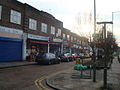
 Parade of Shops, Woodhouse Road - geograph.org.uk - 1626370.jpg 640 × 405; 206 KB
-
 Park view from the flower garden - geograph.org.uk - 1550858.jpg 640 × 480; 102 KB
-
 Passing East Finchley Station - geograph.org.uk - 1608856.jpg 640 × 460; 232 KB
-
 Path through the trees - geograph.org.uk - 1550847.jpg 640 × 480; 116 KB
-
 Phoenix, East Finchley, N2.jpg 2,848 × 2,136; 2.06 MB
-
 Please Find Alternate Route - geograph.org.uk - 1386092.jpg 640 × 408; 177 KB
-
 Portsdown Mews - geograph.org.uk - 1141352.jpg 640 × 427; 129 KB
-
 Powerleague Copthall - geograph.org.uk - 1130369.jpg 640 × 421; 145 KB
-
 Princess Park Manor - geograph.org.uk - 1506995.jpg 640 × 401; 237 KB
-

-
 Railway and disused signal box - geograph.org.uk - 1275533.jpg 640 × 480; 91 KB
-
 Rani Vegetarian, Finchley, London (3350424818).jpg 3,968 × 2,232; 3.28 MB
-
 Rasper Road - geograph.org.uk - 1479689.jpg 640 × 403; 138 KB
-
 Rotherwick Road NW11 - geograph.org.uk - 1624750.jpg 640 × 480; 78 KB
-

-
 Saturday Evening Traffic - geograph.org.uk - 1609347.jpg 640 × 384; 208 KB
-
 Semi-detached houses, Hoop Lane NW11 - geograph.org.uk - 1624770.jpg 640 × 480; 55 KB
-
 Semi-Detached on the A1000 - geograph.org.uk - 1479957.jpg 640 × 388; 149 KB
-
-
 Shops and Cottages on St. Albans Road - geograph.org.uk - 1577772.jpg 640 × 421; 148 KB
-
 Signs - geograph.org.uk - 1501812.jpg 398 × 640; 176 KB
-
 Site of the former mill hill hale railway station 2009.JPG 2,048 × 1,536; 816 KB
-
 Snowing on Finchley Road NW1 - geograph.org.uk - 1624738.jpg 480 × 640; 81 KB
-

-

-
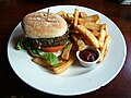 Spinach and lentil burger with chips - Old White Lion, East Finchley, London.jpg 2,848 × 2,136; 2.4 MB
-
 St Barnabas church.jpg 1,950 × 2,925; 3.4 MB
-

-
 St Mary, Monken Hadley, Herts - geograph.org.uk - 1494552.jpg 640 × 410; 70 KB
-
 St Mary, Monken Hadley, Herts - geograph.org.uk - 1494553.jpg 640 × 449; 80 KB
-
 St. John The Apostle - geograph.org.uk - 1479695.jpg 640 × 427; 143 KB
-
 St.Marylebone Cemetery - geograph.org.uk - 1626549.jpg 640 × 436; 225 KB
-
 Stanley Road Playing Fields - geograph.org.uk - 1626520.jpg 396 × 640; 147 KB
-
 Station Approach - geograph.org.uk - 1507143.jpg 640 × 410; 176 KB
-
 Station footpath, Finchley Road NW11 - geograph.org.uk - 1624542.jpg 480 × 640; 84 KB
-
 Sunday Cyclists - geograph.org.uk - 1501798.jpg 640 × 429; 104 KB
-
 Sunset to the west of the Burroughs. - geograph.org.uk - 1514059.jpg 640 × 480; 35 KB
-
 The Holy Cross and St. Michael - geograph.org.uk - 1142100.jpg 640 × 432; 146 KB
-
 The Lane in Winter - geograph.org.uk - 1144042.jpg 640 × 427; 159 KB
-
 The Orange Tree, Totteridge Village - geograph.org.uk - 1464455.jpg 640 × 427; 187 KB
-
 The Refectory, Finchley Road NW11 - geograph.org.uk - 1624715.jpg 480 × 640; 70 KB
-
 The Ridgeway, Golders Green - geograph.org.uk - 1640401.jpg 640 × 480; 55 KB
-
 The Spaniards Inn - panoramio.jpg 3,317 × 2,673; 4.65 MB
-
 The Vale - geograph.org.uk - 1553325.jpg 640 × 427; 134 KB
-
 The White Lion, Barnet, Herts - geograph.org.uk - 1584070.jpg 640 × 417; 59 KB
-
 To 42A Temple Gardens NW11 - geograph.org.uk - 1141317.jpg 640 × 427; 150 KB
-
 Totteridge Village Green - geograph.org.uk - 1464416.jpg 640 × 427; 139 KB
-
 Underground on Heathfield Gardens - geograph.org.uk - 1357111.jpg 640 × 373; 137 KB
-
 Underhill, Barnet - geograph.org.uk - 1637212.jpg 640 × 480; 70 KB
-
 Uno Kitchens - geograph.org.uk - 1479668.jpg 640 × 395; 164 KB
-
 Vernon Court, Hendon Way - geograph.org.uk - 1554699.jpg 640 × 480; 52 KB
-
 View Across the Dollis Valley - geograph.org.uk - 1175354.jpg 427 × 640; 198 KB
-
 View from Barnet Hill - geograph.org.uk - 1637225.jpg 640 × 480; 45 KB
-
 Warwick Road, Barnet - geograph.org.uk - 1706563.jpg 1,594 × 1,081; 543 KB
-
 Where Once There Were Tracks - geograph.org.uk - 1129536.jpg 427 × 640; 216 KB
-

-
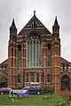
 Woodhouse College - geograph.org.uk - 1626346.jpg 640 × 490; 276 KB


_Viaduct_-_geograph.org.uk_-_1510134.jpg)


.jpg)

.jpg)


.jpg)


