Category:2007 in the Isle of Man
Wikimedia category | |||||
| Upload media | |||||
| Instance of | |||||
|---|---|---|---|---|---|
| Category combines topics | |||||
| Isle of Man | |||||
historic nation and a self-governing British Crown dependency  someja satełitar in agosto    | |||||
| Instance of | |||||
| Part of |
| ||||
| Location | Irish Sea | ||||
| Capital | |||||
| Legislative body | |||||
| Executive body | |||||
| Official language | |||||
| Anthem | |||||
| Currency | |||||
| Head of state |
| ||||
| Head of government |
| ||||
| Inception |
| ||||
| Highest point | |||||
| Population |
| ||||
| Area |
| ||||
| Top-level Internet domain | |||||
| Different from | |||||
| official website | |||||
 | |||||
English: 2007 in the Isle of Man
Svenska: 2007 i Isle of Man
Subcategories
This category has the following 2 subcategories, out of 2 total.
*
T
- 2007 Isle of Man TT (8 F)
Media in category "2007 in the Isle of Man"
The following 45 files are in this category, out of 45 total.
-
 023 11thmilestone.jpg 477 × 727; 362 KB
-
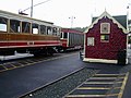
 Snaefell summit station - geograph.org.uk - 475873.jpg 480 × 640; 35 KB
-
 Snaefell summit station - geograph.org.uk - 476390.jpg 640 × 480; 41 KB
-
-
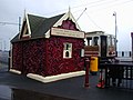
 Bungalow tram station - geograph.org.uk - 1925920.jpg 1,600 × 1,200; 456 KB
-
 Beach at The Lhen - geograph.org.uk - 469808.jpg 640 × 427; 119 KB
-
-
 Beach near Bride - geograph.org.uk - 640631.jpg 427 × 640; 101 KB
-
 Derelict building at the Lhen - geograph.org.uk - 513716.jpg 640 × 480; 108 KB
-
 Douglas beach - geograph.org.uk - 478045.jpg 640 × 480; 41 KB
-
 Douglas Beach at Low Tide - geograph.org.uk - 505953.jpg 640 × 480; 110 KB
-
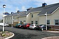
 Dreemskerry Road Ballajora Isle of Man 2007.JPG 2,560 × 1,712; 1.3 MB
-
 Footpath above Glen Mona - geograph.org.uk - 475139.jpg 640 × 480; 116 KB
-
 Isle of Man Hospice exterior-1 2007.JPG 2,560 × 1,712; 1.37 MB
-
 Isle of Man Hospice exterior-2 2007.JPG 2,560 × 1,712; 1.43 MB
-
 Isle of Man Hospice In-Patient Reception sign 2007.JPG 2,560 × 1,712; 1.26 MB
-
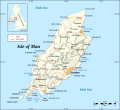 Isle of Man map-en.svg 1,200 × 1,100; 686 KB
-
 IsleOfMan SheadingsAndParishes-en.svg 1,200 × 1,100; 222 KB
-
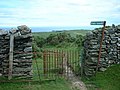 Kissing gate above Glen Mona - geograph.org.uk - 475144.jpg 640 × 480; 96 KB
-
 Land beside Mount Murray golf club car park 2007.jpg 2,560 × 1,712; 1.53 MB
-
 Laxey beach - geograph.org.uk - 503018.jpg 640 × 479; 71 KB
-
-
-
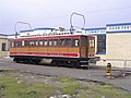
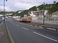
 Manx Tram passing through Ballajora 2007.JPG 2,560 × 1,712; 1.36 MB
-
 Mount Murray golf club car park-1 2007.jpg 2,560 × 1,712; 1.52 MB
-
 Mount Murray golf club car park-2 2007.jpg 2,560 × 1,712; 1.43 MB
-
 Old Laxey - geograph.org.uk - 472509.jpg 640 × 480; 207 KB
-
 Old Laxey - geograph.org.uk - 472511.jpg 640 × 480; 212 KB
-
 Old Laxey, beach - geograph.org.uk - 472534.jpg 640 × 480; 209 KB
-
 Port Erin beach - geograph.org.uk - 475130.jpg 640 × 480; 269 KB
-
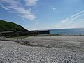
 Port Erin beach and lighthouse - geograph.org.uk - 475142.jpg 640 × 480; 228 KB
-
 Port Erin beach, and Bay Hotel - geograph.org.uk - 475156.jpg 640 × 480; 270 KB
-
 Port Erin, beach and seafront buildings - geograph.org.uk - 475137.jpg 640 × 480; 255 KB
-
 Ramsey Beach - geograph.org.uk - 477940.jpg 640 × 480; 90 KB
-
 Ramsey Beach, steps from the promenade - geograph.org.uk - 477955.jpg 640 × 444; 122 KB
-
 Rockery, Port Erin seafront - geograph.org.uk - 473153.jpg 640 × 480; 282 KB
-
 Stormy day, Douglas - geograph.org.uk - 472500.jpg 640 × 480; 217 KB
-
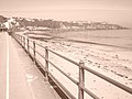
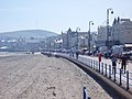 Strolling along Douglas Prom. - geograph.org.uk - 505968.jpg 640 × 480; 127 KB
-
 Summerland remains.jpg 640 × 480; 89 KB
-
 The Lifeboat station at Port Erin - geograph.org.uk - 482968.jpg 640 × 480; 81 KB
-
 The Wedding Cake - geograph.org.uk - 566474.jpg 640 × 417; 94 KB
-
 Tynwald Day, 2007 - geograph.org.uk - 725482.jpg 640 × 480; 89 KB
-
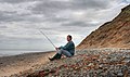 Waiting for the tide - geograph.org.uk - 570852.jpg 640 × 378; 80 KB
-
 Wave breaking, Old Laxey beach - geograph.org.uk - 472537.jpg 640 × 480; 215 KB
-
 Looking towards the coast - geograph.org.uk - 458210.jpg 640 × 426; 37 KB


