Category:2007 in the London Borough of Harrow
Boroughs of London: City of London · City of Westminster · Barking and Dagenham · Barnet · Bexley · Brent · Bromley · Camden · Croydon · Ealing · Enfield · Greenwich · Hackney · Hammersmith and Fulham · Haringey · Harrow · Havering · Hillingdon · Hounslow · Islington · Kensington and Chelsea · Kingston · Lambeth · Lewisham · Merton · Newham · Redbridge · Richmond · Southwark · Sutton · Tower Hamlets · Waltham Forest · Wandsworth
Media in category "2007 in the London Borough of Harrow"
The following 51 files are in this category, out of 51 total.
-
 Pinner tube lifts under construction.jpg 2,136 × 2,848; 2.26 MB
-
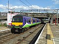
 Hugh llewelyn 321 402 (6309051677).jpg 2,592 × 1,944; 918 KB
-
 Hugh llewelyn 321 421 (6306948788).jpg 2,592 × 1,944; 1.25 MB
-
 Hugh llewelyn 321 421 (6306950348).jpg 2,592 × 1,944; 1.24 MB
-
 Hugh llewelyn 508 301 (6306431189).jpg 2,592 × 1,944; 1.21 MB
-
 16800X leaves Harrow-on-the-Hill.jpg 1,600 × 1,200; 533 KB
-
 Canons Park - geograph.org.uk - 486346.jpg 640 × 480; 85 KB
-
 Canons Park November 2007 - geograph.org.uk - 848027.jpg 640 × 480; 100 KB
-

-
 Canons Park, The Temple - geograph.org.uk - 638421.jpg 640 × 480; 107 KB
-
 Cornwall Road, Hatch End - geograph.org.uk - 371642.jpg 640 × 479; 94 KB
-
 Devonshire Road, Hatch End - geograph.org.uk - 371656.jpg 640 × 455; 84 KB
-

-

-
 Glanleam Road, Stanmore - geograph.org.uk - 2244678.jpg 1,600 × 1,200; 554 KB
-
 Harrow College Playing Fields, London Borough of Harrow, HA1 (1234343247).jpg 1,280 × 960; 316 KB
-
 Harrow on the Hill, Middlesex - geograph.org.uk - 364697.jpg 640 × 427; 74 KB
-
 Harrow, St George's Shopping and Leisure - geograph.org.uk - 528187.jpg 640 × 482; 146 KB
-
 Harrow-on-the-Hill, High Street - geograph.org.uk - 1730290.jpg 2,496 × 1,664; 3.15 MB
-
 Harrow-on-the-Hill, High Street - geograph.org.uk - 1730292.jpg 2,442 × 1,626; 2.87 MB
-
-

-

-

-
-
 Leeway Close, Hatch End - geograph.org.uk - 371669.jpg 640 × 468; 88 KB
-
 Leeway Close, Hatch End - geograph.org.uk - 371675.jpg 640 × 498; 92 KB
-
 North London Collegiate School - geograph.org.uk - 486337.jpg 640 × 480; 123 KB
-
 Northwick Park, London Borough of Harrow, HA0 HA9 (1235208970).jpg 1,280 × 960; 307 KB
-
 PA220223.JPG 1,600 × 1,200; 535 KB
-
 Pinner United Free Church - geograph.org.uk - 375402.jpg 640 × 480; 84 KB
-
 Rayners Lane station - geograph.org.uk - 830306.jpg 640 × 480; 74 KB
-
 Rayners Lane station.jpg 640 × 427; 57 KB
-
 Rayners Lane, Newton Farm Ecology Park - geograph.org.uk - 596419.jpg 640 × 480; 132 KB
-
 Roxborough Road - geograph.org.uk - 441138.jpg 640 × 480; 96 KB
-
 Roxborough Road - geograph.org.uk - 441140.jpg 640 × 480; 98 KB
-

-

-

-
 Stanmore, Culver Grove - geograph.org.uk - 477916.jpg 640 × 480; 90 KB
-

-
 The Chapel, Harrow School, Middlesex - geograph.org.uk - 364755.jpg 640 × 427; 76 KB
-

-
 Uxbridge Road, Hatch End - geograph.org.uk - 371638.jpg 640 × 479; 86 KB
-
 Uxbridge Road, Hatch End - geograph.org.uk - 371680.jpg 640 × 479; 97 KB
-
 Uxbridge Road, Hatch End, HA5 - geograph.org.uk - 371623.jpg 640 × 479; 105 KB
-
 Uxbridge Road, Hatch End, HA5 - geograph.org.uk - 371626.jpg 640 × 479; 90 KB
-
 Uxbridge Road, Hatch End, London HA5 - geograph.org.uk - 371616.jpg 640 × 460; 106 KB
-
 Wellington Road, Hatch End - geograph.org.uk - 371660.jpg 640 × 458; 115 KB
-
 Woodridings Close, Hatch End - geograph.org.uk - 371665.jpg 640 × 479; 95 KB
-
 Woodridings Close, Hatch End - geograph.org.uk - 371671.jpg 640 × 434; 93 KB

.jpg)
.jpg)
.jpg)
.jpg)


.jpg)


.jpg)


