Category:2010 maps of California
States of the United States: Alabama · Alaska · Arizona · Arkansas · California · Colorado · Connecticut · Delaware · Florida · Georgia · Hawaii · Idaho · Illinois · Indiana · Iowa · Kansas · Kentucky · Louisiana · Maine · Maryland · Massachusetts · Michigan · Minnesota · Mississippi · Missouri · Montana · Nebraska · Nevada · New Hampshire · New Jersey · New Mexico · New York · North Carolina · North Dakota · Ohio · Oklahoma · Oregon · Pennsylvania · Rhode Island · South Carolina · South Dakota · Tennessee · Texas · Utah · Vermont · Virginia · Washington · West Virginia · Wisconsin · Wyoming – Washington, D.C.
Guam · Puerto Rico
Guam · Puerto Rico
| ← 2010 2011 2012 2013 2014 2015 2016 2017 2018 2019 → |
Subcategories
This category has the following 2 subcategories, out of 2 total.
Media in category "2010 maps of California"
The following 95 files are in this category, out of 95 total.
-
 19th Avenue San Francisco.png 611 × 719; 440 KB
-
-

-

-

-

-
-
-
-
-

-

-

-

-

-

-
-

-

-

-
-

-
-

-
-
-
-

-

-

-

-
-
-
-

-

-

-

-
-

-

-

-
-

-

-

-
-

-

-

-
-
-

-

-

-
-

-

-
-
-
-
-

-
-
-
-
-
-
-
-

-
-
-
-
-
-
-
-
-
-
-
-

-
-
 2010 Census Urbanized Area Reference Map for Los Angeles--Long Beach--Anaheim, California - DPLA - 9250b202dcbce487222a90f050363015.pdf 5,404 × 4,800, 11 pages; 18.44 MB
-
-
-
-
-
 Haight-Ashbury.svg 588 × 341; 113 KB
-

-
 Race and ethnicity 2010- San Francisco, Oakland, Berkeley (5560477152).png 3,009 × 3,009; 4.76 MB
-
 San Francisco districts map.png 3,115 × 3,008; 4.16 MB
-
 San Francisco districts map.svg 406 × 418; 1.54 MB
-
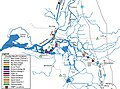 StocktonDeepwaterShippingChannel.jpg 800 × 592; 87 KB


_(cropped).png)
.png)


