Category:2013 maps of South America
Temperate regions: North America · South America · Africa · Europe · Asia · Oceania – Polar regions: – Other regions:
| ← 2010 2011 2012 2013 2014 2015 2016 2017 2018 2019 → |
Subcategories
This category has the following 6 subcategories, out of 6 total.
A
- 2013 maps of Argentina (14 F)
B
- 2013 maps of Brazil (5 F)
G
- 2013 maps of Guyana (1 F)
S
- 2013 maps of Suriname (1 F)
U
- 2013 maps of Uruguay (2 F)
V
- 2013 maps of Venezuela (1 F)
Media in category "2013 maps of South America"
The following 7 files are in this category, out of 7 total.
-
 Base Map of South America.png 2,366 × 2,813; 352 KB
-
 Brazilian States by teledensity.png 2,000 × 1,762; 290 KB
-
 Colombia departments by population 2013.png 810 × 1,089; 52 KB
-
 Español del cono sur.png 273 × 396; 10 KB
-
 FARC areas of operation.jpg 262 × 262; 81 KB
-
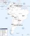
 Map of South Atlantic Cable System route.svg 1,321 × 977; 1.67 MB
-
 Mercosur-map-pt.svg 509 × 628; 144 KB


