Category:2020 presidential election maps of Colorado
States of the United States: Alabama · Alaska · Arizona · Arkansas · California · Colorado · Connecticut · Delaware · Florida · Georgia · Hawaii · Idaho · Illinois · Indiana · Iowa · Kansas · Kentucky · Louisiana · Maine · Maryland · Massachusetts · Michigan · Minnesota · Mississippi · Missouri · Montana · Nebraska · Nevada · New Hampshire · New Jersey · New York · North Carolina · Ohio · Pennsylvania · Texas
Media in category "2020 presidential election maps of Colorado"
The following 7 files are in this category, out of 7 total.
-
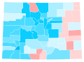
 CO President 2020.svg 810 × 589; 16.8 MB
-
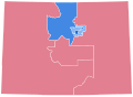 CO-20-pres-districts.svg 810 × 589; 619 KB
-
 Colorado County Flips 2020.svg 810 × 589; 44 KB
-
 Colorado County Swing 2020.svg 744 × 548; 316 KB
-
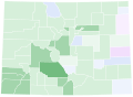
 Colorado County Trend 2020.svg 744 × 548; 316 KB
-
-


svg.svg)
