Category:2020 presidential election maps of New Hampshire
States of the United States: Alabama · Alaska · Arizona · Arkansas · California · Colorado · Connecticut · Delaware · Florida · Georgia · Hawaii · Idaho · Illinois · Indiana · Iowa · Kansas · Kentucky · Louisiana · Maine · Maryland · Massachusetts · Michigan · Minnesota · Mississippi · Missouri · Montana · Nebraska · Nevada · New Hampshire · New Jersey · New York · North Carolina · Ohio · Pennsylvania · Texas
Media in category "2020 presidential election maps of New Hampshire"
The following 17 files are in this category, out of 17 total.
-
 2020NHGOPpresidentialCD.svg 810 × 810; 47 KB
-
 2020NHGOPpresidentialCDprimary.svg 810 × 810; 47 KB
-
 2020NHGOPpresidentialprimary.svg 744 × 744; 49 KB
-
 2020NHGOPprimary.svg 810 × 810; 14 KB
-
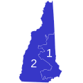
 Hillsborough County NH 2020 Presidential Results.svg 619 × 393; 239 KB
-
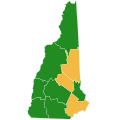
 New Hampshire County Flips 2020.svg 1,024 × 1,024; 88 KB
-
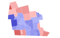
 New Hampshire County Swing 2020.svg 744 × 744; 51 KB
-
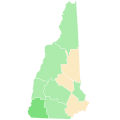
 New Hampshire County Trend 2020.svg 744 × 744; 51 KB
-

-

-
-
-

-

-
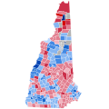
 New Hampshire Presidential Results 2020 by Municipality.svg 810 × 810; 99 KB
-
 NH President 2020.svg 810 × 810; 1.03 MB
-
 Primaria de Nuevo Hampshire 2020, resultados por condado.svg 1,758 × 3,072; 80 KB


,_2020.svg)

,_2020.svg)

.svg)


