Category:20th-century maps of Bangladesh
Countries of Asia: Afghanistan · Armenia‡ · Azerbaijan‡ · Bangladesh · Cambodia · People's Republic of China · Cyprus‡ · Egypt‡ · Georgia‡ · India · Indonesia‡ · Iran · Iraq · Israel · Japan · Jordan · Kazakhstan‡ · Kyrgyzstan · Laos · Lebanon · Malaysia · Mongolia · Myanmar · Nepal · North Korea · Oman · Pakistan · Philippines · Russia‡ · Saudi Arabia · Singapore · South Korea · Sri Lanka · Syria · Tajikistan · Thailand · Turkey‡ · Turkmenistan · United Arab Emirates · Uzbekistan · Vietnam · Yemen
Limited recognition: Abkhazia‡ · Taiwan · State of Palestine
‡: partly located in Asia
Limited recognition: Abkhazia‡ · Taiwan · State of Palestine
‡: partly located in Asia
Subcategories
This category has the following 2 subcategories, out of 2 total.
1
Media in category "20th-century maps of Bangladesh"
The following 10 files are in this category, out of 10 total.
-
 1907-east-bengal-assam3.jpg 1,200 × 994; 405 KB
-
 1947 India showing Provinces, States and Districts by Survey of India.jpg 7,867 × 6,491; 3.93 MB
-
 National Geographic Map of Indian Subcontinent.jpg 2,060 × 1,700; 1.1 MB
-
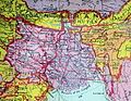
 1962 East Pakistan Map.jpg 4,524 × 6,364; 3.74 MB
-
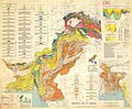 1964 Pakistan Geology Map.jpg 8,493 × 7,001; 8.4 MB
-
 Admiralty Chart No 3493 Cox's Bazaar to Mayu River, Published 1964.jpg 11,221 × 16,360; 26.65 MB
-
 Bangladesh LOC 1996 map.jpg 1,596 × 2,000; 1.5 MB
-
 Bangladesh. LOC 96685763.tif 2,007 × 2,807; 16.12 MB
-
-
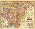
 Easter Bengal and Assam with Bhutan.jpg 1,000 × 806; 294 KB


