Category:20th-century maps of China
Countries of Asia: Afghanistan · Armenia‡ · Azerbaijan‡ · Bangladesh · Cambodia · People's Republic of China · Cyprus‡ · Egypt‡ · Georgia‡ · India · Indonesia‡ · Iran · Iraq · Israel · Japan · Jordan · Kazakhstan‡ · Kyrgyzstan · Laos · Lebanon · Malaysia · Mongolia · Myanmar · Nepal · North Korea · Oman · Pakistan · Philippines · Russia‡ · Saudi Arabia · Singapore · South Korea · Sri Lanka · Syria · Tajikistan · Thailand · Turkey‡ · Turkmenistan · United Arab Emirates · Uzbekistan · Vietnam · Yemen
Limited recognition: Abkhazia‡ · Taiwan · State of Palestine
‡: partly located in Asia
Limited recognition: Abkhazia‡ · Taiwan · State of Palestine
‡: partly located in Asia
Subcategories
This category has the following 16 subcategories, out of 16 total.
#
2
- 20th-century maps of Manchuria (11 F)
E
- Eastern China 1-50,000 (4 F)
G
M
T
- 20th-century maps of Tibet (58 F)
Media in category "20th-century maps of China"
The following 8 files are in this category, out of 8 total.
-
 China-India border. LOC 2001629012.jpg 4,165 × 3,174; 1.99 MB
-
 China-India border. LOC 2001629012.tif 4,165 × 3,174; 37.82 MB
-

-
 General sketch of China, 1927-1933.jpg 8,860 × 10,466; 15.84 MB
-
 Kartenskizze der Vertragshäfen und Eisenbahnen in China.tif 3,021 × 2,331; 20.17 MB
-
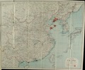 Map of China.tif 4,176 × 3,442; 41.15 MB
-
 Pieni 1 0017.jpg 3,443 × 2,552; 2.28 MB
-
 Карта к статье «Китай». Военная энциклопедия Сытина (Санкт-Петербург, 1911-1915).jpg 1,684 × 1,539; 644 KB

_(14744799346).jpg)


.jpg)