Category:19th-century maps of China
Countries of Asia: Afghanistan · Armenia‡ · Azerbaijan‡ · Bangladesh · Cambodia · People's Republic of China · Cyprus‡ · Egypt‡ · Georgia‡ · India · Indonesia‡ · Iran · Iraq · Japan · Jordan · Laos · Lebanon · Malaysia · Mongolia · Myanmar · Nepal · Oman · Pakistan · Philippines · Russia‡ · Singapore · Sri Lanka · Syria · Thailand · Turkey‡ · Turkmenistan · Uzbekistan · Vietnam · Yemen
Limited recognition: Abkhazia‡ · Taiwan · State of Palestine
‡: partly located in Asia
Limited recognition: Abkhazia‡ · Taiwan · State of Palestine
‡: partly located in Asia
Subcategories
This category has the following 16 subcategories, out of 16 total.
#
+
1
L
N
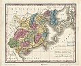
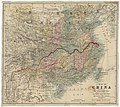
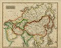
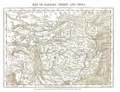
Media in category "19th-century maps of China"
The following 25 files are in this category, out of 25 total.
-
 China, Japan, etc. LOC 2006629349.jpg 4,423 × 3,585; 2.71 MB
-
 Huang chao zhi sheng di yu quan tu - Cai shang zhi - btv1b52505774d (2 of 3).jpg 15,120 × 20,033; 49.07 MB
-

-

-
 A Map of China... - btv1b8439046p (1 of 2).jpg 8,002 × 7,159; 10.43 MB
-
 A new universal atlas of the world.Asia.jpg 3,172 × 2,497; 1.59 MB
-
 Area and Population of the Chinese Empire.tif 2,904 × 3,555; 29.56 MB
-
 Chart of the East Coast of China Reeves Horsburgh 1835.jpg 8,212 × 12,034; 10.39 MB
-
 Chengde 1875-1890.jpg 29,875 × 14,490; 55.71 MB
-
 China in Asia from Court Game of Geography MET DP862916.jpg 806 × 1,200; 365 KB
-
 Chinese manuscript Huang-ch'ao i-t'ung yu-ti ch'uan-t'u. Wellcome L0020669.jpg 2,120 × 884; 853 KB
-
 Chinese manuscript Huang-ch'ao i-t'ung yu-ti ch'uan-t'u. Wellcome L0020670.jpg 1,668 × 1,130; 1.21 MB
-

-
 Geological map of the Yang-Tzé valley - btv1b531983848.jpg 9,089 × 6,341; 9.81 MB
-
 Hainan 1820-1875.jpg 11,719 × 23,437; 36.26 MB
-
 Hedin-First expedition.jpg 1,598 × 1,479; 326 KB
-
 Map of Escape Creek.jpg 912 × 734; 242 KB
-
 Map of Tartary, Thibet, and China.png 2,951 × 2,262; 6.01 MB
-
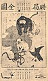 Political Map of 19th Century China(時局全圖).jpg 580 × 974; 259 KB
-
 A Map of China... - btv1b8439046p (2 of 2).jpg 7,978 × 7,150; 7.42 MB
-

-
 Tibet, Political Map of 19th Century China(時局全圖) (cropped).jpg 149 × 108; 9 KB
-

-
 Topographical map of the Yang-tze valley - btv1b53198383t.jpg 9,122 × 6,199; 8.71 MB
-
 光绪泰和城池.jpg 2,400 × 1,691; 608 KB

.jpg)
.jpg)
.jpg)
.jpg)


.jpg)
.jpg)
.jpg)
.jpg)

