Category:20th-century maps of Haiti
Countries of North America: Antigua and Barbuda · The Bahamas · Barbados · Belize · Canada · Costa Rica · Cuba · Dominica · Dominican Republic · Guatemala · Haiti · Honduras · Jamaica · Mexico · Nicaragua · Panama · Saint Kitts and Nevis · Saint Vincent and the Grenadines · Trinidad and Tobago‡ · United States of America‡
Other territories: Bermuda · Greenland · Guadeloupe · Martinique · Puerto Rico
‡: partly located in North America
Other territories: Bermuda · Greenland · Guadeloupe · Martinique · Puerto Rico
‡: partly located in North America
Subcategories
This category has the following 6 subcategories, out of 6 total.
- 1900s maps of Haiti (2 F)
Media in category "20th-century maps of Haiti"
The following 3 files are in this category, out of 3 total.
-
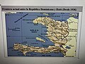 Frontera actual entre la República Dominicana y Haití .jpg 4,032 × 3,024; 8.55 MB
-
 Admiralty Chart No 465 Fort Liberte to Ile Tortuga, Published 1955.jpg 11,114 × 16,298; 24.92 MB
-
 Ernest gruening haiti.PNG 717 × 552; 317 KB


