Category:Abbey Dore
village and civil parish in Herefordshire, England  Eglwys Abadol y Santes Fair, Abbey Dore | |||||
| Upload media | |||||
| Instance of | |||||
|---|---|---|---|---|---|
| Location | Herefordshire, West Midlands, England | ||||
| Population |
| ||||
 | |||||
Main Wikipedia article: Abbey Dore.
Media in category "Abbey Dore"
The following 200 files are in this category, out of 266 total.
(previous page) (next page)-
 A glimpse into Whitfield Park - geograph.org.uk - 4774592.jpg 1,600 × 901; 722 KB
-
 A rare tree - geograph.org.uk - 1022865.jpg 480 × 640; 160 KB
-
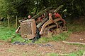 Abandoned Caterpillar at Brook Farm - geograph.org.uk - 572669.jpg 640 × 426; 147 KB
-
 Abbey Dore Court - 1 1102907 67dc9738-by-Trevor-Rickard.jpg 640 × 371; 73 KB
-
 Abbey Dore Court - 2 1102916 f46910f3-by-Trevor-Rickard.jpg 429 × 640; 121 KB
-
 Abbey Dore Court - geograph.org.uk - 3070648.jpg 640 × 480; 87 KB
-
 Abbey Dore Court - geograph.org.uk - 5270359.jpg 1,000 × 664; 947 KB
-
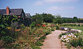 Abbey Dore Court Gardens.jpg 640 × 380; 102 KB
-
 Abbey Dore Railway Station - geograph.org.uk - 5960115.jpg 3,648 × 2,736; 3.49 MB
-
 Abbey Dore Village Hall - geograph.org.uk - 5959392.jpg 4,096 × 3,072; 5.84 MB
-
 Abbeydore station site geograph-3221935-by-Ben-Brooksbank.jpg 2,347 × 1,322; 2.48 MB
-
 Abbeydore village hall.jpg 640 × 480; 84 KB
-
 Above the Golden Valley - geograph.org.uk - 2287140.jpg 1,024 × 680; 181 KB
-

-
 Approaching Dore Abbey - geograph.org.uk - 3682145.jpg 640 × 480; 69 KB
-
 Approaching Hollingwood Farm - geograph.org.uk - 4933286.jpg 640 × 480; 85 KB
-
 Arable field near Whitfield Estate - geograph.org.uk - 2080506.jpg 3,072 × 2,304; 2.63 MB
-
 Arable land in the Grey Valley - geograph.org.uk - 2080262.jpg 640 × 480; 95 KB
-
 Arable land near Blackmoor Farm - geograph.org.uk - 2287569.jpg 1,024 × 680; 263 KB
-
 Autumn Tree at Dore Abbey - geograph.org.uk - 5959940.jpg 3,648 × 2,736; 4.85 MB
-
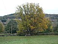 Autumn Tree by Dore Abbey - geograph.org.uk - 5959485.jpg 3,648 × 2,736; 4.24 MB
-
 B4347 from Abbey Dore towards Hay-on-Wye - geograph.org.uk - 5614430.jpg 800 × 715; 117 KB
-

-
 B4347 south of Abbey Dore - geograph.org.uk - 6137379.jpg 1,600 × 902; 651 KB
-
 Barns at Blackmoor Farm - geograph.org.uk - 6602144.jpg 640 × 480; 86 KB
-
 Beef in sunny pasture - geograph.org.uk - 4496046.jpg 800 × 600; 276 KB
-
 Below Toi et Moi at Holling Grange - geograph.org.uk - 4933344.jpg 640 × 480; 82 KB
-
 Bent gate and the Dore Valley - geograph.org.uk - 3753867.jpg 800 × 600; 325 KB
-
 Blackmoor Farm - geograph.org.uk - 2287566.jpg 1,024 × 680; 281 KB
-
 Blackmoor Farm - geograph.org.uk - 2289758.jpg 1,024 × 680; 256 KB
-
 Bullocks in field below Riverdale - geograph.org.uk - 6593252.jpg 640 × 480; 296 KB
-
 Carved choir screen, Abbey Dore - geograph.org.uk - 6588804.jpg 5,184 × 3,888; 4.12 MB
-
 Ceiling at Dore Abbey (South Aisle) - geograph.org.uk - 5959966.jpg 3,648 × 2,736; 2.68 MB
-
 Cereal field in the Grey Valley - geograph.org.uk - 4773785.jpg 1,600 × 901; 701 KB
-
 Cereal, pasture and woodland, 1 - geograph.org.uk - 4496055.jpg 800 × 450; 211 KB
-
 Cereal, pasture and woodland, 2 - geograph.org.uk - 4496058.jpg 800 × 450; 255 KB
-
 Church Sign - geograph.org.uk - 1509053.jpg 640 × 479; 100 KB
-
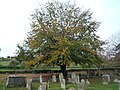
 Churchyard at Dore Abbey - geograph.org.uk - 5959937.jpg 3,648 × 2,736; 4.68 MB
-
 Churchyard at Dore Abbey - geograph.org.uk - 5959942.jpg 3,648 × 2,736; 4.66 MB
-
 Cider orchards in the Golden Valley - geograph.org.uk - 4496052.jpg 800 × 600; 260 KB
-
 Cockyard Farm - geograph.org.uk - 6602167.jpg 640 × 480; 71 KB
-
 Combine harvester at Cockyard Farm - geograph.org.uk - 6602169.jpg 640 × 480; 90 KB
-
 Combine harvester at Cockyard Farm - geograph.org.uk - 6602175.jpg 640 × 480; 106 KB
-

-
 Country lane junction - geograph.org.uk - 4504430.jpg 800 × 600; 257 KB
-
 Cwm Farm (geograph 7061247).jpg 1,024 × 768; 1,011 KB
-
 Cwm Farm - geograph.org.uk - 2364472.jpg 640 × 425; 126 KB
-
 Cwm Farm - geograph.org.uk - 5269751.jpg 1,000 × 664; 799 KB
-
 Cwm Farm - geograph.org.uk - 5269752.jpg 1,000 × 664; 612 KB
-
 Cwm Farm - geograph.org.uk - 5269754.jpg 1,000 × 664; 611 KB
-
 Cwm Farm - geograph.org.uk - 5269755.jpg 1,000 × 664; 883 KB
-
 Cwm Farm - geograph.org.uk - 5269757.jpg 1,000 × 664; 742 KB
-
 Cwm Farm - geograph.org.uk - 5269758.jpg 1,000 × 664; 694 KB
-
 Cwm Farm in the Golden Valley - geograph.org.uk - 3070645.jpg 640 × 480; 91 KB
-
 Cwm Pitch - geograph.org.uk - 206221.jpg 640 × 480; 76 KB
-
 Cwm Road west of Abbey Dore - geograph.org.uk - 5614408.jpg 800 × 750; 228 KB
-
 Deer pasture in the Golden Valley - geograph.org.uk - 3070634.jpg 640 × 480; 53 KB
-
 Descent into the Grey Valley - geograph.org.uk - 6602145.jpg 640 × 480; 75 KB
-
 Diverging footpaths - geograph.org.uk - 4504457.jpg 800 × 800; 435 KB
-
 Dore Abbey - geograph.org.uk - 6593234.jpg 480 × 640; 312 KB
-
 Dore Abbey entrance - geograph.org.uk - 5249105.jpg 640 × 480; 81 KB
-
 Dore Abbey Farm - geograph.org.uk - 5959608.jpg 3,648 × 2,736; 3.82 MB
-
 Dore Abbey Farm - geograph.org.uk - 5960098.jpg 3,648 × 2,736; 4.66 MB
-
 Dore Abbey from the churchyard - geograph.org.uk - 5249140.jpg 640 × 480; 81 KB
-
 Dore Abbey in Herefordshire - geograph.org.uk - 5249087.jpg 640 × 480; 57 KB
-
 Dore Bridge - geograph.org.uk - 2839287.jpg 690 × 518; 229 KB
-
 Drive to Longwood Farm - geograph.org.uk - 2287119.jpg 1,024 × 680; 145 KB
-
 Driveway and stile - geograph.org.uk - 1815016.jpg 426 × 640; 79 KB
-
 Driveway to Kingstone Grange Farm - geograph.org.uk - 6602339.jpg 640 × 480; 74 KB
-
 Edge of Blackmoor Plantation - geograph.org.uk - 4773778.jpg 1,600 × 901; 811 KB
-
 Edge of Blackmoor Plantation - geograph.org.uk - 928169.jpg 640 × 480; 104 KB
-

-
-

-

-

-
 Entrance to Whitfield Estate - geograph.org.uk - 2080243.jpg 3,072 × 2,304; 1.88 MB
-
 Fallen tree beside the path - geograph.org.uk - 4933331.jpg 640 × 480; 87 KB
-
 Fallow deer above the Golden Valley - geograph.org.uk - 3070641.jpg 640 × 480; 59 KB
-
 Farm building, above Moorhampton Park Farm - geograph.org.uk - 2287132.jpg 1,024 × 680; 191 KB
-
 Farm buildings at Grange Farm - geograph.org.uk - 6602147.jpg 640 × 480; 80 KB
-
 Farm buildings, Tan House Farm - geograph.org.uk - 6589541.jpg 5,184 × 3,888; 4.19 MB
-
 Farm buildings, the Dorelands - geograph.org.uk - 6593230.jpg 640 × 480; 290 KB
-
 Farm track and public footpath - geograph.org.uk - 4710156.jpg 800 × 451; 171 KB
-
 Farmhouse at Grange Farm - geograph.org.uk - 6602148.jpg 640 × 480; 96 KB
-
 Farmland at Abbey Dore - geograph.org.uk - 3567752.jpg 1,024 × 680; 182 KB
-
 Farmland near Park Farm - geograph.org.uk - 2287142.jpg 680 × 1,024; 181 KB
-
 Ffarm Hollingwood Farm, Abbey Dore - geograph.org.uk - 2859499.jpg 690 × 518; 158 KB
-
 Field gates on an Abbey Dore corner - geograph.org.uk - 5702141.jpg 800 × 521; 168 KB
-
 Field near Cockyard Farm - geograph.org.uk - 6602164.jpg 640 × 480; 81 KB
-
 Fields near Whitfield House - geograph.org.uk - 6602333.jpg 640 × 480; 83 KB
-
 Fields overlooking Dore Abbey - geograph.org.uk - 3070298.jpg 640 × 480; 74 KB
-
 Flush bracket, Abbeydore - geograph.org.uk - 6099938.jpg 2,681 × 3,903; 1.04 MB
-
 Footbridge across the River Dore - geograph.org.uk - 3070653.jpg 640 × 480; 125 KB
-
 Footpath approaching Park Farm - geograph.org.uk - 2288955.jpg 1,024 × 680; 249 KB
-
 Footpath this way - geograph.org.uk - 4500432.jpg 600 × 800; 275 KB
-
 Footpath to Ewyas Harold Common - geograph.org.uk - 2775410.jpg 1,024 × 768; 361 KB
-
 Former stables at Dore Abbey.jpg 4,000 × 3,000; 4.87 MB
-

-
 Gilbert's Hill Wood - geograph.org.uk - 2288723.jpg 1,024 × 680; 171 KB
-
 Grassy hillside - geograph.org.uk - 4500371.jpg 800 × 450; 219 KB
-
 Green lane and footpath - geograph.org.uk - 4496040.jpg 800 × 800; 578 KB
-
 Green lane near Kerry's Gate - geograph.org.uk - 2287573.jpg 680 × 1,024; 270 KB
-
 Green Man inside Dore Abbey (Ambulatory) - geograph.org.uk - 5960029.jpg 3,648 × 2,736; 3.01 MB
-
 Grey Valley - geograph.org.uk - 2080260.jpg 640 × 480; 115 KB
-
 Grey Valley - geograph.org.uk - 2080268.jpg 3,072 × 2,304; 1.94 MB
-
 Hedgerow trees - geograph.org.uk - 1812780.jpg 640 × 426; 95 KB
-
 Hillside above the Golden Valley - geograph.org.uk - 2288952.jpg 1,024 × 680; 150 KB
-
 Hollingwood Farm (geograph 7113170).jpg 1,024 × 683; 778 KB
-
 Home Farm, Dulas - geograph.org.uk - 448873.jpg 640 × 397; 228 KB
-
 House at entrance to Hill Farm - geograph.org.uk - 6602141.jpg 640 × 480; 98 KB
-
 House at Forty Acre Pitch - geograph.org.uk - 6602140.jpg 640 × 480; 78 KB
-
 Houses at Kerry's Gate - geograph.org.uk - 6602142.jpg 640 × 480; 85 KB
-
 Houses in Riverdale - geograph.org.uk - 6593259.jpg 640 × 480; 303 KB
-
 Inside Toi et Moi French restaurant - geograph.org.uk - 3707240.jpg 640 × 480; 70 KB
-
 Interior, Dore Abbey - geograph.org.uk - 6593238.jpg 480 × 640; 251 KB
-
 Ivy Green Farm - geograph.org.uk - 1812758.jpg 640 × 426; 77 KB
-
 Jury Cottage Farm - geograph.org.uk - 4773802.jpg 1,600 × 901; 734 KB
-
 Kerry's Gate - geograph.org.uk - 2290342.jpg 1,024 × 680; 202 KB
-
 Kerry's Gate - geograph.org.uk - 6602143.jpg 640 × 480; 64 KB
-
 Kingstone Grange - geograph.org.uk - 2080247.jpg 3,072 × 2,304; 1.5 MB
-
 Kingstone Grange - geograph.org.uk - 4774743.jpg 1,600 × 901; 588 KB
-
 Lambs in a field near Abbey Dore - geograph.org.uk - 1815910.jpg 640 × 426; 86 KB
-
 Lane in the Grey Valley - geograph.org.uk - 4773800.jpg 1,600 × 901; 708 KB
-
 Lane south of Brampton Hill - geograph.org.uk - 928166.jpg 640 × 480; 123 KB
-
 Lane to Abbey Dore - geograph.org.uk - 4500413.jpg 800 × 451; 265 KB
-
 Lane to Kerry's Gate - geograph.org.uk - 4496048.jpg 800 × 600; 263 KB
-
 Lane to Kerry's Gate - geograph.org.uk - 4500422.jpg 800 × 600; 290 KB
-
 Lane to Thruxton - geograph.org.uk - 4774738.jpg 1,600 × 901; 710 KB
-
 Lodge to Whitfield House - geograph.org.uk - 6602165.jpg 640 × 461; 82 KB
-
 Lowerpark and the Golden Valley - geograph.org.uk - 2287150.jpg 1,024 × 680; 183 KB
-
 Maentwlch in the Golden Valley - geograph.org.uk - 2289827.jpg 680 × 1,024; 138 KB
-
 Map Abbey Dore 1886.jpg 2,000 × 1,326; 578 KB
-
 Mill Lane at Tremorithic Road - geograph.org.uk - 4710130.jpg 800 × 451; 206 KB
-
 Minns Close Tump - geograph.org.uk - 6593245.jpg 640 × 480; 275 KB
-
 Mistletoe-laden trees - geograph.org.uk - 1812785.jpg 640 × 426; 96 KB
-
 Morehampton Park and Newcourt Farms - geograph.org.uk - 4500385.jpg 800 × 450; 302 KB
-
 Morehampton Park Farm - geograph.org.uk - 4496064.jpg 800 × 450; 316 KB
-
 Morehampton Park Farm - geograph.org.uk - 4497438.jpg 800 × 450; 225 KB
-
 Nell's Wood - geograph.org.uk - 2287561.jpg 1,024 × 680; 238 KB
-
 Newbarns Farm - geograph.org.uk - 2287125.jpg 1,024 × 680; 142 KB
-
 Newbarns Farm - geograph.org.uk - 2287127.jpg 1,024 × 680; 138 KB
-
 Newbrook Farm - geograph.org.uk - 4905095.jpg 1,600 × 901; 678 KB
-
 Newbrook Farm and Cockyard Tump - geograph.org.uk - 2289773.jpg 1,024 × 680; 169 KB
-
 Newbrook Farm and the Grey Valley - geograph.org.uk - 4905089.jpg 1,600 × 901; 699 KB
-
 Newbrook Farm sign - geograph.org.uk - 4905093.jpg 1,600 × 901; 723 KB
-
 Newcourt Farm, Bacton - geograph.org.uk - 2289836.jpg 1,024 × 680; 166 KB
-
 No Through Road - geograph.org.uk - 2288716.jpg 1,024 × 680; 201 KB
-
 Oak and beech in Big Wood - geograph.org.uk - 4905115.jpg 1,197 × 1,600; 981 KB
-
 Oak tree beside the footpath - geograph.org.uk - 4933309.jpg 640 × 480; 90 KB
-
 Oaks and meadows - geograph.org.uk - 4504443.jpg 800 × 451; 214 KB
-
 Obituary Lieut Col Prothero 1929.jpg 800 × 2,270; 457 KB
-
 Old Milepost by the B4347, Morehampton Park, Abbey Dore Parish (geograph 6044787).jpg 1,182 × 1,704; 399 KB
-
 Old Milepost by the B4347, Pontapina, Abbey Dore Parish (geograph 6047822).jpg 1,117 × 1,704; 405 KB
-

-

-
 Pasture at Ponty Pinna - geograph.org.uk - 4497069.jpg 800 × 600; 269 KB
-
 Pasture land in the Dore valley - geograph.org.uk - 2772895.jpg 1,024 × 768; 389 KB
-
 Path from Ponty Pinna - geograph.org.uk - 4497073.jpg 600 × 800; 299 KB
-
 Pond at Kingstone Grange - geograph.org.uk - 4774747.jpg 1,600 × 901; 562 KB
-
 Private drive to Red Barn - geograph.org.uk - 6137372.jpg 1,600 × 901; 824 KB
-
 Pruned orchard - geograph.org.uk - 2288340.jpg 1,024 × 680; 200 KB
-
 Public Footpath by Dore Abbey - geograph.org.uk - 5959504.jpg 3,648 × 2,736; 4.77 MB
-

-
 Red Campion, Silene dioica - geograph.org.uk - 4496034.jpg 799 × 800; 268 KB
-
 Red phonebox, Abbey Dore - geograph.org.uk - 5702068.jpg 800 × 676; 140 KB
-
 River Dore - geograph.org.uk - 206236.jpg 640 × 480; 108 KB
-
 Riverdale - geograph.org.uk - 6593249.jpg 640 × 480; 291 KB
-
 Road between Abbey Dore and Bacton - geograph.org.uk - 2288373.jpg 1,024 × 680; 185 KB
-
 Road past Blackbush Farm - geograph.org.uk - 2288346.jpg 1,024 × 680; 154 KB
-
 Road to Abbey Dore - geograph.org.uk - 1812782.jpg 640 × 426; 76 KB
-
 Road to Cockyard Tump - geograph.org.uk - 2287564.jpg 1,024 × 680; 193 KB
-
 Road to Ewyas Harold - geograph.org.uk - 2288719.jpg 1,024 × 680; 185 KB
-
 Rusty roofs of Blackmoor Farm - geograph.org.uk - 4496027.jpg 800 × 450; 271 KB
-
 Sale ad for Abbey Dore Court 1875.jpg 850 × 2,650; 626 KB
-
 Sheep by a public footpath - geograph.org.uk - 4500406.jpg 800 × 451; 259 KB
-
 Sheep in a field in the Golden Valley - geograph.org.uk - 2288333.jpg 1,024 × 680; 184 KB
-
 Sheep near Hollingwood Farm - geograph.org.uk - 1814589.jpg 640 × 426; 76 KB
-
 Sheep pasture below Newbarns Wood - geograph.org.uk - 4497442.jpg 800 × 450; 180 KB
-
 Signpost on a grass triangle, Abbey Dore - geograph.org.uk - 5702127.jpg 800 × 741; 161 KB
-
 Soggy footpath - geograph.org.uk - 928154.jpg 640 × 480; 104 KB
-
 South View bus stop, Abbey Dore - geograph.org.uk - 5614420.jpg 751 × 800; 162 KB
-
 South View, Abbey Dore - geograph.org.uk - 5614330.jpg 800 × 586; 138 KB
-
 Southern Hawker (Aeshana cyanea) - geograph.org.uk - 431439.jpg 605 × 640; 48 KB
-

-

-
 Stile over deer fencing - geograph.org.uk - 3070628.jpg 640 × 480; 81 KB
-
 Stone Street by Blackmoor farm - geograph.org.uk - 4495739.jpg 800 × 450; 259 KB
-
 Stone Street near Blackmoor farm - geograph.org.uk - 4495749.jpg 800 × 450; 230 KB
-
 Stone Street near Blackmoor farm - geograph.org.uk - 4496028.jpg 800 × 450; 313 KB
-
 Tan House Farm, Abbey Dore - geograph.org.uk - 835607.jpg 640 × 480; 84 KB
-
 The B4347 through The Golden Valley - geograph.org.uk - 2352688.jpg 816 × 612; 87 KB
-
 The Dore valley - geograph.org.uk - 2775404.jpg 1,024 × 768; 423 KB
-
 The Dore Valley - geograph.org.uk - 3753866.jpg 800 × 600; 321 KB
-
 The Golden Valley - geograph.org.uk - 1814581.jpg 640 × 426; 89 KB
-
 The Golden Valley - geograph.org.uk - 1814593.jpg 640 × 426; 81 KB
-
 The Golden Valley - geograph.org.uk - 2288941.jpg 1,024 × 680; 193 KB
-
 The Golden Valley - geograph.org.uk - 4497431.jpg 800 × 600; 329 KB
-
 The Golden Valley at Ponty Pinna - geograph.org.uk - 4496067.jpg 800 × 600; 251 KB
-
 The Grey Valley - geograph.org.uk - 928164.jpg 640 × 480; 104 KB


_-_geograph.org.uk_-_5959966.jpg)


.jpg)


_-_geograph.org.uk_-_5960029.jpg)


.jpg)


.jpg)
.jpg)
.jpg)


_-_geograph.org.uk_-_431439.jpg)


