Category:Abdon and Heath
civil parish in Shropshire, England | |||||
| Upload media | |||||
| Instance of |
| ||||
|---|---|---|---|---|---|
| Named after | |||||
| Location | Shropshire, West Midlands, England | ||||
| Population |
| ||||
 | |||||
Subcategories
This category has the following 3 subcategories, out of 3 total.
Media in category "Abdon and Heath"
The following 151 files are in this category, out of 151 total.
-
 A cottage below Brown Clee Hill - geograph.org.uk - 2081402.jpg 640 × 480; 92 KB
-

-
 Almost true - geograph.org.uk - 2269066.jpg 640 × 480; 83 KB
-
 Another obsolete telephone box - geograph.org.uk - 6278136.jpg 1,024 × 768; 338 KB
-
 Arable land, Broncroft - geograph.org.uk - 2542734.jpg 640 × 359; 66 KB
-
 Arable land, Corvedale - geograph.org.uk - 2470822.jpg 640 × 480; 95 KB
-
 Ash pile - geograph.org.uk - 2545763.jpg 640 × 480; 193 KB
-
 Blocked Doorway at St. Catherine's Church (Nave ^ Tugford) - geograph.org.uk - 5893982.jpg 3,648 × 2,736; 4.82 MB
-
 Bridge and cottages in upper Cockshutford - geograph.org.uk - 5629132.jpg 1,306 × 979; 576 KB
-

-
 Bridleway descending Brown Clee Hill - geograph.org.uk - 6276491.jpg 1,024 × 768; 295 KB
-
 Bridleway descending Brown Clee Hill - geograph.org.uk - 6278128.jpg 1,024 × 768; 309 KB
-
 Bridleway on Brown Clee Hill - geograph.org.uk - 6278125.jpg 1,024 × 768; 274 KB
-
 Brown Clee Hill - geograph.org.uk - 4903950.jpg 2,048 × 1,536; 492 KB
-
 Brown Clee Hill - geograph.org.uk - 6285673.jpg 3,648 × 2,736; 3.34 MB
-
 Brown Clee seen from Holdgate - geograph.org.uk - 4716686.jpg 1,024 × 683; 310 KB
-
 Brown heather on Brown Clee Hill - geograph.org.uk - 6278103.jpg 1,024 × 768; 475 KB
-
 Byway near Peckledy Farm - geograph.org.uk - 5633484.jpg 5,184 × 3,456; 3.66 MB
-
 Cattle at a gate - geograph.org.uk - 1008580.jpg 640 × 480; 99 KB
-
 Cereals, Corvedale - geograph.org.uk - 2470824.jpg 640 × 480; 77 KB
-
 Col on the Brown Clee - geograph.org.uk - 2269785.jpg 640 × 480; 125 KB
-
 Corve Dale at Balaam's Heath - geograph.org.uk - 6712416.jpg 800 × 605; 173 KB
-
 Corvedale grassland - geograph.org.uk - 2542738.jpg 640 × 359; 76 KB
-
 Cottages below Brown Clee Hill - geograph.org.uk - 2081429.jpg 640 × 480; 85 KB
-
 Country road passing The Damson Patch - geograph.org.uk - 6278210.jpg 1,024 × 768; 298 KB
-
 Entrance to St. Catherine's Church (Tugford) - geograph.org.uk - 5893988.jpg 3,648 × 2,736; 4.84 MB
-
 Farm buildings at Lower Norncott - geograph.org.uk - 5639927.jpg 5,184 × 3,456; 3.1 MB
-
 Farm road, Baucott - geograph.org.uk - 2542740.jpg 640 × 480; 112 KB
-
 Farmland at Tugford - geograph.org.uk - 5893987.jpg 3,648 × 2,736; 4.77 MB
-
 Farmland beneath Holdgate - geograph.org.uk - 2545740.jpg 640 × 359; 82 KB
-
 Farmland in Corve Dale - geograph.org.uk - 6712417.jpg 800 × 600; 165 KB
-
 Farmland on Brown Clee Hill - geograph.org.uk - 6278132.jpg 1,024 × 768; 261 KB
-
 Fenceline and gate on Sandy Nap - geograph.org.uk - 5628472.jpg 1,142 × 857; 419 KB
-
 Field near Cockshutford - geograph.org.uk - 4716524.jpg 1,024 × 683; 265 KB
-
 Field, Abdon - geograph.org.uk - 4716531.jpg 1,024 × 683; 303 KB
-
 Flush bracket, Brown Clee - geograph.org.uk - 2269061.jpg 640 × 480; 139 KB
-
 Footpath at Lower Norncott - geograph.org.uk - 5639918.jpg 5,184 × 3,456; 2.6 MB
-

-
 Footpath to Lower Norncott - geograph.org.uk - 5639906.jpg 5,184 × 3,456; 2.47 MB
-
 Ford at Abdon - geograph.org.uk - 4596549.jpg 1,084 × 725; 374 KB
-
 Ford at Beambridge - geograph.org.uk - 4596615.jpg 1,084 × 725; 507 KB
-
 Gate to St. Catherine's Church (Tugford) - geograph.org.uk - 5893990.jpg 3,648 × 2,736; 5.04 MB
-
 Grassland beneath the Brown Clee - geograph.org.uk - 2470826.jpg 640 × 359; 84 KB
-
 Grown out hedge, Abdon - geograph.org.uk - 2546171.jpg 640 × 480; 99 KB
-
 Heath Chapel - geograph.org.uk - 5628247.jpg 5,184 × 3,456; 2.14 MB
-
 Heath Chapel - geograph.org.uk - 5628253.jpg 5,184 × 3,456; 1.99 MB
-
 Heather on Brown Clee Hill - geograph.org.uk - 6278101.jpg 1,024 × 768; 357 KB
-
 Hey sister^ - geograph.org.uk - 2081229.jpg 640 × 480; 67 KB
-
 Holdgate - geograph.org.uk - 4716698.jpg 1,024 × 683; 262 KB
-
 Holy Trinity, Holdgate - geograph.org.uk - 4777441.jpg 3,375 × 2,244; 1.99 MB
-
 Holy Trinity, Holdgate - geograph.org.uk - 4777446.jpg 2,829 × 2,349; 1.74 MB
-
 Holy Trinity, Holdgate - geograph.org.uk - 4777454.jpg 3,168 × 2,425; 1.8 MB
-
 Holy Trinity, Holdgate - geograph.org.uk - 4777467.jpg 2,859 × 2,395; 1.73 MB
-
 Holy Trinity, Holdgate - geograph.org.uk - 4777476.jpg 3,201 × 2,129; 4.76 MB
-
 Holy Trinity, Holdgate - geograph.org.uk - 4777491.jpg 2,410 × 3,382; 2.14 MB
-
 Holy Trinity, Holdgate - geograph.org.uk - 4777500.jpg 2,200 × 3,308; 2.59 MB
-
 Horses on Brown Clee Hill - geograph.org.uk - 6278109.jpg 1,024 × 768; 233 KB
-
 House on the hillside - geograph.org.uk - 5628482.jpg 1,142 × 857; 572 KB
-
 Interior of Heath Chapel - geograph.org.uk - 5629038.jpg 3,456 × 5,184; 2.83 MB
-
 Lambs under the Brown Clee - geograph.org.uk - 2546164.jpg 640 × 480; 106 KB
-
 Land at Lower Norncott - geograph.org.uk - 5639910.jpg 5,184 × 3,456; 3.26 MB
-
 Lane crossing Abdon stream - geograph.org.uk - 2035934.jpg 640 × 480; 151 KB
-
 Lane in Corvedale towards Tugford - geograph.org.uk - 6712418.jpg 800 × 600; 133 KB
-
 Lane near Earnstrey Hall - geograph.org.uk - 2035940.jpg 640 × 480; 128 KB
-
 Livestock water tank - geograph.org.uk - 6278146.jpg 1,024 × 768; 345 KB
-

-
 Low cloud over Brown Clee Hill - geograph.org.uk - 5639923.jpg 7,479 × 4,176; 2.43 MB
-
 Lower Norncott - geograph.org.uk - 5639929.jpg 5,184 × 3,456; 2.61 MB
-
 Marsh Farm - geograph.org.uk - 6278130.jpg 1,024 × 768; 304 KB
-
 Mast on Brown Clee Hill - geograph.org.uk - 6285676.jpg 3,648 × 2,736; 3.22 MB
-
 Mast on Brown Clee Hill - geograph.org.uk - 6285685.jpg 3,648 × 2,736; 3.46 MB
-
 Masts on Brown Clee Hill - geograph.org.uk - 6285658.jpg 3,648 × 2,736; 3.48 MB
-
 Minor Road East of Beambridge - geograph.org.uk - 6344390.jpg 1,024 × 575; 266 KB
-
 Oak tree - geograph.org.uk - 6278153.jpg 1,024 × 768; 297 KB
-
 Oak, Balaam's Heath - geograph.org.uk - 2542748.jpg 640 × 480; 105 KB
-
 Oak, Corvedale - geograph.org.uk - 2542756.jpg 640 × 480; 95 KB
-

-
 Old Farm Buildings Near Tugford - geograph.org.uk - 5620514.jpg 5,184 × 3,456; 1.86 MB
-

-
 Once a green lane - geograph.org.uk - 4716696.jpg 1,024 × 683; 452 KB
-
 OS benchmark - Brown Clee, fencepost SE of memorial - geograph.org.uk - 5628387.jpg 1,224 × 1,632; 1.04 MB
-
 Passing through Baucott Farm - geograph.org.uk - 1073424.jpg 640 × 480; 89 KB
-
 Path into Oak Dingle - geograph.org.uk - 1283186.jpg 480 × 640; 365 KB
-
 Path through oilseed rape - geograph.org.uk - 2542745.jpg 640 × 359; 116 KB
-
 Path, Abdon Marsh - geograph.org.uk - 4716526.jpg 1,024 × 683; 560 KB
-
 Path, Abdon Marsh - geograph.org.uk - 4716528.jpg 1,024 × 683; 453 KB
-
 Path, Baalam's Heath - geograph.org.uk - 2542753.jpg 640 × 480; 103 KB
-
 Priest's Door at St. Catherine's Church (Tugford) - geograph.org.uk - 5893944.jpg 3,648 × 2,736; 4.68 MB
-
 Radio mast in Abdon Burf - geograph.org.uk - 6278058.jpg 768 × 1,024; 223 KB
-
 Relocated OS flush bracket on Brown Clee hill - geograph.org.uk - 5256506.jpg 1,102 × 1,469; 1.03 MB
-
 Road to Harp Farm, Heath - geograph.org.uk - 4716674.jpg 1,024 × 683; 406 KB
-
 Road to Lower Norncott - geograph.org.uk - 4716678.jpg 1,024 × 683; 326 KB
-
 September fields near Nordy Bank - geograph.org.uk - 2081387.jpg 640 × 480; 81 KB
-
 Sheep grazing at Broncroft - geograph.org.uk - 2470814.jpg 640 × 359; 63 KB
-
 Sheep in a barn, Heath - geograph.org.uk - 4716670.jpg 1,024 × 683; 376 KB
-
 Shropshire County Top - geograph.org.uk - 2269044.jpg 640 × 480; 101 KB
-
 Site of the Medieval Village of Heath - geograph.org.uk - 5629047.jpg 13,644 × 7,456; 4.57 MB
-
 St Catherine's Church, Tugford - geograph.org.uk - 5617515.jpg 4,988 × 3,361; 3.73 MB
-
 St Catherine's church, Tugford - geograph.org.uk - 6712405.jpg 800 × 610; 145 KB
-
 St. Catherine's Church (Bell Tower ^ Porch ^ Tugford) - geograph.org.uk - 5893937.jpg 3,648 × 2,736; 4.03 MB
-
 St. Catherine's Church (Bell Tower ^ Tugford) - geograph.org.uk - 5893847.jpg 3,648 × 2,736; 4.19 MB
-
 St. Catherine's Church (Bell Tower ^ Tugford) - geograph.org.uk - 5893984.jpg 3,648 × 2,736; 3.39 MB
-
 St. Catherine's Church (Bell Tower ^ Tugford) - geograph.org.uk - 5893986.jpg 2,048 × 2,730; 2.41 MB
-
 St. Catherine's Church (Chancel ^ Tugford) - geograph.org.uk - 5892963.jpg 3,648 × 2,736; 3.25 MB
-

-
 St. Catherine's Church (Font ^ Tugford) - geograph.org.uk - 5893843.jpg 3,648 × 2,736; 2.54 MB
-
 St. Catherine's Church (Lectern ^ Tugford) - geograph.org.uk - 5893829.jpg 3,648 × 2,736; 2.5 MB
-
 St. Catherine's Church (Nave ^ Tugford) - geograph.org.uk - 5893470.jpg 3,648 × 2,736; 3.09 MB
-
 St. Catherine's Church (Organ ^ Tugford) - geograph.org.uk - 5892966.jpg 3,648 × 2,736; 2.41 MB
-
 St. Catherine's Church (Porch ^ Tugford) - geograph.org.uk - 5893929.jpg 3,648 × 2,736; 4.96 MB
-
 St. Catherine's Church (Porch ^ Tugford) - geograph.org.uk - 5893934.jpg 3,648 × 2,736; 4.86 MB
-
 St. Catherine's Church (Pulpit ^ Tugford) - geograph.org.uk - 5892957.jpg 3,648 × 2,736; 2.42 MB
-
 St. Catherine's Church (Tugford) - geograph.org.uk - 5879786.jpg 3,648 × 2,736; 4.81 MB
-
 St. Catherine's Church (Tugford) - geograph.org.uk - 5892954.jpg 1,920 × 1,080; 646 KB
-
 St. Catherine's Church (Tugford) - geograph.org.uk - 5893833.jpg 3,648 × 2,736; 2.61 MB
-
 St. Catherine's Church (Tugford) - geograph.org.uk - 5893940.jpg 3,648 × 2,736; 4.44 MB
-
 St. Catherine's Church (Tugford) - geograph.org.uk - 5893969.jpg 3,648 × 2,736; 4.33 MB
-
 Stile on the Shropshire Way - geograph.org.uk - 2035937.jpg 480 × 640; 130 KB
-
 Stone barn, Holdgate - geograph.org.uk - 4716681.jpg 1,024 × 683; 256 KB
-
 The City of Birmingham - geograph.org.uk - 6285692.jpg 3,648 × 2,056; 2.74 MB
-
 The Jack Mytton Way heading towards Broncroft - geograph.org.uk - 5620523.jpg 5,184 × 3,456; 2.5 MB
-
 The Rectory (Tugford) - geograph.org.uk - 5892941.jpg 2,048 × 1,360; 1.34 MB
-
 The reverse of the memorial plaque - geograph.org.uk - 868743.jpg 640 × 480; 84 KB
-
 The Tugford Veteran Yew - geograph.org.uk - 4663516.jpg 951 × 1,426; 939 KB
-
 The Yews At Abdon - geograph.org.uk - 4792255.jpg 1,368 × 912; 999 KB
-
 Titterstone Clee Hill (Viewed from Brown Clee Hill) - geograph.org.uk - 6285684.jpg 3,648 × 2,056; 2.51 MB
-
 Toposcope and mast, Abdon Burf - geograph.org.uk - 6276485.jpg 1,024 × 768; 230 KB
-
 Toposcope and mast, Abdon Burf - geograph.org.uk - 6276486.jpg 768 × 1,024; 227 KB
-
 Toposcope on Abdon Burf - geograph.org.uk - 6277364.jpg 1,024 × 768; 228 KB
-
 Toposcope on Brown Clee Hill - geograph.org.uk - 6285666.jpg 3,648 × 2,056; 2.85 MB
-
 Toposcope on Brown Clee Hill - geograph.org.uk - 6285674.jpg 3,648 × 2,736; 3.79 MB
-
 Toposcope on Brown Clee Hill - geograph.org.uk - 6285688.jpg 3,648 × 2,736; 4.39 MB
-
 Toposcope on Brown Clee Hill - geograph.org.uk - 6285689.jpg 3,648 × 2,736; 3.67 MB
-
 Toposcope on Brown Clee Hill - geograph.org.uk - 6285690.jpg 3,648 × 2,736; 4.69 MB
-
 Towards Lower Norncott - geograph.org.uk - 5639915.jpg 5,184 × 3,456; 1.46 MB
-
 Towards Tugford - geograph.org.uk - 5639932.jpg 5,184 × 3,456; 2.58 MB
-

-
 Track and bridleway - geograph.org.uk - 6278163.jpg 768 × 1,024; 361 KB
-
 Track to Upper Heath - geograph.org.uk - 5636769.jpg 5,184 × 3,456; 2.21 MB
-
 Track to Woodbank - geograph.org.uk - 6278212.jpg 1,024 × 768; 195 KB
-
 Tugford Brook - geograph.org.uk - 2542365.jpg 640 × 480; 156 KB
-
 Tugford Brook, Broncroft - geograph.org.uk - 2542357.jpg 640 × 480; 123 KB
-
 View from Brown Clee Hill - geograph.org.uk - 6285679.jpg 3,648 × 2,056; 2.59 MB
-
 View from Brown Clee Hill - geograph.org.uk - 6285680.jpg 3,648 × 2,056; 2.91 MB
-
 View from Brown Clee Hill - geograph.org.uk - 6285681.jpg 3,648 × 2,056; 3.31 MB
-
 View south from Brown Clee Hill - geograph.org.uk - 6278114.jpg 1,024 × 768; 204 KB
-
 Village notice board, Tugford - geograph.org.uk - 3416957.jpg 640 × 480; 313 KB
-
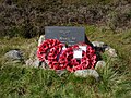 War memorial on Brown Clee Hill - geograph.org.uk - 6278084.jpg 1,024 × 768; 410 KB
-
 War memorial on Brown Clee Hill - geograph.org.uk - 6278087.jpg 1,024 × 768; 240 KB
-
 Wheat, Holdgate - geograph.org.uk - 4716697.jpg 1,024 × 683; 287 KB
-
 Window outside St. Catherine's Church (Chancel ^ Tugford) - geograph.org.uk - 5893961.jpg 2,048 × 2,730; 2.83 MB


_-_geograph.org.uk_-_5893982.jpg)


_-_geograph.org.uk_-_5893988.jpg)


_-_geograph.org.uk_-_5893990.jpg)


_-_geograph.org.uk_-_5893944.jpg)


_-_geograph.org.uk_-_5893937.jpg)
_-_geograph.org.uk_-_5893847.jpg)
_-_geograph.org.uk_-_5893984.jpg)
_-_geograph.org.uk_-_5893986.jpg)
_-_geograph.org.uk_-_5892963.jpg)
_-_geograph.org.uk_-_5893973.jpg)
_-_geograph.org.uk_-_5893843.jpg)
_-_geograph.org.uk_-_5893829.jpg)
_-_geograph.org.uk_-_5893470.jpg)
_-_geograph.org.uk_-_5892966.jpg)
_-_geograph.org.uk_-_5893929.jpg)
_-_geograph.org.uk_-_5893934.jpg)
_-_geograph.org.uk_-_5892957.jpg)
_-_geograph.org.uk_-_5879786.jpg)
_-_geograph.org.uk_-_5892954.jpg)
_-_geograph.org.uk_-_5893833.jpg)
_-_geograph.org.uk_-_5893940.jpg)
_-_geograph.org.uk_-_5893969.jpg)


_-_geograph.org.uk_-_5892941.jpg)


_-_geograph.org.uk_-_6285684.jpg)


_-_geograph.org.uk_-_5893961.jpg)