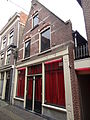
Category:Achterdam 11, Alkmaar
| Object location | | View all coordinates using: OpenStreetMap |
|---|
 | |||||
| Upload media | |||||
| Instance of |
| ||||
|---|---|---|---|---|---|
| Location | Alkmaar, North Holland, Netherlands | ||||
| Street address |
| ||||
| Heritage designation |
| ||||
 | |||||
|
This is a category about rijksmonument number 7139
|
| Address |
|
Media in category "Achterdam 11, Alkmaar"
The following 19 files are in this category, out of 19 total.
-
 Achterdam 11, Alkmaar.JPG 3,672 × 4,896; 4.7 MB
-

-

-

-

-

-

-

-

-

-

-

-

-
 Achtergevel aan de Kooltuin - Alkmaar - 20006028 - RCE.jpg 961 × 1,200; 330 KB
-
 Achtergevels aan de Kooltuin - Alkmaar - 20006022 - RCE.jpg 946 × 1,200; 297 KB
-

-
 Overzicht met achtergevels van de Achterdam - Alkmaar - 20006318 - RCE.jpg 1,200 × 975; 299 KB
-

-
 Voorgevels - Alkmaar - 20006025 - RCE.jpg 801 × 1,200; 184 KB


