Category:Aerial photographs of Drenthe
Provinces of the Netherlands: Drenthe · Flevoland · Friesland · Gelderland · Groningen · Limburg · North Brabant · North Holland · Overijssel · South Holland · Utrecht · Zeeland
Subcategories
This category has only the following subcategory.
Media in category "Aerial photographs of Drenthe"
The following 28 files are in this category, out of 28 total.
-
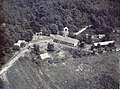 De marke luchtfoto rond 1960.jpg 1,024 × 761; 196 KB
-
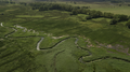 Gasterschediep, drentsche aa.png 3,992 × 2,242; 15.11 MB
-
 Groningen Airport Eelde overview.jpg 2,592 × 1,728; 1.82 MB
-
 Luchtfoto Sterrenbeeldenbuurt - panoramio.jpg 1,221 × 721; 1.35 MB
-
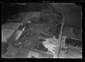
 Luchtfoto's - Coevorden - 20046925 - RCE.jpg 1,195 × 1,200; 375 KB
-
 Luchtfoto's - Coevorden - 20046926 - RCE.jpg 1,188 × 1,200; 404 KB
-
 Luchtfoto's - Coevorden - 20046927 - RCE.jpg 1,195 × 1,200; 393 KB
-
 Luchtfoto's - Coevorden - 20046928 - RCE.jpg 1,188 × 1,200; 405 KB
-
 Luchtfoto's - Coevorden - 20046929 - RCE.jpg 1,185 × 1,200; 424 KB
-
 Luchtfoto's - Coevorden - 20046930 - RCE.jpg 1,190 × 1,200; 448 KB
-
 Luchtfoto's - Coevorden - 20046931 - RCE.jpg 1,188 × 1,200; 350 KB
-
 Luchtfoto's - Coevorden - 20046932 - RCE.jpg 1,192 × 1,200; 382 KB
-
 Luchtfoto's - Coevorden - 20046933 - RCE.jpg 1,194 × 1,200; 404 KB
-
 NIMH - 2011 - 0130 - Aerial photograph of Emmen, The Netherlands - 1920 - 1940.jpg 3,500 × 2,536; 1.8 MB
-
 NIMH - 2011 - 0345 - Aerial photograph of Meppel, The Netherlands - 1920 - 1940.jpg 3,500 × 2,552; 1.83 MB
-
 NIMH - 2011 - 0346 - Aerial photograph of Meppel, The Netherlands - 1920 - 1940.jpg 3,500 × 2,571; 2.08 MB
-
-
 NIMH - 2011 - 0724 - Aerial photograph of Assen, The Netherlands - 1920 - 1940.jpg 3,500 × 2,509; 1.71 MB
-
 NIMH - 2011 - 0725 - Aerial photograph of Assen, The Netherlands - 1920 - 1940.jpg 3,500 × 2,545; 1.77 MB
-
 NIMH - 2011 - 0726 - Aerial photograph of Assen, The Netherlands - 1920 - 1940.jpg 3,500 × 2,549; 1.55 MB
-
 NIMH - 2011 - 0800 - Aerial photograph of Zuidlaren, The Netherlands - 1920 - 1940.jpg 3,500 × 2,570; 1.59 MB
-
 NIMH - 2011 - 0802 - Aerial photograph of Zuidlaren, The Netherlands - 1920 - 1940.jpg 3,500 × 2,558; 2.22 MB
-
 NIMH - 2011 - 0803 - Aerial photograph of Zuidlaren, The Netherlands - 1920 - 1940.jpg 3,500 × 2,568; 2.06 MB
-
 NIMH - 2155 043705 - Aerial photograph of Zwartendijkerschans, The Netherlands.jpg 5,018 × 3,386; 3.85 MB
-
 NIMH - 2155 043706 - Aerial photograph of Zwartendijkerschans, The Netherlands.jpg 5,105 × 3,436; 3.96 MB
-
 NIMH - 2155 043712 - Aerial photograph of Zwartendijkerschans, The Netherlands.jpg 5,174 × 3,436; 3.97 MB
-
 NIMH - 2155 043717 - Aerial photograph of Zwartendijkerschans, The Netherlands.jpg 4,971 × 3,388; 3.78 MB
-
 Puur Exloo - Drone - 2024.jpg 3,499 × 1,968; 6.84 MB


