Category:Aerial photographs of South Holland
Provinces of the Netherlands: Drenthe · Flevoland · Friesland · Gelderland · Groningen · Limburg · North Brabant · North Holland · Overijssel · South Holland · Utrecht · Zeeland
Subcategories
This category has the following 25 subcategories, out of 25 total.
A
D
G
- Aerial photographs of Gouda (50 F)
H
K
L
- Aerial photographs of Leiden (22 F)
M
- Aerial photographs of Maassluis (13 F)
N
P
R
S
- Aerial photographs of Schiedam (15 F)
T
V
W
Media in category "Aerial photographs of South Holland"
The following 125 files are in this category, out of 125 total.
-
 'Katwijk-Sluis van Koning Willem-Alexander gemaal-03.jpg 698 × 360; 362 KB
-
 A4 midden delfland.jpg 672 × 480; 44 KB
-
 Aerial photo of Bodegraven.jpg 3,376 × 2,188; 1.51 MB
-
 Aerial photo of De Meije.jpg 3,204 × 2,173; 2.04 MB
-
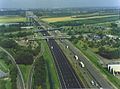
 Aerial photo of Prins Clausplein.jpg 4,320 × 3,240; 5.81 MB
-
 Aerial photograph Netherlands 2014 02.jpg 3,872 × 2,592; 4.25 MB
-
 Aerial photograph Netherlands 2014 03.jpg 3,872 × 2,592; 3.89 MB
-
 Aerial photograph Netherlands 2014 04.jpg 3,872 × 2,592; 5.37 MB
-
 Aerial photograph of Langeraar NOV2018.jpg 5,472 × 3,080; 3.81 MB
-
 Aerial photograph of Zegveld.jpg 3,456 × 2,304; 2.91 MB
-
 AerialPhotographOfAarlanderveenNOV2018.jpg 5,472 × 3,080; 3.63 MB
-
 AerialPhotographofZwammerdamNov2018.jpg 5,472 × 3,080; 3.4 MB
-
 AZC De Lier.jpg 320 × 263; 60 KB
-
 Berkel en Roderijs 20050928 40331.jpg 1,942 × 1,062; 167 KB
-
 Boerderij SHBO 30 LUCHTFOTO HOLLAND B - Hei- en Boeicop - 20451852 - RCE.jpg 1,200 × 900; 222 KB
-
 BollenstreekAPR2018-1.jpg 5,472 × 3,648; 3.97 MB
-
 Condensspoor boven Alphen aan den Rijn.jpg 5,184 × 3,456; 6.22 MB
-
 DeEngelApr2013.JPG 1,655 × 1,210; 347 KB
-
 DIA42147 Biertse polder ±1977.jpg 3,326 × 1,982; 975 KB
-
 Dorpsaanzicht 2014.jpg 576 × 768; 95 KB
-
 Dronefoto van Simonshaven met de phantom 3 pro.jpg 4,000 × 3,000; 5.64 MB
-
 Hervormde kerk te s-Gravendeel.JPG 1,024 × 768; 436 KB
-
 Holanda Meridional 1999 02.jpg 1,021 × 668; 279 KB
-
 Kiltunnel vanuit 's-Gravendeel.jpg 490 × 367; 120 KB
-
 KorteraarJUL2017-1b.jpg 3,709 × 2,736; 2.56 MB
-
 Kruithuisweg A4.jpeg 600 × 450; 52 KB
-
 Luchtfoto boerderij - Heicop - 20451960 - RCE.jpg 1,200 × 900; 257 KB
-
 Luchtfoto boerderij - Heicop - 20498473 - RCE.jpg 1,200 × 900; 238 KB
-
 Luchtfoto boerderijen KLM-AEROCARTO NO.36061 - Unknown - 20468691 - RCE.jpg 1,200 × 900; 245 KB
-
 Luchtfoto ingang Botlekspoortunnel.jpg 3,032 × 2,008; 2.16 MB
-
 Luchtfoto tijdens bouw van eco-aquaduct Zweth en Slinksloot.jpg 1,920 × 1,280; 2.23 MB
-

-
 Luchtfoto's - Maasland - 20144447 - RCE.jpg 1,197 × 1,200; 465 KB
-
 Luchtfoto's - Maasland - 20144448 - RCE.jpg 1,185 × 1,200; 447 KB
-
 Luchtfoto's - Maasland - 20144449 - RCE.jpg 1,190 × 1,200; 464 KB
-
 Luchtfoto's - Maasland - 20144450 - RCE.jpg 1,197 × 1,200; 460 KB
-
 Luchtfoto's - Maasland - 20144451 - RCE.jpg 1,195 × 1,200; 478 KB
-
 Maasdijk, kassen foto1 2014-03-09 11.07.jpg 3,925 × 2,944; 6.16 MB
-
 Map NL - Liemeer - Noordse Dorp.png 800 × 600; 246 KB
-
 Map NL - Liemeer - Vrouwenakker.png 800 × 600; 248 KB
-
 Map NL - Nieuwkoop - Achttienhoven.png 800 × 600; 258 KB
-
 Map NL - Nieuwkoop - Nieuwkoop.png 800 × 600; 260 KB
-
 Map NL - Nieuwkoop - Noorden.png 800 × 600; 256 KB
-
 Map NL - Nieuwkoop - Slikkendam.png 800 × 600; 252 KB
-
 Monster-AUG2016-01.jpg 1,782 × 1,075; 337 KB
-

-

-
 Nieuwesluis jaren 60.jpg 1,161 × 1,030; 386 KB
-
 NieuwkoopJUL2017.jpg 5,030 × 2,723; 3.08 MB
-

-

-

-
 NIMH - 2011 - 0009 - Aerial photograph of Ameide, The Netherlands - 1920 - 1940.jpg 3,500 × 2,482; 2.1 MB
-
 NIMH - 2011 - 0010 - Aerial photograph of Ameide, The Netherlands - 1920 - 1940.jpg 3,500 × 2,501; 2.27 MB
-
 NIMH - 2011 - 0292 - Aerial photograph of Krimpen, The Netherlands - 1920 - 1940.jpg 3,500 × 2,541; 1.96 MB
-
 NIMH - 2011 - 0320 - Aerial photograph of Maasland, The Netherlands - 1920 - 1940.jpg 3,500 × 2,565; 2.54 MB
-
 NIMH - 2011 - 0352 - Aerial photograph of Moerdijkbruggen, The Netherlands - 1920 - 1940.jpg 3,500 × 2,580; 1.77 MB
-
 NIMH - 2011 - 0353 - Aerial photograph of Moerdijkbruggen, The Netherlands - 1920 - 1940.jpg 3,500 × 2,531; 1.87 MB
-
 NIMH - 2011 - 0354 - Aerial photograph of Moerdijkbrug, The Netherlands - 1920 - 1940.jpg 3,500 × 2,520; 1.79 MB
-
 NIMH - 2011 - 0355 - Aerial photograph of Moerdijkbrug, The Netherlands - 1920 - 1940.jpg 3,500 × 2,541; 1.98 MB
-
-
 NIMH - 2011 - 0369 - Aerial photograph of Nootdorp, The Netherlands - 1920 - 1940.jpg 3,500 × 2,486; 2.42 MB
-
 NIMH - 2011 - 0370 - Aerial photograph of Nootdorp, The Netherlands - 1920 - 1940.jpg 3,500 × 2,538; 2.15 MB
-
 NIMH - 2011 - 0379 - Aerial photograph of Noordwijkerhout, The Netherlands - 1920 - 1940.jpg 3,500 × 2,589; 2.33 MB
-
 NIMH - 2011 - 0392 - Aerial photograph of Oegstgeest, The Netherlands - 1920 - 1940.jpg 3,500 × 2,548; 2.28 MB
-

-

-

-
 NIMH - 2011 - 0585 - Aerial photograph of Wassenaar, The Netherlands - 1920 - 1940.jpg 3,500 × 2,568; 2.15 MB
-
 NIMH - 2011 - 0841 - Aerial photograph of Merwe, The Netherlands - 1920 - 1940.jpg 3,500 × 2,448; 1.57 MB
-
 NIMH - 2011 - 0842 - Aerial photograph of Merwe, The Netherlands - 1920 - 1940.jpg 3,500 × 2,463; 1.34 MB
-
 NIMH - 2011 - 0860 - Aerial photograph of te Werve, The Netherlands - 1920 - 1940.jpg 3,500 × 2,529; 2.18 MB
-
 NIMH - 2011 - 1044 - Aerial photograph of Numansdorp, The Netherlands - 1920 - 1940.jpg 3,500 × 2,575; 1.62 MB
-
 NIMH - 2011 - 1045 - Aerial photograph of Numansdorp, The Netherlands - 1920 - 1940.jpg 3,500 × 2,572; 2.7 MB
-
 NIMH - 2011 - 2848 - Aerial photograph of Lisse, The Netherlands.jpg 3,500 × 2,573; 1.79 MB
-
 NIMH - 2011 - 5206 - Aerial photograph of Rijswijk, The Netherlands.jpg 4,000 × 2,649; 2.26 MB
-

-
 NIMH - 2155 005253 - Aerial photograph of Numansdorp, Fort Buitensluis, The Netherlands.jpg 3,520 × 2,379; 2.32 MB
-

-

-
 NIMH - 2155 032154 - Aerial photograph of Puttershoek, The Netherlands.jpg 2,371 × 3,508; 1.45 MB
-
 NIMH - 2155 035916 - Aerial photograph of Ockenburg, The Netherlands.jpg 3,700 × 2,398; 2.21 MB
-
 NIMH - 2155 043569 - Aerial photograph of Numansdorp, The Netherlands.jpg 5,063 × 3,411; 3.73 MB
-
 NIMH - 2155 044449 - Aerial photograph of Ockenburg, The Netherlands.jpg 5,289 × 3,454; 3.51 MB
-
 NIMH - 2155 044450 - Aerial photograph of Ockenburg, The Netherlands.jpg 5,114 × 3,454; 3.39 MB
-
 NIMH - 2155 071844 - Aerial photograph of Bodegraven, The Netherlands.jpg 2,761 × 4,000; 2.74 MB
-
 NIMH - 2155 071845 - Aerial photograph of Bodegraven, The Netherlands.jpg 2,662 × 4,000; 2.89 MB
-
 NIMH - 2155 076408 - Aerial photograph of Nieuwerbrug, The Netherlands.jpg 3,375 × 4,000; 2.78 MB
-
 Noordeinde (Nieuwkoop)2017.jpg 4,685 × 2,637; 2.4 MB
-
 Noordtunnel-2017-1a.jpg 5,472 × 3,080; 4.05 MB
-

-
 Part of Noordwijkerhout and the Bollenstreek.JPG 2,592 × 1,944; 1.93 MB
-
 Países Bajos, aéreas (2000) 01.jpg 678 × 1,040; 553 KB
-
 Países Bajos, aéreas (2000) 02.jpg 1,000 × 699; 1.02 MB
-
 Países Bajos, aéreas (2000) 04.jpg 676 × 958; 1.11 MB
-
 Países Bajos, aéreas (2000) 05.jpg 1,068 × 710; 786 KB
-
 Pijnacker 20050928 40341.JPG 1,929 × 1,085; 179 KB
-
 Praha-London.jpg 2,272 × 1,704; 1.1 MB
-
 Put van Broekhoven.jpg 1,024 × 768; 430 KB
-
 Ridderkerk interchange.jpg 1,600 × 1,200; 951 KB
-
 Ridderkerk2017-1a.jpg 5,472 × 3,080; 5.59 MB
-
 Rijksweg 12, bij de Gouwe, Basculebrug (1) NL-HaNA 2.24.10.02 0 127-0325 1.jpg 2,400 × 1,800; 703 KB
-
 Rijksweg 12, bij de Gouwe, Basculebrug (2) NL-HaNA 2.24.10.02 0 127-0326 1.jpg 2,400 × 1,800; 727 KB
-
 Rivieren 4.46933E 51.88083N.jpg 1,280 × 958; 191 KB
-
 Sandelingen.jpg 646 × 480; 43 KB
-
 SGravenzande-AUG2016-01.jpg 3,093 × 2,204; 1.26 MB
-
 Sion (1944).jpg 2,488 × 2,488; 1.14 MB
-
 South Holland by Sentinel-2.jpg 10,249 × 8,600; 98.76 MB
-
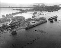
 Stadsgezichten, scheepvaart, landerijen, Bestanddeelnr 250-8873.jpg 2,512 × 2,530; 1.36 MB
-
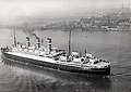 Statendam III trial 1929.jpg 960 × 677; 247 KB
-
 Prins Clausplein.jpg 640 × 480; 59 KB
-
 Tiengemeten 20040517 0658.jpg 2,032 × 1,354; 1.18 MB
-
 Vliegkamp Valkenburg - luchtfoto.jpg 4,736 × 3,157; 2.65 MB
-
 Voor- en zijgevels - Laagblokland - 20506398 - RCE.jpg 1,200 × 900; 225 KB
-
 Voor- en zijgevels - Ottoland - 20503098 - RCE.jpg 1,200 × 900; 251 KB
-
 Vrouwenakker2017.jpg 5,472 × 3,080; 3.67 MB
-
 Waterbushalte Papendrecht Veerdam luchtfoto 02.jpg 3,888 × 2,592; 2.15 MB
-
 Watersnoodramp 1953.jpg 2,943 × 2,366; 1.94 MB
-
 Westland-Monster-22OKT2022-1.jpg 4,032 × 3,024; 2.52 MB
-
 Wierickerschans 4.78363E 52.08103N.png 624 × 380; 301 KB
-
 Zandmotor luchtfoto (airplane cropped).jpg 3,574 × 2,240; 3.1 MB
-
 Zandmotor luchtfoto.jpg 4,000 × 3,000; 4.24 MB
-
 Zandmotor-juli-2014.jpg 3,508 × 2,081; 313 KB
-
 Zuid-Holland 4.43583E 51.94308N.jpg 1,280 × 958; 192 KB
-
 Zuid-Holland 4.46664E 51.94925N.jpg 1,280 × 958; 192 KB


2017.jpg)


_01.jpg)
_02.jpg)
_04.jpg)
_05.jpg)


_NL-HaNA_2.24.10.02_0_127-0325_1.jpg)
_NL-HaNA_2.24.10.02_0_127-0326_1.jpg)


.jpg)


.jpg)


