Category:Aerial photographs of Kreis Mettmann
Subcategories
This category has the following 5 subcategories, out of 5 total.
Media in category "Aerial photographs of Kreis Mettmann"
The following 10 files are in this category, out of 10 total.
-
 Aerial image of the Langenfeld-Wiescheid gliding site.jpg 5,100 × 3,300; 8.7 MB
-
 Am Sprung, nördlich von Heiligenhaus - panoramio.jpg 2,048 × 1,536; 2.23 MB
-
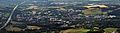
 As-Mettmann-luft-2016.jpg 3,020 × 4,318; 1.75 MB
-
 Düsseldorf aus der Luft.jpg 1,594 × 1,166; 190 KB
-

-
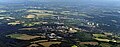
 Erkrath-2016.jpg 5,828 × 1,621; 1.04 MB
-
 Haus Linnep.jpg 3,576 × 2,480; 5.22 MB
-
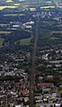
 Hochdahl.luft-2016.jpg 7,361 × 2,870; 4.3 MB
-
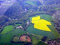
 Luftbild auf Reusrath, Stadtteil Langenfeld (Rheinland).jpg 1,200 × 763; 200 KB
-
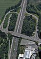
 Steilrampe-2016.jpg 901 × 1,556; 513 KB


.jpg)
