Category:Aerial photographs of Kreis Olpe
Subcategories
This category has the following 7 subcategories, out of 7 total.
A
- Aerial photographs of Attendorn (66 F)
D
- Aerial photographs of Drolshagen (23 F)
F
- Aerial photographs of Finnentrop (87 F)
K
L
- Aerial photographs of Lennestadt (145 F)
O
- Aerial photographs of Olpe (75 F)
W
- Aerial photographs of Wenden (22 F)
Media in category "Aerial photographs of Kreis Olpe"
The following 2 files are in this category, out of 2 total.
-
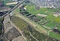
 Aerial image of the Attendorn-Finnentrop airfield.jpg 4,900 × 3,000; 6 MB
-
 Aerial image of the Hünsborn airfield.jpg 4,600 × 3,200; 5.61 MB

