Category:Aerial photographs of Skagit County, Washington
Media in category "Aerial photographs of Skagit County, Washington"
The following 39 files are in this category, out of 39 total.
-

-
-
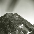
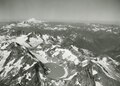
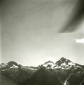
 Aerial view of North Cascades (e67c80f5-58e2-454d-ba3a-3d4268572254).tif 2,821 × 2,244; 11.29 MB
-

-
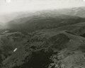
 Aerial view of town in North Cascades (e49d51dc-0a66-43f6-a43b-5544dddb51fa).tif 2,807 × 2,251; 9.62 MB
-
 Alpine Lakes Wilderness, unidentified lake (4a55b355-0e04-484d-975f-15e8c2b3828d).tif 6,576 × 8,347; 400.74 MB
-

-

-
 Black Lake in Pasayten Wilderness (731cb825-4c3b-4d31-975a-9d1bbce20752).tif 6,560 × 6,505; 244.18 MB
-
-
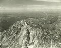
 Eldorado Peak and Marble Creek watershed (04b3f453-738a-418e-9ba6-94d5af02162f).tif 2,814 × 2,233; 9.8 MB
-
-

-
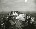
 Lake at base of Mount Shuksan (9026129b-9dbe-41be-87ef-99dfd53683d4).tif 2,239 × 2,788; 13.68 MB
-
-

-

-

-
-

-

-

-

-

-
-
-

-

-
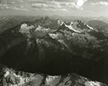
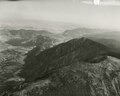
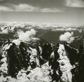 Picket Range, aerial view (89093ba5-7311-48e0-b0bd-da4d0782857e).tif 1,345 × 1,315; 3.22 MB
-
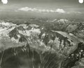
 Picket Range, long aerial shot from north (bf1a3a8b-46d0-4456-99cc-b7a195765ee1).tif 1,344 × 1,316; 2.86 MB
-
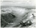
 Ross Lake looking south (19198dfb-c08e-4d5e-84ea-a5b0be0dff0a).tif 5,674 × 4,474; 145.26 MB
-
-
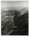
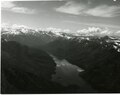
 Skagit River and Ross Lake (8e81a62e-3156-492a-bca6-07e3c4132a70).tif 2,832 × 2,269; 9.75 MB
-
 Small subalpine lake on Mount Shuksan (37198879-48b9-43be-a3ef-842d762bc955).tif 5,903 × 4,818; 162.74 MB
-
-

-
-

-

.jpg)
.jpg)