Category:Altranft Manor
| Object location | | View all coordinates using: OpenStreetMap |
|---|
manor in Landkreis Märkisch-Oderland, Brandenburg, Germany  | |||||
| Upload media | |||||
| Instance of | |||||
|---|---|---|---|---|---|
| Part of | |||||
| Location | Altranft, Bad Freienwalde, Märkisch-Oderland District, Brandenburg, Germany | ||||
| Heritage designation | |||||
 | |||||
This is the category of the Brandenburger Baudenkmal (cultural heritage monument) with the ID 09180346 (Wikidata)
|
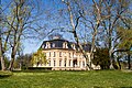
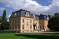
Media in category "Altranft Manor"
The following 4 files are in this category, out of 4 total.
-
 Altranft Schloss.JPG 1,526 × 1,099; 278 KB
-
 Herrenhaus Altranft.jpg 2,500 × 1,667; 1.97 MB
-
 Schloss Altranft.jpg 3,872 × 2,592; 4.35 MB
-
 Schlosspark Altranft.jpg 3,872 × 2,592; 7.27 MB


