Category:April 2003 in Cumbria
Ceremonial counties of England: Berkshire · Buckinghamshire · Cambridgeshire · Cheshire · Cornwall · Cumbria · Derbyshire · Devon · Dorset · Durham · East Riding of Yorkshire · East Sussex · Essex · Gloucestershire · Greater London · Greater Manchester · Hampshire · Herefordshire · Kent · Lancashire · Leicestershire · Lincolnshire · Norfolk · North Yorkshire · Northamptonshire · Northumberland · Nottinghamshire · Oxfordshire · Shropshire · Somerset · South Yorkshire · Staffordshire · Suffolk · Surrey · Warwickshire · West Midlands · West Sussex · West Yorkshire · Wiltshire · Worcestershire
City-counties:
Former historic counties:
Other former counties:
City-counties:
Former historic counties:
Other former counties:
Deutsch: Bilder, die im April 2003 in Cumbria aufgenommen worden sind. Bitte beachten Sie, dass dies weder das Datum des Uploads noch das Datum des Scannens eines Fotos ist.
English: Images/pictures taken in Cumbria during April 2003. Note this is not the date of the upload, nor the date a photo was scanned.
Español: Fotografías o imágenes tomadas en Cumbria durante abril 2003. No es la fecha de subida ni escaneo, sino la fecha en que las fotografías o imágenes se crearon.
Esperanto: Bildoj faritaj en Cumbria en aprilo 2003. Tio ne estas la dato, kiam la bildoj estis alŝutitaj aŭ skanitaj.
Français : Photographies ou images prises en Cumbria durant avril 2003. Ce n'est pas la date du téléchargement ou du scan.
Galego: Fotografías ou imaxes tomadas en Cumbria durante abril 2003. Non é a data de subida nin escaneamento, senón a data na que se crearon as fotografías ou imaxes.
Italiano: Fotografie o immagini scattate a Cumbria nel aprile 2003. Nota bene: la data non si riferisce né a quella di upload né a quella in cui la foto è stata digitalizzata.
Norsk bokmål: Bilder tatt i Cumbria i løpet av april 2003. Merk at dette ikke er datoen for opplasting, eller når et bilde har blitt skannet.
Norsk nynorsk: Bilete teke i Cumbria i løpet av april 2003. Merk at dette ikkje er datoen for opplasting, eller når eit bilete har vorte skanna.
Русский: Изображения, сделанные в Cumbria в течение апрель 2003 (не дата загрузки изображения).
Українська: Зображення, зроблені в Cumbria протягом квітень 2003. Зауважте, що це не дата завантаження чи дата сканування фотографії.
| April 2002 | ← | April 2003 | → | April 2004 | |||||||
| Jan | Feb | Mar | Apr | May | Jun | Jul | Aug | Sep | Oct | Nov | Dec |
| 20 | 39 | 5 | 50 | 8 | 12 | 11 | 16 | 4 | 72 | 18 | 3 |
|---|---|---|---|---|---|---|---|---|---|---|---|
Media in category "April 2003 in Cumbria"
The following 50 files are in this category, out of 50 total.
-
 Cockley Beck Bridge - geograph.org.uk - 49694.jpg 640 × 480; 138 KB
-
 Coniston Water from Thurston - geograph.org.uk - 20667.jpg 640 × 480; 38 KB
-
 Corney Fell - geograph.org.uk - 49675.jpg 640 × 480; 55 KB
-

-
 Ennerdale Water, the head of the lake - geograph.org.uk - 521101.jpg 600 × 450; 43 KB
-
 Finsthwaite and Finsthwaite Heights - geograph.org.uk - 521122.jpg 600 × 450; 57 KB
-
 Ford at Birks bridge, River Winster - geograph.org.uk - 73840.jpg 640 × 443; 153 KB
-
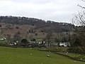
 Greenholme Farm - geograph.org.uk - 36906.jpg 640 × 480; 151 KB
-
 Greenup Edge overlooking Ullscarf - geograph.org.uk - 20674.jpg 640 × 480; 37 KB
-
 Killoran Hotel, Wetheral - geograph.org.uk - 124672.jpg 640 × 480; 104 KB
-
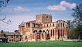 Lanercost Priory - geograph.org.uk - 1465620.jpg 640 × 368; 86 KB
-
 Low Hacket - geograph.org.uk - 49699.jpg 640 × 438; 80 KB
-
 Pool in the River Dee - geograph.org.uk - 53192.jpg 640 × 480; 130 KB
-
 River Irthing west of Wallholme - geograph.org.uk - 1465538.jpg 640 × 368; 87 KB
-
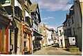 Sedbergh, Market Town. - geograph.org.uk - 131482.jpg 640 × 438; 129 KB
-
 Shepherd's Bridge, Hew Yewdale - geograph.org.uk - 8089.jpg 640 × 320; 144 KB
-
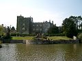 Sizergh Castle 02.jpg 640 × 476; 120 KB
-
 Slater's Bridge, Little Langdale - geograph.org.uk - 20672.jpg 640 × 480; 65 KB
-

-
 St. Cuthbert's Church, Nether Denton - geograph.org.uk - 1465602.jpg 640 × 368; 79 KB
-
 Summit cairn on Lingmoor Fell - geograph.org.uk - 8091.jpg 640 × 320; 98 KB
-
 The County Stone - geograph.org.uk - 54384.jpg 640 × 429; 124 KB
-
 The County Stone - geograph.org.uk - 846744.jpg 597 × 400; 118 KB
-
 Three Shire Stone, Wrynose Pass - geograph.org.uk - 20673.jpg 640 × 480; 62 KB
-
 Ullswater in evening light - geograph.org.uk - 851463.jpg 640 × 480; 55 KB
-
 Village green, Banks - geograph.org.uk - 1465571.jpg 640 × 368; 94 KB
-
 Yewbarrow - geograph.org.uk - 36920.jpg 640 × 480; 100 KB
-
 A Lane in Dent. - geograph.org.uk - 131457.jpg 640 × 441; 117 KB
-
 A Yard in Dent. - geograph.org.uk - 131470.jpg 435 × 640; 115 KB
-
 Cottage under Loughrigg Fell - geograph.org.uk - 20669.jpg 640 × 480; 85 KB
-
 Dentdale from Dent. - geograph.org.uk - 131476.jpg 640 × 437; 148 KB
-
 Dore Head - geograph.org.uk - 36926.jpg 640 × 480; 93 KB
-

-
 Erratic on Hazel Moor - geograph.org.uk - 125786.jpg 640 × 425; 83 KB
-
 Fly Fishing, Sandwick - geograph.org.uk - 700010.jpg 640 × 480; 89 KB
-
 Hedgerow and sheep - geograph.org.uk - 49687.jpg 640 × 480; 70 KB
-
 Hincaster Tunnel, Lancaster Canal - geograph.org.uk - 24718.jpg 480 × 640; 165 KB
-
 Hodge Close quarry - geograph.org.uk - 8095.jpg 640 × 320; 128 KB
-
 Holme Fell and Ivy Crag - geograph.org.uk - 8094.jpg 640 × 320; 181 KB
-

-
 Lane to Beacon Tarn - geograph.org.uk - 36910.jpg 640 × 480; 119 KB
-
 Logan Beck and Penn - geograph.org.uk - 49670.jpg 640 × 480; 69 KB
-
 Mazon Wath - geograph.org.uk - 125797.jpg 640 × 425; 95 KB
-
 Mill Stream and Bridge - geograph.org.uk - 49715.jpg 640 × 480; 113 KB
-
 Over Beck - geograph.org.uk - 36932.jpg 640 × 480; 79 KB
-
 Spout House Farm - geograph.org.uk - 49682.jpg 640 × 480; 125 KB
-
 Stone Close, Dent. - geograph.org.uk - 131463.jpg 640 × 438; 91 KB
-
 Swineside - geograph.org.uk - 355704.jpg 640 × 480; 61 KB
-
 Tongue Gill - geograph.org.uk - 125774.jpg 640 × 425; 81 KB
-
 Village Green at Wetheral - geograph.org.uk - 124676.jpg 640 × 480; 47 KB


.jpg)