Category:October 2003 in Cumbria
Ceremonial counties of England: Bedfordshire · Berkshire · Cheshire · Cornwall · Cumbria · Derbyshire · Devon · East Riding of Yorkshire · East Sussex · Essex · Gloucestershire · Greater London · Greater Manchester · Hampshire · Herefordshire · Hertfordshire · Kent · Lancashire · Leicestershire · Lincolnshire · Merseyside · Norfolk · North Yorkshire · Northamptonshire · Northumberland · Nottinghamshire · Oxfordshire · Shropshire · South Yorkshire · Staffordshire · Surrey · West Yorkshire · Wiltshire · Worcestershire
City-counties: Bristol ·
Former historic counties:
Other former counties:
City-counties: Bristol ·
Former historic counties:
Other former counties:
Deutsch: Bilder, die im Oktober 2003 in Cumbria aufgenommen worden sind. Bitte beachten Sie, dass dies weder das Datum des Uploads noch das Datum des Scannens eines Fotos ist.
English: Images/pictures taken in Cumbria during October 2003. Note this is not the date of the upload, nor the date a photo was scanned.
Español: Fotografías o imágenes tomadas en Cumbria durante octubre 2003. No es la fecha de subida ni escaneo, sino la fecha en que las fotografías o imágenes se crearon.
Esperanto: Bildoj faritaj en Cumbria en oktobro 2003. Tio ne estas la dato, kiam la bildoj estis alŝutitaj aŭ skanitaj.
Français : Photographies ou images prises en Cumbria durant octobre 2003. Ce n'est pas la date du téléchargement ou du scan.
Galego: Fotografías ou imaxes tomadas en Cumbria durante outubro 2003. Non é a data de subida nin escaneamento, senón a data na que se crearon as fotografías ou imaxes.
Italiano: Fotografie o immagini scattate a Cumbria nel ottobre 2003. Nota bene: la data non si riferisce né a quella di upload né a quella in cui la foto è stata digitalizzata.
Norsk bokmål: Bilder tatt i Cumbria i løpet av oktober 2003. Merk at dette ikke er datoen for opplasting, eller når et bilde har blitt skannet.
Norsk nynorsk: Bilete teke i Cumbria i løpet av oktober 2003. Merk at dette ikkje er datoen for opplasting, eller når eit bilete har vorte skanna.
Русский: Изображения, сделанные в Cumbria в течение октябрь 2003 (не дата загрузки изображения).
Українська: Зображення, зроблені в Cumbria протягом жовтень 2003. Зауважте, що це не дата завантаження чи дата сканування фотографії.
| October 2002 | ← | October 2003 | → | October 2004 | |||||||
| Jan | Feb | Mar | Apr | May | Jun | Jul | Aug | Sep | Oct | Nov | Dec |
| 20 | 39 | 5 | 50 | 8 | 12 | 11 | 16 | 4 | 72 | 18 | 3 |
|---|---|---|---|---|---|---|---|---|---|---|---|
Media in category "October 2003 in Cumbria"
The following 72 files are in this category, out of 72 total.
-
 "Autumn Leaves" - geograph.org.uk - 60824.jpg 640 × 480; 110 KB
-
 Abandoned Barn Grisedale - geograph.org.uk - 10556.jpg 640 × 427; 325 KB
-
 Ashness Bridge in autumn - geograph.org.uk - 473798.jpg 640 × 423; 81 KB
-
-
 Deergarth How Island, Thirlmere - geograph.org.uk - 964914.jpg 640 × 358; 47 KB
-
 Derwent Water and Keswick - geograph.org.uk - 7730.jpg 480 × 640; 125 KB
-

-
 Derwentwater Beneath Low Clouds - geograph.org.uk - 238083.jpg 640 × 480; 68 KB
-

-
 Grasmere - geograph.org.uk - 7738.jpg 640 × 480; 105 KB
-

-
 Grisedale from Helvellyn Footpath - geograph.org.uk - 10554.jpg 640 × 427; 65 KB
-
 Intricate sundial - geograph.org.uk - 482546.jpg 429 × 640; 86 KB
-
 Hawkshead, Grammar School - geograph.org.uk - 482550.jpg 640 × 429; 83 KB
-
 Hawkshead, parish church, hills beyond - geograph.org.uk - 480428.jpg 640 × 420; 103 KB
-
 Hawkshead, Queen's Head - geograph.org.uk - 482551.jpg 640 × 429; 84 KB
-
 Helm Crag from Gibson Knott - geograph.org.uk - 60816.jpg 640 × 480; 62 KB
-
 Holiday Cottage Lake District - geograph.org.uk - 10553.jpg 640 × 427; 147 KB
-
 Holy Trinity Church, Brathay.jpg 443 × 640; 85 KB
-

-
 Keswick and Derwent Water from Skiddaw - geograph.org.uk - 24053.jpg 640 × 427; 78 KB
-
 MilburnVillageCumbria(SimonLedingham)Oct2003.jpg 640 × 480; 175 KB
-
 Old Harbour Wall, Port Carlisle, Cumbria - geograph.org.uk - 72848.jpg 640 × 453; 144 KB
-
 Piot Crag below Mardale Ill Bell - geograph.org.uk - 65745.jpg 640 × 480; 59 KB
-
 Rockcliffe church and houses - geograph.org.uk - 646381.jpg 640 × 480; 61 KB
-

-

-
 St John's in the Vale - geograph.org.uk - 11024.jpg 640 × 480; 132 KB
-
 Stickle Ghyll - geograph.org.uk - 7719.jpg 640 × 480; 116 KB
-
 Tewfaitegreen, Cumbria, cottages. - geograph.org.uk - 646380.jpg 640 × 480; 72 KB
-
 The Esk Estuary at Ravenglass - geograph.org.uk - 104125.jpg 640 × 480; 62 KB
-
 Thirsty Work near Mardale Ill Bell - geograph.org.uk - 65735.jpg 640 × 480; 61 KB
-
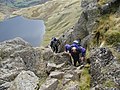 Topping out of Jack's Rake - geograph.org.uk - 1067175.jpg 640 × 480; 106 KB
-
 Watendlath Tarn - geograph.org.uk - 7744.jpg 640 × 480; 127 KB
-

-
 Wood Howe in Haweswater - geograph.org.uk - 65691.jpg 640 × 480; 53 KB
-
 Borrowdale Youth Hostel - geograph.org.uk - 10551.jpg 577 × 385; 84 KB
-
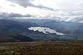
 Buttermere - geograph.org.uk - 7125.jpg 640 × 480; 118 KB
-
 Car Park at the Head of Haweswater - geograph.org.uk - 65716.jpg 640 × 480; 73 KB
-

-
 Flakehowe Crags, across Haweswater - geograph.org.uk - 65685.jpg 640 × 480; 60 KB
-

-
 Garsdale Sheep - geograph.org.uk - 95088.jpg 640 × 480; 50 KB
-

-

-

-

-
 Little Man on Skiddaw - geograph.org.uk - 24055 (cropped).jpg 571 × 381; 55 KB
-
 Little Man on Skiddaw - geograph.org.uk - 24055.jpg 640 × 427; 74 KB
-
-
 Near Low Rigg , Lake District - geograph.org.uk - 11023.jpg 640 × 480; 191 KB
-

-
 Rebuilt Path from Latrigg to Skiddaw - geograph.org.uk - 24052.jpg 427 × 640; 75 KB
-
 Ridding Wood - geograph.org.uk - 49722.jpg 640 × 480; 98 KB
-
 Roa Island slipway - geograph.org.uk - 498566.jpg 640 × 420; 102 KB
-
 Rough Crag from Long Stile - geograph.org.uk - 65709.jpg 640 × 480; 75 KB
-
 Ruthwaite Lodge, Grisedale - geograph.org.uk - 10555 (cropped).jpg 427 × 427; 81 KB
-
 Ruthwaite Lodge, Grisedale - geograph.org.uk - 10555.jpg 427 × 640; 97 KB
-
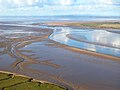
 Sands of the Solway Estuary, Cumbria - geograph.org.uk - 72867.jpg 640 × 480; 88 KB
-
 Small Water - geograph.org.uk - 65749.jpg 640 × 480; 76 KB
-
-
 St John's Vale - geograph.org.uk - 7724.jpg 640 × 480; 112 KB
-
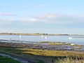
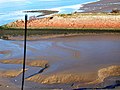
 Swirls in Morecambe Bay - geograph.org.uk - 447256.jpg 640 × 429; 37 KB
-
 The Bowder Stone - geograph.org.uk - 7734.jpg 640 × 480; 189 KB
-
 The Bridge to Nowhere - geograph.org.uk - 356376.jpg 640 × 480; 59 KB
-
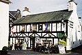
 The Bull Hotel, Sedbergh - geograph.org.uk - 315109.jpg 640 × 480; 93 KB
-
 The Esk Estuary near Newbiggin - geograph.org.uk - 104131.jpg 640 × 480; 58 KB
-
 The Forces Swindale Beck - geograph.org.uk - 107495.jpg 640 × 363; 74 KB
-
 Thirlmere from the footpath up Helvellyn - geograph.org.uk - 14020.jpg 640 × 480; 166 KB
-
 Two Sheep near Rough Crag - geograph.org.uk - 65726.jpg 640 × 480; 86 KB
-
 Ullock Pike from Skiddaw - geograph.org.uk - 24054 (cropped).jpg 576 × 384; 42 KB
-
 Ullock Pike from Skiddaw - geograph.org.uk - 24054.jpg 578 × 385; 44 KB


.jpg)


.jpg)

Oct2003.jpg)


.jpg)

.jpg)
.jpg)


.jpg)


.jpg)


.jpg)
