Category:Ash-cum-Ridley
English: Ash-cum-Ridley is a civil parish in the Sevenoaks district of Kent, England. According to the 2001 census the parish had a population of 7,070. The parish includes the villagea of Ash, Hodsoll Street, New Ash Green and Ridley.
civil parish in Kent, UK | |||||
| Upload media | |||||
| Instance of | |||||
|---|---|---|---|---|---|
| Named after | |||||
| Location | Sevenoaks, Kent, South East England, England | ||||
| Population |
| ||||
 | |||||
Subcategories
This category has the following 5 subcategories, out of 5 total.
Media in category "Ash-cum-Ridley"
The following 143 files are in this category, out of 143 total.
-
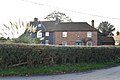
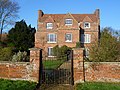 Ash Manor - geograph.org.uk - 3300928.jpg 4,000 × 3,000; 3.9 MB
-
 Ash Road, Ash - geograph.org.uk - 5074202.jpg 3,143 × 2,357; 1.57 MB
-
 Barn on Rosemary Lane - geograph.org.uk - 3551031.jpg 640 × 430; 79 KB
-
 Bluebells, Hall Wood - geograph.org.uk - 3611151.jpg 640 × 430; 147 KB
-
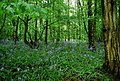 Bluebells, Hall Wood - geograph.org.uk - 3611154.jpg 640 × 430; 137 KB
-
 Bluebells, Lion Wood - geograph.org.uk - 3551025.jpg 640 × 430; 142 KB
-
 Bowdler's Well at Ridley - geograph.org.uk - 3793598.jpg 4,000 × 3,000; 4.32 MB
-
 Bowdler's Well at Ridley - geograph.org.uk - 3793606.jpg 4,000 × 3,000; 4.55 MB
-
 Bridleway off Hodsoll Street - geograph.org.uk - 3551450.jpg 640 × 430; 134 KB
-
 Bridleway, Hodsoll Street - geograph.org.uk - 3551454.jpg 640 × 430; 102 KB
-
 Bunkers Hill - geograph.org.uk - 3322559.jpg 4,000 × 3,000; 4.07 MB
-
 Bunkers Hill, Ridley - geograph.org.uk - 5074398.jpg 3,264 × 2,448; 2.76 MB
-
 Butchers Lane, Ash - geograph.org.uk - 5074170.jpg 2,448 × 2,448; 1.51 MB
-
 Butchers Lane, Ash - geograph.org.uk - 5074174.jpg 2,448 × 2,448; 1.89 MB
-
 Butlers Place, Ash - geograph.org.uk - 5074181.jpg 2,448 × 2,448; 1.73 MB
-
 By Lion Wood - geograph.org.uk - 3551029.jpg 640 × 430; 60 KB
-
 Byway, Pettings Court Farm - geograph.org.uk - 3611139.jpg 640 × 430; 146 KB
-
 Coppiced tree - geograph.org.uk - 3611148.jpg 640 × 430; 146 KB
-
 Dairy House Farm - geograph.org.uk - 3551039.jpg 640 × 430; 77 KB
-
 Dairy House Farm - geograph.org.uk - 3551413.jpg 640 × 430; 82 KB
-
 Doves on a house at Hodsoll Street - geograph.org.uk - 6388186.jpg 3,373 × 2,529; 1.8 MB
-
 Entrance to recreation ground at New Ash Green - geograph.org.uk - 3300286.jpg 4,000 × 3,000; 4.14 MB
-
 Farm buildings, Rosemary Lane - geograph.org.uk - 3551033.jpg 640 × 430; 83 KB
-
 Farmland and woodland - geograph.org.uk - 3551028.jpg 640 × 430; 62 KB
-
 Farmland near Hodsoll Street - geograph.org.uk - 3611129.jpg 640 × 430; 61 KB
-
 Farmland, Pettings Court Farm - geograph.org.uk - 3611142.jpg 640 × 430; 77 KB
-
 Field alongside Dunmery Grove - geograph.org.uk - 3322412.jpg 4,000 × 3,000; 4.13 MB
-
 Field and barn by New Street Road - geograph.org.uk - 5942781.jpg 7,157 × 2,240; 3.05 MB
-
 Field by Church Road - geograph.org.uk - 3127620.jpg 640 × 480; 153 KB
-
 Field by Church Road - geograph.org.uk - 3127624.jpg 640 × 480; 95 KB
-
 Field by Hartley Bottom Road - geograph.org.uk - 3127569.jpg 640 × 480; 84 KB
-
 Field next to Manor Lane - geograph.org.uk - 3181256.jpg 4,000 × 3,000; 3.9 MB
-
 Footpath along a fence - geograph.org.uk - 3551418.jpg 640 × 430; 74 KB
-
 Footpath at Fairseat Lane - geograph.org.uk - 3321718.jpg 4,000 × 3,000; 4.1 MB
-
 Footpath at Hodsoll Street - geograph.org.uk - 3551439.jpg 640 × 430; 123 KB
-
 Footpath entering Hodsoll Street - geograph.org.uk - 3551420.jpg 640 × 430; 121 KB
-
 Footpath entering Lion Wood - geograph.org.uk - 3551020.jpg 640 × 430; 121 KB
-
 Footpath from Hartley Bottom Road - geograph.org.uk - 3298246.jpg 4,000 × 3,000; 4.32 MB
-
 Footpath in Lion Wood - geograph.org.uk - 3551022.jpg 640 × 430; 131 KB
-
 Footpath leading away from Fairseat Lane - geograph.org.uk - 3321710.jpg 4,000 × 3,000; 3.9 MB
-
 Footpath leading to recreation ground at New Ash Green - geograph.org.uk - 3300355.jpg 4,000 × 3,000; 4.04 MB
-
 Footpath near New Street Farm - geograph.org.uk - 3322582.jpg 3,000 × 4,000; 4.18 MB
-
 Footpath to Fairseat - geograph.org.uk - 3611168.jpg 640 × 430; 154 KB
-
 Footpath to Ridley - geograph.org.uk - 3322405.jpg 4,000 × 3,000; 4.28 MB
-
 Footpath to White Ash Wood - geograph.org.uk - 3322408.jpg 4,000 × 3,000; 3.88 MB
-
 Gates, Culverstone Manor Farm - geograph.org.uk - 5168643.jpg 640 × 428; 125 KB
-
 Gravesend Road, Vigo Village - geograph.org.uk - 5174467.jpg 2,304 × 1,728; 872 KB
-
 Hall Wood - geograph.org.uk - 3611141.jpg 640 × 430; 85 KB
-
 Hartley Bottom Road - geograph.org.uk - 3127570.jpg 640 × 480; 114 KB
-
 Hartley Bottom Road - geograph.org.uk - 3322393.jpg 4,000 × 3,000; 4.08 MB
-
 Hartley Bottom Road looking towards Cuckolds Corner - geograph.org.uk - 3298231.jpg 4,000 × 3,000; 4.13 MB
-
 Hartley Bottom Road, near Hartley - geograph.org.uk - 5073203.jpg 3,264 × 2,448; 2.01 MB
-
 Hartley Bottom Road, near New Ash Green - geograph.org.uk - 5073208.jpg 3,264 × 2,448; 2.52 MB
-
 Hartley Bottom Road, near Ridley - geograph.org.uk - 5074340.jpg 3,264 × 2,448; 2.2 MB
-
 Haven Hill - geograph.org.uk - 3321674.jpg 4,000 × 3,000; 4.42 MB
-
 Haven Hill - geograph.org.uk - 3322506.jpg 4,000 × 3,000; 4.38 MB
-
 Haven Hill, near Ridley - geograph.org.uk - 5074334.jpg 3,264 × 2,448; 2.39 MB
-
 Hodsoll Street - geograph.org.uk - 3551442.jpg 640 × 430; 81 KB
-
 Hodsoll Street - geograph.org.uk - 3551445.jpg 640 × 430; 108 KB
-
 Hodsoll Street - geograph.org.uk - 3551451.jpg 640 × 430; 105 KB
-
 Hodsoll Street - geograph.org.uk - 3611126.jpg 640 × 430; 63 KB
-
 Hodsoll Street Village Hall - geograph.org.uk - 3551441.jpg 640 × 430; 90 KB
-
 Hodsoll Street, near Wrotham - geograph.org.uk - 2087563.jpg 3,488 × 2,616; 2.27 MB
-
 Holywell Farmhouse - geograph.org.uk - 3793539.jpg 4,000 × 3,000; 4.2 MB
-
 Holywell Park Farm - geograph.org.uk - 3551416.jpg 640 × 430; 85 KB
-
 Home Farm House - geograph.org.uk - 3551453.jpg 640 × 430; 123 KB
-
 Honeypot Lane - geograph.org.uk - 3611145.jpg 640 × 430; 97 KB
-
 Honeypot Lane - geograph.org.uk - 3611147.jpg 640 × 430; 148 KB
-
 Horse in a field - geograph.org.uk - 3551417.jpg 640 × 430; 78 KB
-
 Horses by Idleigh Court - geograph.org.uk - 3298288.jpg 4,000 × 3,000; 4.1 MB
-
 Idleigh Court Road - geograph.org.uk - 3298265.jpg 4,000 × 3,000; 4.11 MB
-
 Idleigh Court Road by Idleigh Court - geograph.org.uk - 3298270.jpg 4,000 × 3,000; 4.18 MB
-
 Idleigh Court Road, near Meopham - geograph.org.uk - 5073205.jpg 3,264 × 2,448; 2.49 MB
-
 Idleigh Court Road, near Meopham - geograph.org.uk - 5074611.jpg 3,264 × 2,448; 2.44 MB
-
 Industrial park off Michaels Lane - geograph.org.uk - 2074112.jpg 640 × 428; 91 KB
-
 Interior of St Peter's Church, Ridley - geograph.org.uk - 6387905.jpg 4,000 × 3,000; 4.66 MB
-
 Interior of St Peter's Church, Ridley - geograph.org.uk - 6387906.jpg 3,901 × 2,925; 2 MB
-
 Johnson's Farmhouse (geograph 6646817).jpg 1,024 × 685; 157 KB
-
 Kissing gate, Rosemary Lane - geograph.org.uk - 3551036.jpg 640 × 430; 118 KB
-
 Lake on London Golf Course - geograph.org.uk - 4175508.jpg 640 × 430; 70 KB
-
 Lambardes, New Ash Green - geograph.org.uk - 2916808.jpg 640 × 427; 187 KB
-
 Lion Wood - geograph.org.uk - 3551024.jpg 640 × 430; 153 KB
-
 Lion Wood - geograph.org.uk - 3551026.jpg 640 × 430; 143 KB
-
 Lion Wood - geograph.org.uk - 3551030.jpg 640 × 430; 59 KB
-
 Manor Forstal - geograph.org.uk - 2362095.jpg 640 × 428; 108 KB
-
 Muddy farm field near Hodsoll Street - geograph.org.uk - 3322520.jpg 4,000 × 3,000; 4.13 MB
-
 New Street Road - geograph.org.uk - 3322575.jpg 4,000 × 3,000; 4.23 MB
-
 New Street Road, near Hodsoll Street - geograph.org.uk - 5074575.jpg 3,264 × 2,448; 2.6 MB
-
 Oak Farm Lane, near Fairseat - geograph.org.uk - 5071789.jpg 3,264 × 2,448; 2.31 MB
-
 Oast House - geograph.org.uk - 5474551.jpg 4,000 × 2,981; 3.46 MB
-
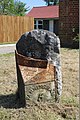 Old Milepost by the A20, London Road, Stansted (geograph 5784916).jpg 533 × 800; 157 KB
-
 Over Minnis, New Ash Green - geograph.org.uk - 2916847.jpg 640 × 427; 228 KB
-
 Path leading to the Church of St Peter and St Paul, Ash Road - geograph.org.uk - 3300389.jpg 4,000 × 3,000; 4.17 MB
-
 Path to Hodsoll Street - geograph.org.uk - 3551415.jpg 640 × 430; 94 KB
-
 Path to the Church of St Peter and St Paul - geograph.org.uk - 3300381.jpg 4,000 × 3,000; 4.26 MB
-
 Pease Hill - geograph.org.uk - 3322399.jpg 4,000 × 3,000; 4.34 MB
-
 Pease Hill, Ash - geograph.org.uk - 5074317.jpg 3,264 × 2,448; 2.17 MB
-
 Pettings Court Farm - geograph.org.uk - 3611132.jpg 640 × 430; 49 KB
-
 Pettings Court Farm - geograph.org.uk - 3611134.jpg 640 × 430; 54 KB
-
 Private drive at Hodsoll Street - geograph.org.uk - 3322483.jpg 4,000 × 3,000; 4.24 MB
-
 Recreation ground at New Ash Green - geograph.org.uk - 3300370.jpg 4,000 × 3,000; 4.1 MB
-
 Rectory Road, Ridley - geograph.org.uk - 5074403.jpg 3,264 × 2,448; 2.05 MB
-
 Rectory Road, Ridley - geograph.org.uk - 5074571.jpg 3,264 × 2,448; 2.69 MB
-
 Redundant stile - geograph.org.uk - 3551034.jpg 640 × 430; 113 KB
-
 Ridley Hill - geograph.org.uk - 3793640.jpg 4,000 × 3,000; 4.31 MB
-
 Ridley Hill, Ridley - geograph.org.uk - 5074354.jpg 3,083 × 2,313; 2 MB
-
 Ridley Hill, Ridley - geograph.org.uk - 5074387.jpg 3,264 × 2,448; 2.82 MB
-
 Ridley Village Sign - geograph.org.uk - 5074383.jpg 3,264 × 2,448; 2.78 MB
-
 Rosemary Lane - geograph.org.uk - 3551037.jpg 640 × 430; 114 KB
-
 Rosemary Lane - geograph.org.uk - 3551038.jpg 640 × 430; 119 KB
-
 Shipley Hills Road, near Meopham - geograph.org.uk - 5074616.jpg 3,264 × 2,448; 2.56 MB
-
 Snowdrops in St Peter's Churchyard, Ridley - geograph.org.uk - 6387846.jpg 4,000 × 3,000; 4.87 MB
-
 Snowdrops in St Peter's Churchyard, Ridley - geograph.org.uk - 6387853.jpg 4,000 × 3,000; 4.97 MB
-
 St Peter and St Paul and the Manor House, Ash - geograph.org.uk - 3300790.jpg 4,000 × 3,000; 4.04 MB
-
 St Peter's Church, Ridley - geograph.org.uk - 3793622.jpg 4,000 × 3,000; 4.05 MB
-
 St Peter's Church, Ridley - geograph.org.uk - 6387832.jpg 3,733 × 2,776; 1.52 MB
-
 St. Peter's Church Ridley - geograph.org.uk - 3204604.jpg 2,560 × 1,920; 1.09 MB
-
 St. Peter's, Ridley - geograph.org.uk - 5074370.jpg 3,264 × 2,448; 2.56 MB
-
 Stile, Pettings Court Farm - geograph.org.uk - 3611138.jpg 640 × 430; 101 KB
-
 The Badger, New Ash Green - geograph.org.uk - 5073210.jpg 2,448 × 2,448; 1.84 MB
-
 The edge of Hall Wood - geograph.org.uk - 3611156.jpg 640 × 430; 87 KB
-
 The Minnis, New Ash Green - geograph.org.uk - 2916790.jpg 640 × 427; 67 KB
-
 The Ridley Angel - geograph.org.uk - 3793582.jpg 4,000 × 3,000; 3.93 MB
-
 The Ridley Angel and Bowdler's Well - geograph.org.uk - 3793591.jpg 4,000 × 3,000; 3.84 MB
-
 The Row, New Ash Green - geograph.org.uk - 2916836.jpg 640 × 427; 88 KB
-
 The Row, New Ash Green - geograph.org.uk - 5073211.jpg 2,448 × 2,448; 1.36 MB
-
 The Row, New Ash Green - geograph.org.uk - 6336603.jpg 640 × 431; 74 KB
-
 The Royal Oak, New Ash Green - geograph.org.uk - 5073212.jpg 2,428 × 1,580; 762 KB
-
 The Street, Ash - geograph.org.uk - 5074270.jpg 2,448 × 2,448; 1.3 MB
-
 The Street, Ash - geograph.org.uk - 5074274.jpg 3,264 × 2,448; 1.74 MB
-
 The Street, Ash - geograph.org.uk - 5074282.jpg 3,264 × 2,448; 2.41 MB
-
 The White Swan, Ash - geograph.org.uk - 3300397.jpg 4,000 × 3,000; 4.12 MB
-
 The White Swan, Ash - geograph.org.uk - 5074214.jpg 2,195 × 1,565; 776 KB
-
 Transformer station - geograph.org.uk - 3551447.jpg 640 × 430; 112 KB
-
 Tree belt near Culverstone Green - geograph.org.uk - 2604961.jpg 4,000 × 3,000; 3.96 MB
-
 View across fields near Culverstone Green - geograph.org.uk - 2604956.jpg 4,000 × 3,000; 3.92 MB
-
 View alongside Fairseat Lane - geograph.org.uk - 3321705.jpg 4,000 × 3,000; 4.31 MB
-
 View from Michaels Lane - geograph.org.uk - 3181767.jpg 4,000 × 3,000; 4.3 MB
-
 View to Holywell Park - geograph.org.uk - 3793554.jpg 4,000 × 3,000; 4.1 MB
-
 Vigo Cottage on Gravesend Road - geograph.org.uk - 5174466.jpg 2,304 × 1,728; 853 KB
-
 Way on to recreation ground at New Ash Green - geograph.org.uk - 3300361.jpg 4,000 × 3,000; 4.17 MB
-
 Wooded pond - geograph.org.uk - 3611160.jpg 640 × 430; 145 KB
-
 Woodland belt around New Ash Green - geograph.org.uk - 2362066.jpg 640 × 428; 77 KB


.jpg)


.jpg)


