Category:Aston Cantlow
village in United Kingdom   | |||||
| Upload media | |||||
| Instance of | |||||
|---|---|---|---|---|---|
| Location | Stratford-on-Avon, Warwickshire, West Midlands, England | ||||
| Population |
| ||||
| Area |
| ||||
 | |||||
English: Aston Cantlow is a village and civil parish in the Stratford district of Warwickshire, England, on the River Alne. It lies 5 miles north-west of Stratford, and 2 miles north-east of Wilmcote, the parish stretching across the valley of the Alne. The main village, consisting of a single street, lies on the east bank of the stream; and behind the hamlet of Little Alne on the opposite bank, about ¼ mile north-west, the Alne Hills rise to rather over 400 ft. round the scattered hamlet of Shelfield. The valley is bounded on the east and south by a line of low hills, partly wooded, which divide it from the Avon. On this ridge are two more hamlets-Newnham and, about a mile to the south of it, Wilmcote, which has been a separate ecclesiastical parish since 1863. The eastern extremity of the parish touches Bearley and Snitterfield and includes the hamlet of Pathlow on the Birmingham-Stratford road. It was the home of Mary Arden, Shakespeare's mother.
Svenska: Aston Cantlow är en by och civil parish i Stratford-distriktet av Warwickshire i England. Byn ligger vid floden Alne.
Subcategories
This category has the following 5 subcategories, out of 5 total.
Media in category "Aston Cantlow"
The following 200 files are in this category, out of 234 total.
(previous page) (next page)-
 A bridleway to Iron Gate Farm - geograph.org.uk - 5068231.jpg 1,024 × 680; 337 KB
-
 Across the field - geograph.org.uk - 5960794.jpg 1,024 × 768; 170 KB
-
 Across the fields to Aston Cantlow - geograph.org.uk - 5960791.jpg 1,024 × 768; 189 KB
-
 Alongside the disused quarry - geograph.org.uk - 5960799.jpg 1,024 × 768; 120 KB
-
 Approaching Little Alne - geograph.org.uk - 5960808.jpg 768 × 1,024; 196 KB
-

-
-
 Aqueduct (43818075592).jpg 3,648 × 2,736; 5.93 MB
-
 Arden Way off Wood Lane - geograph.org.uk - 5960803.jpg 768 × 1,024; 202 KB
-
 Aston Cantlow - geograph.org.uk - 20834.jpg 640 × 480; 107 KB
-
 Aston Cantlow - geograph.org.uk - 2255258.jpg 640 × 406; 67 KB
-
 Aston Cantlow - geograph.org.uk - 5586735.jpg 1,600 × 1,200; 405 KB
-
 Aston Cantlow bridleway - geograph.org.uk - 5960800.jpg 1,024 × 768; 285 KB
-
 Aston Cantlow Church - geograph.org.uk - 6290982.jpg 1,024 × 768; 205 KB
-
 Aston Cantlow Road Junction - geograph.org.uk - 6203520.jpg 1,600 × 1,067; 427 KB
-
 Aston Grove - geograph.org.uk - 1876047.jpg 640 × 426; 97 KB
-

-
 B4089 Entering Little Alne (2) - geograph.org.uk - 4897917.jpg 640 × 480; 91 KB
-
 B4089 Entering Little Alne - geograph.org.uk - 4897915.jpg 640 × 480; 69 KB
-
 B4089 Road to Little Alne (2) - geograph.org.uk - 4898751.jpg 640 × 495; 60 KB
-
 B4089 Road to Little Alne (3) - geograph.org.uk - 4897890.jpg 640 × 435; 83 KB
-
 B4089, Little Alne - geograph.org.uk - 5380163.jpg 640 × 480; 74 KB
-
 Badbury Hill - geograph.org.uk - 1916486.jpg 640 × 426; 92 KB
-

-
 Barn on the bridleway - geograph.org.uk - 5960798.jpg 1,024 × 768; 213 KB
-
 Barn, Mill Farm - geograph.org.uk - 5379903.jpg 640 × 480; 118 KB
-
 Bearley Road - geograph.org.uk - 5379935.jpg 640 × 480; 89 KB
-
 Bearley Road, Aston Cantlow - geograph.org.uk - 5379926.jpg 640 × 480; 60 KB
-
 Bearley Road, Aston Cantlow - geograph.org.uk - 5960790.jpg 1,024 × 768; 141 KB
-
 Beside Sheffield Square Farm - geograph.org.uk - 4971098.jpg 640 × 480; 60 KB
-

-
 Brick Bridge Little Alne - geograph.org.uk - 2255238.jpg 640 × 464; 104 KB
-
 Bridge 58, Stratford-upon-Avon Canal - geograph.org.uk - 2257337.jpg 640 × 480; 102 KB
-
 Bridge No 58, Stratford-upon-Avon Canal - geograph.org.uk - 2778629.jpg 2,000 × 1,492; 471 KB
-
 Bridge over the Stratford Canal (1975) - geograph.org.uk - 2153015.jpg 1,024 × 683; 125 KB
-

-
 Bridleway to Iron Gate Farm - geograph.org.uk - 3337659.jpg 2,000 × 1,500; 571 KB
-
 Bridleway to Newnham - geograph.org.uk - 3337318.jpg 2,000 × 1,500; 516 KB
-
 Bridleway to Newnham - geograph.org.uk - 3337330.jpg 2,000 × 1,500; 525 KB
-
 Cantella Farm, Aston Cantlow - geograph.org.uk - 5379923.jpg 640 × 466; 49 KB
-
 Chapel Lane Aston Cantlow - geograph.org.uk - 2255252.jpg 640 × 418; 59 KB
-
 Church Lane, Aston Cantlow - geograph.org.uk - 2548047.jpg 1,280 × 960; 557 KB
-

-

-

-
 Country road - geograph.org.uk - 1633121.jpg 640 × 432; 61 KB
-
 Country road north of Billesley - geograph.org.uk - 5068235.jpg 1,024 × 680; 302 KB
-
 Country road to Aston Cantlow - geograph.org.uk - 5068228.jpg 1,024 × 680; 319 KB
-
 Countryside near Aston Grove - geograph.org.uk - 2256242.jpg 640 × 445; 68 KB
-
 Countryside near Little Alne - geograph.org.uk - 2662250.jpg 640 × 480; 67 KB
-
 Crop field east of Mill Lane - geograph.org.uk - 5379898.jpg 640 × 480; 38 KB
-
 Cross in Aston Cantlow churchyard - geograph.org.uk - 1874604.jpg 426 × 640; 100 KB
-
 Deer Fence - geograph.org.uk - 2662270.jpg 640 × 480; 97 KB
-
 Draper Bridge near Bearley, Warwickshire - geograph.org.uk - 4169972.jpg 1,024 × 695; 406 KB
-
 Draper Bridge near Bearley, Warwickshire - geograph.org.uk - 4169975.jpg 1,024 × 1,024; 637 KB
-
 Draper Bridge near Bearley, Warwickshire - geograph.org.uk - 4169984.jpg 768 × 1,024; 423 KB
-
 Edstone Aqueduct - geograph.org.uk - 2254174.jpg 640 × 450; 85 KB
-
 Edstone Aqueduct - geograph.org.uk - 2288260.jpg 417 × 640; 66 KB
-
 Edstone Aqueduct - geograph.org.uk - 2288267.jpg 410 × 640; 73 KB
-
 Edstone aqueduct - geograph.org.uk - 2413420.jpg 2,592 × 1,552; 1.09 MB
-
 Edstone Aqueduct - geograph.org.uk - 2804041.jpg 1,500 × 1,995; 496 KB
-
 Edstone Aqueduct - geograph.org.uk - 2808207.jpg 2,000 × 1,333; 490 KB
-
 Edstone Aqueduct - geograph.org.uk - 3027153.jpg 640 × 427; 102 KB
-
 Edstone Aqueduct - geograph.org.uk - 4844529.jpg 1,280 × 851; 375 KB
-
 Edstone Aqueduct - geograph.org.uk - 6143931.jpg 1,024 × 768; 273 KB
-

-
 Edstone Aqueduct Looking North - geograph.org.uk - 4897955.jpg 640 × 480; 72 KB
-

-

-

-
 Edstone aqueduct, 1965 - geograph.org.uk - 2725808.jpg 640 × 640; 112 KB
-
 Edstone Aqueduct, Stratford-upon-Avon Canal - geograph.org.uk - 3567961.jpg 2,389 × 2,886; 4.13 MB
-
 Edstone Aqueduct-Stratford On Avon Canal - geograph.org.uk - 6203532.jpg 1,600 × 1,067; 565 KB
-
 Edstone canal aqueduct - geograph.org.uk - 5759043.jpg 1,600 × 900; 316 KB
-

-

-
 Entrance to Aston Cantlow - geograph.org.uk - 4082116.jpg 640 × 469; 79 KB
-
 Farm building, Holmlea Farm - geograph.org.uk - 5379932.jpg 640 × 480; 52 KB
-
 Farm track and Aston Grove - geograph.org.uk - 6270788.jpg 1,024 × 768; 229 KB
-
 Farm track south of Aston Cantlow - geograph.org.uk - 1874958.jpg 640 × 426; 104 KB
-
 Farm track, Aston Cantlow - geograph.org.uk - 1874955.jpg 640 × 426; 100 KB
-
 Farmland near Billesley - geograph.org.uk - 5068223.jpg 1,024 × 680; 315 KB
-
 Farmland near Walcot - geograph.org.uk - 5746539.jpg 1,024 × 680; 292 KB
-
 Fenced path between fields - geograph.org.uk - 2748027.jpg 640 × 480; 121 KB
-
 Field edge path in summer - geograph.org.uk - 2411120.jpg 640 × 480; 79 KB
-
 Field entrance below Aston Grove - geograph.org.uk - 6270796.jpg 1,024 × 768; 273 KB
-
 Field near Aston Cantlow (geograph 1874629).jpg 640 × 426; 109 KB
-
 Field Near Bearley - geograph.org.uk - 6119080.jpg 640 × 480; 42 KB
-
 Field near Little Alne - geograph.org.uk - 2255225.jpg 640 × 480; 88 KB
-
 Field of oilseed rape - geograph.org.uk - 6270791.jpg 1,024 × 768; 175 KB
-
 Field trackway - geograph.org.uk - 5960795.jpg 1,024 × 768; 174 KB
-
 Fields beyond Bridge 58, Stratford Canal - geograph.org.uk - 2257331.jpg 640 × 480; 110 KB
-
 Fields near Newnham - geograph.org.uk - 2255201.jpg 640 × 480; 94 KB
-
 Fields near Newnham - geograph.org.uk - 3515474.jpg 640 × 480; 47 KB
-
 Fields near Newnham - geograph.org.uk - 3515488.jpg 640 × 480; 44 KB
-
 Fields, Aston Cantlow - geograph.org.uk - 5379931.jpg 640 × 480; 51 KB
-
 Footbridge on footpath to Wilmcote - geograph.org.uk - 2778645.jpg 2,000 × 1,492; 680 KB
-
 Footbridge over tributary of R. Alne - geograph.org.uk - 3542464.jpg 640 × 480; 113 KB
-
 Footpath junction with the Monarch's Way - geograph.org.uk - 3538123.jpg 3,776 × 2,520; 4.24 MB
-
 Footpath through the churchyard, Aston Cantlow - geograph.org.uk - 2806986.jpg 3,264 × 2,448; 2.59 MB
-
 Footpath to Gipsy Hill Farm - geograph.org.uk - 124878.jpg 640 × 480; 87 KB
-
 Footpath to Holmlea Farm - geograph.org.uk - 3339341.jpg 2,000 × 1,500; 619 KB
-

-
 Ford at Great Alne - geograph.org.uk - 2980565.jpg 2,592 × 3,872; 2.34 MB
-
 Ford on byway between Aston Cantlow and Great Alne - geograph.org.uk - 3339483.jpg 2,000 × 1,500; 536 KB
-
 Gap in hedge for bridleway - geograph.org.uk - 5960801.jpg 768 × 1,024; 325 KB
-
 Gap in the hedge - geograph.org.uk - 5960793.jpg 1,024 × 768; 287 KB
-
 Gated farm track near The Poplars - geograph.org.uk - 5348567.jpg 640 × 480; 96 KB
-
 Glebe Farm, Aston Cantlow - geograph.org.uk - 1874962.jpg 640 × 426; 133 KB
-
 Grazing near Little Alne - geograph.org.uk - 5380166.jpg 640 × 480; 67 KB
-
 Grazing near the River Alne - geograph.org.uk - 5379939.jpg 640 × 480; 58 KB
-
 Hare today... - geograph.org.uk - 124871.jpg 640 × 477; 99 KB
-
 Heading to Aston Holdings - geograph.org.uk - 5960802.jpg 1,024 × 768; 159 KB
-
 Heart of England Way - geograph.org.uk - 4971134.jpg 480 × 640; 145 KB
-
 In Aston Cantlow - geograph.org.uk - 5956412.jpg 768 × 1,024; 182 KB
-
 In Aston Cantlow - geograph.org.uk - 5956443.jpg 768 × 1,024; 160 KB
-
 In Newnham - geograph.org.uk - 5960797.jpg 1,024 × 768; 205 KB
-
 Lane near The Poplars - geograph.org.uk - 5348568.jpg 640 × 480; 129 KB
-
 Lane to Aston Cantlow - geograph.org.uk - 3339348.jpg 2,000 × 1,500; 612 KB
-
 Lane to Billesley - geograph.org.uk - 3337644.jpg 2,000 × 1,500; 532 KB
-
 Line of the dismantled railway - geograph.org.uk - 5960804.jpg 1,024 × 768; 384 KB
-
 Little Alne - geograph.org.uk - 1874965.jpg 640 × 426; 88 KB
-

-
 Little Alne Village Sign - geograph.org.uk - 4897894.jpg 640 × 480; 68 KB
-
 Little Alne-Dismantled Railway - geograph.org.uk - 5585492.jpg 1,600 × 1,200; 692 KB
-
 Looking north on Mill Lane - geograph.org.uk - 5379902.jpg 640 × 480; 63 KB
-
 Marshy meadowland, Aston Cantlow - geograph.org.uk - 1874614.jpg 640 × 426; 100 KB
-
 Meadow, Aston Cantlow - geograph.org.uk - 5379909.jpg 640 × 480; 60 KB
-
 Mill Lane near Mill Farm - geograph.org.uk - 5379907.jpg 640 × 480; 73 KB
-
 Minor road near Pear Tree Cottage - geograph.org.uk - 5380168.jpg 640 × 480; 89 KB
-

-

-

-

-

-
 Neals Bridge north of Wilmcote, Warwickshire - geograph.org.uk - 4170970.jpg 727 × 1,024; 362 KB
-
 Neals Bridge north of Wilmcote, Warwickshire - geograph.org.uk - 6183111.jpg 960 × 1,280; 962 KB
-
 Newnham bridleway - geograph.org.uk - 5960796.jpg 1,024 × 768; 221 KB
-
 Oak Tree near Shelfield Park Farm - geograph.org.uk - 2662266.jpg 480 × 640; 101 KB
-
 Old Field Boundary - geograph.org.uk - 3515490.jpg 640 × 480; 82 KB
-
 On Monarch's Way - geograph.org.uk - 5956449.jpg 768 × 1,024; 236 KB
-
 On the Monarch's Way - geograph.org.uk - 5956448.jpg 1,024 × 768; 227 KB
-

-
 Path corner by Bengraves Wood - geograph.org.uk - 2411128.jpg 640 × 480; 94 KB
-
 Path into the wood - geograph.org.uk - 2411110.jpg 640 × 480; 138 KB
-

-
 Permissive path, Little Alne - geograph.org.uk - 3542469.jpg 640 × 480; 121 KB
-

-
 Railway line to Birmingham - geograph.org.uk - 2802070.jpg 2,000 × 1,499; 460 KB
-
 Railway line to Stratford - geograph.org.uk - 2802071.jpg 2,000 × 1,508; 454 KB
-
 Rape on both sides - geograph.org.uk - 2411135.jpg 640 × 480; 70 KB
-
 River Alne - geograph.org.uk - 2255246.jpg 640 × 456; 116 KB
-

-
 River Alne, Aston Cantlow - geograph.org.uk - 1874617.jpg 640 × 426; 119 KB
-
 Road Junction and Signs on the B4089 - geograph.org.uk - 1904612.jpg 640 × 457; 64 KB
-
 Road signs at the junction B4089 - geograph.org.uk - 1904607.jpg 640 × 405; 61 KB
-
 Road to Bearley Cross - geograph.org.uk - 4897941.jpg 640 × 480; 103 KB
-
 Road towards The Poplars - geograph.org.uk - 4971003.jpg 480 × 640; 73 KB
-
 Road towards The Poplars - geograph.org.uk - 4971006.jpg 480 × 640; 71 KB
-
 Rough Hills - geograph.org.uk - 2255268.jpg 640 × 408; 67 KB
-
 Rough Hills Wood - geograph.org.uk - 3337726.jpg 2,000 × 1,500; 504 KB
-
 Rural postbox in Newnham Lane - geograph.org.uk - 4860869.jpg 1,440 × 2,560; 1.94 MB
-
 Salters Lane west of Bearley Cross, Warwickshire - geograph.org.uk - 3354547.jpg 1,024 × 721; 513 KB
-

-
 Sheffield Square Farm - geograph.org.uk - 4971097.jpg 640 × 480; 74 KB
-

-
 Southern end of the Edstone Aqueduct - geograph.org.uk - 4723860.jpg 800 × 620; 164 KB
-

-
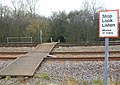 Stop Look Listen - geograph.org.uk - 2778662.jpg 2,000 × 1,419; 396 KB
-
 Stratford Canal - Edstone aqueduct - geograph.org.uk - 6380319.jpg 480 × 640; 65 KB
-
 Stratford Canal - Edstone aqueduct - geograph.org.uk - 6380324.jpg 640 × 480; 92 KB
-
 Stratford Canal - Edstone aqueduct - geograph.org.uk - 6380609.jpg 480 × 640; 81 KB
-
 Stratford canal and towpath walk - geograph.org.uk - 5759050.jpg 1,600 × 900; 497 KB
-
 Stratford Canal north of Wilmcote - geograph.org.uk - 2257327.jpg 640 × 480; 95 KB
-

-

-

-

-

-
 The Arden Way near Little Alne - geograph.org.uk - 1874977.jpg 426 × 640; 103 KB
-
 The Arden Way south of Aston Cantlow - geograph.org.uk - 1876027.jpg 640 × 426; 111 KB
-
 The Arden Way, Little Alne - geograph.org.uk - 1874969.jpg 640 × 426; 117 KB
-
 The B4089 through Little Alne - geograph.org.uk - 3538099.jpg 3,776 × 2,520; 4.28 MB
-

-

-
 The Footpath splits in the Churchyard - geograph.org.uk - 2806978.jpg 3,264 × 2,448; 2.38 MB
-
 The Monarch's Way and the Arden Way west of Little Alne - geograph.org.uk - 3538108.jpg 3,776 × 2,520; 4.17 MB
-
 The River Alne, Little Alne - geograph.org.uk - 5379943.jpg 640 × 480; 126 KB
-
 Towards Elmhurst Farm - geograph.org.uk - 4971020.jpg 480 × 640; 87 KB
-
 Towards Elmhurst Farm - geograph.org.uk - 4971026.jpg 640 × 480; 52 KB
-
 Towards Elmhurst Farm - geograph.org.uk - 4971028.jpg 480 × 640; 78 KB
-
 Towards Elmhurst Farm - geograph.org.uk - 4971031.jpg 480 × 640; 36 KB
-
 Towards Lawnsbrook Farm - geograph.org.uk - 4971011.jpg 640 × 480; 78 KB
-
 Towards Shelfield Lodge Farm - geograph.org.uk - 4971159.jpg 480 × 640; 113 KB
-
 Towards Shelfield Lodge Farm - geograph.org.uk - 4971161.jpg 640 × 480; 69 KB
-
 Towards Shelfield Square Farm - geograph.org.uk - 4971167.jpg 480 × 640; 55 KB
-
 Towards Stoopers Wood - geograph.org.uk - 4971165.jpg 640 × 480; 82 KB
-
 Towards Stoopers Wood - geograph.org.uk - 4971166.jpg 640 × 480; 86 KB
-
 Towards Tut's Cottage - geograph.org.uk - 4971099.jpg 480 × 640; 55 KB
-
 Towards Tut's Cottage - geograph.org.uk - 4971101.jpg 480 × 640; 120 KB


.jpg)


_-_geograph.org.uk_-_4897917.jpg)

_-_geograph.org.uk_-_4898751.jpg)
_-_geograph.org.uk_-_4897890.jpg)


_-_geograph.org.uk_-_2153015.jpg)


.jpg)


