Category:August 2008 in Lancashire
Deutsch: Bilder, die im August 2008 in Lancashire aufgenommen worden sind. Bitte beachten Sie, dass dies weder das Datum des Uploads noch das Datum des Scannens eines Fotos ist.
English: Images/pictures taken in Lancashire during August 2008. Note this is not the date of the upload, nor the date a photo was scanned.
Español: Fotografías o imágenes tomadas en Lancashire durante agosto 2008. No es la fecha de subida ni escaneo, sino la fecha en que las fotografías o imágenes se crearon.
Esperanto: Bildoj faritaj en Lancashire en aŭgusto 2008. Tio ne estas la dato, kiam la bildoj estis alŝutitaj aŭ skanitaj.
Français : Photographies ou images prises en Lancashire durant août 2008. Ce n'est pas la date du téléchargement ou du scan.
Galego: Fotografías ou imaxes tomadas en Lancashire durante agosto 2008. Non é a data de subida nin escaneamento, senón a data na que se crearon as fotografías ou imaxes.
Italiano: Fotografie o immagini scattate a Lancashire nel agosto 2008. Nota bene: la data non si riferisce né a quella di upload né a quella in cui la foto è stata digitalizzata.
Norsk bokmål: Bilder tatt i Lancashire i løpet av august 2008. Merk at dette ikke er datoen for opplasting, eller når et bilde har blitt skannet.
Norsk nynorsk: Bilete teke i Lancashire i løpet av august 2008. Merk at dette ikkje er datoen for opplasting, eller når eit bilete har vorte skanna.
Русский: Изображения, сделанные в Lancashire в течение август 2008 (не дата загрузки изображения).
Українська: Зображення, зроблені в Lancashire протягом серпень 2008. Зауважте, що це не дата завантаження чи дата сканування фотографії.
| August 2007 | ← | August 2008 | → | August 2009 | |||||||
| Jan | Feb | Mar | Apr | May | Jun | Jul | Aug | Sep | Oct | Nov | Dec |
| 94 | 117 | 78 | 50 | 113 | 105 | 48 | 74 | 88 | 76 | 69 | 97 |
|---|---|---|---|---|---|---|---|---|---|---|---|
Media in category "August 2008 in Lancashire"
The following 74 files are in this category, out of 74 total.
-
 A fat man's agony - geograph.org.uk - 945142.jpg 476 × 640; 141 KB
-
 Bikers cafe Glasson dock - panoramio.jpg 2,048 × 1,360; 671 KB
-
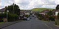 Birch Avenue - geograph.org.uk - 932453.jpg 640 × 320; 46 KB
-
 Boundary Mill Store - geograph.org.uk - 927035.jpg 640 × 359; 63 KB
-
 Bridge 79 the Cockerham Road Bridge - geograph.org.uk - 946252.jpg 640 × 428; 93 KB
-
 Buckingham Close, Helmshore - geograph.org.uk - 905277.jpg 640 × 480; 81 KB
-
 Carnforth station subway - geograph.org.uk - 985038.jpg 640 × 480; 135 KB
-
 Cocker House, Cockerham - geograph.org.uk - 946143.jpg 640 × 471; 94 KB
-
 Cockerham parish hall - geograph.org.uk - 946482.jpg 640 × 460; 81 KB
-

-
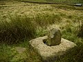 Combe Hill Cross - geograph.org.uk - 933470.jpg 640 × 480; 106 KB
-
 Cottage at White Coppice - geograph.org.uk - 923229.jpg 430 × 640; 164 KB
-
 Cowes Avenue - geograph.org.uk - 932506.jpg 640 × 480; 69 KB
-
 The Chapel of the Holy Cross, Croston - geograph.org.uk - 940443.jpg 640 × 480; 207 KB
-
 The Chapel of the Holy Cross, Croston - geograph.org.uk - 940445.jpg 640 × 480; 180 KB
-

-
 Farmers Glory, Porch Detail - geograph.org.uk - 941983.jpg 640 × 480; 105 KB
-
 Farmers Glory, Roundhill Road, Haslingden - geograph.org.uk - 941614.jpg 610 × 458; 164 KB
-

-
 Fields at Hardhorn - geograph.org.uk - 941310.jpg 640 × 422; 50 KB
-
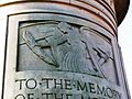 Fleetewood War Memorial 1.jpg 448 × 336; 42 KB
-
 Fleetwood War Memorial 2.jpg 336 × 448; 25 KB
-
 Fleetwood war Memorial 3.jpg 336 × 448; 33 KB
-
 Fleetwood War Memorial 4.jpg 336 × 448; 42 KB
-
 Heysham Port railway station in 2008.jpg 640 × 426; 60 KB
-
 Higher ground above Anglezarke Reservoir - geograph.org.uk - 1690621.jpg 3,872 × 2,592; 4.8 MB
-
 Light house ENG 046 - panoramio.jpg 2,048 × 1,360; 646 KB
-
 Postboxes in St Anne's - geograph.org.uk - 933939.jpg 640 × 480; 138 KB
-
 Railway Building, Freckleton Street - geograph.org.uk - 913955.jpg 640 × 480; 66 KB
-
 Railway Station - geograph.org.uk - 913989.jpg 640 × 480; 65 KB
-
 Railway Station - geograph.org.uk - 914009.jpg 640 × 480; 67 KB
-
 Railway Station - geograph.org.uk - 914021.jpg 640 × 480; 80 KB
-
 Railway Station - geograph.org.uk - 914032.jpg 640 × 480; 64 KB
-
 Railway Station Plaques - geograph.org.uk - 914003.jpg 640 × 314; 73 KB
-
 Rawtenstall Grammar School - geograph.org.uk - 928652.jpg 640 × 480; 91 KB
-
 Richmond Avenue - geograph.org.uk - 932515.jpg 640 × 480; 84 KB
-
 Richmond Avenue - geograph.org.uk - 932878.jpg 640 × 299; 41 KB
-
 River Yarrow with mediaeval bridge - geograph.org.uk - 940458.jpg 640 × 480; 203 KB
-
 Roller - geograph.org.uk - 923232.jpg 471 × 640; 127 KB
-
 Shopping Parade - geograph.org.uk - 942093.jpg 640 × 311; 41 KB
-
 Sign at Houghton Hagg Wood - geograph.org.uk - 945128.jpg 640 × 480; 107 KB
-
 St Annes-on-the-Sea railway station in 2008.jpg 640 × 480; 106 KB
-
 St James's Church, Whitechapel - geograph.org.uk - 913335.jpg 640 × 480; 150 KB
-
 St James's Church, Whitechapel, Altar - geograph.org.uk - 913363.jpg 640 × 480; 198 KB
-
 St James's Church, Whitechapel, Graveyard - geograph.org.uk - 914281.jpg 640 × 480; 144 KB
-
 St James's Church, Whitechapel, Porch - geograph.org.uk - 913341.jpg 640 × 480; 177 KB
-
 St James's Church, Whitechapel, Pulpit - geograph.org.uk - 913358.jpg 640 × 480; 169 KB
-
 St Michael's Church, Croston - geograph.org.uk - 940472.jpg 480 × 640; 191 KB
-
 St Michael's Church, Croston - geograph.org.uk - 940474.jpg 640 × 480; 164 KB
-
 St Michael's Church, Croston, Doorway - geograph.org.uk - 940470.jpg 460 × 616; 186 KB
-
 St Michael's Church, Croston, Doorway - geograph.org.uk - 940471.jpg 480 × 640; 179 KB
-
 St Michael's Church, Croston, Graveyard - geograph.org.uk - 941532.jpg 640 × 480; 200 KB
-
 The Adelphi, Fylde Street, Preston - geograph.org.uk - 915633.jpg 640 × 480; 239 KB
-
 The Black Horse, Redearth Road, Darwen - geograph.org.uk - 975473.jpg 604 × 452; 183 KB
-
 The Boulevard - geograph.org.uk - 914039.jpg 640 × 480; 81 KB
-
-
 The Crown, Redearth Road, Darwen - geograph.org.uk - 975472.jpg 622 × 466; 161 KB
-
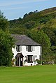
 The Fleece Inn, Higher Penwortham - geograph.org.uk - 905583.jpg 640 × 480; 168 KB
-
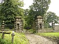 The Gates of Emmott Hall - geograph.org.uk - 933520.jpg 640 × 480; 131 KB
-
 The Grapes, Town Road, Croston - geograph.org.uk - 940464.jpg 640 × 480; 167 KB
-
 The Manor Inn, Cockerham - geograph.org.uk - 927046.jpg 640 × 425; 91 KB
-
 The Parish Church of St Michael, Kirkham - geograph.org.uk - 919715.jpg 480 × 640; 150 KB
-
 The Variety, Adelphi Street, Preston - geograph.org.uk - 915637.jpg 640 × 480; 235 KB
-
 The Wheatsheaf, Town Road, Croston - geograph.org.uk - 940371.jpg 640 × 480; 153 KB
-
 Tor View - geograph.org.uk - 932887.jpg 640 × 480; 120 KB
-
 Tor View Road - geograph.org.uk - 932884.jpg 480 × 640; 107 KB
-
 Tor View Road - geograph.org.uk - 932899.jpg 640 × 480; 96 KB
-
 Tower ballroom.jpg 1,280 × 960; 213 KB
-
 Underground Reservoir, Cedar Avenue - geograph.org.uk - 932430.jpg 640 × 292; 37 KB
-
 Usha Restaurant, A677 - geograph.org.uk - 942004.jpg 640 × 305; 28 KB
-
 Ventnor Road - geograph.org.uk - 932511.jpg 640 × 356; 53 KB
-
 War Memorial, Croston - geograph.org.uk - 940452.jpg 640 × 480; 175 KB
-
 War memorial, Poulton-le-Fylde - geograph.org.uk - 927024.jpg 504 × 640; 105 KB
-
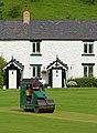
 White Coppice Cricket Pitch - geograph.org.uk - 923227.jpg 640 × 421; 176 KB


