Category:March 2008 in Lancashire
Deutsch: Bilder, die im März 2008 in Lancashire aufgenommen worden sind. Bitte beachten Sie, dass dies weder das Datum des Uploads noch das Datum des Scannens eines Fotos ist.
English: Images/pictures taken in Lancashire during March 2008. Note this is not the date of the upload, nor the date a photo was scanned.
Español: Fotografías o imágenes tomadas en Lancashire durante marzo 2008. No es la fecha de subida ni escaneo, sino la fecha en que las fotografías o imágenes se crearon.
Esperanto: Bildoj faritaj en Lancashire en marto 2008. Tio ne estas la dato, kiam la bildoj estis alŝutitaj aŭ skanitaj.
Français : Photographies ou images prises en Lancashire durant mars 2008. Ce n'est pas la date du téléchargement ou du scan.
Galego: Fotografías ou imaxes tomadas en Lancashire durante marzo 2008. Non é a data de subida nin escaneamento, senón a data na que se crearon as fotografías ou imaxes.
Italiano: Fotografie o immagini scattate a Lancashire nel marzo 2008. Nota bene: la data non si riferisce né a quella di upload né a quella in cui la foto è stata digitalizzata.
Norsk bokmål: Bilder tatt i Lancashire i løpet av mars 2008. Merk at dette ikke er datoen for opplasting, eller når et bilde har blitt skannet.
Norsk nynorsk: Bilete teke i Lancashire i løpet av mars 2008. Merk at dette ikkje er datoen for opplasting, eller når eit bilete har vorte skanna.
Русский: Изображения, сделанные в Lancashire в течение март 2008 (не дата загрузки изображения).
Українська: Зображення, зроблені в Lancashire протягом березень 2008. Зауважте, що це не дата завантаження чи дата сканування фотографії.
| March 2007 | ← | March 2008 | → | March 2009 | |||||||
| Jan | Feb | Mar | Apr | May | Jun | Jul | Aug | Sep | Oct | Nov | Dec |
| 101 | 131 | 84 | 52 | 114 | 109 | 59 | 84 | 89 | 79 | 72 | 103 |
|---|---|---|---|---|---|---|---|---|---|---|---|
Media in category "March 2008 in Lancashire"
The following 84 files are in this category, out of 84 total.
-
 2 ready 2 to go - geograph.org.uk - 747418.jpg 608 × 456; 178 KB
-
 Trade units on Tong Lane, Whitworth, Lancashire, England.jpg 2,444 × 1,832; 4.34 MB
-
 Trade unit entrance on Tong Lane, Whitworth, Lancashire, England.jpg 2,444 × 1,832; 3.65 MB
-
 Social housing terrace, John Street, Whitworth, Lancashire, England.jpg 2,494 × 1,870; 3.76 MB
-
 The Whitaker, Rawtenstall, formerly Rossendale Museum, Lancashire, England 2008.jpg 2,510 × 1,882; 2.98 MB
-
 Access road - geograph.org.uk - 746347.jpg 640 × 480; 160 KB
-
 Amy's house - geograph.org.uk - 714084.jpg 640 × 482; 71 KB
-
 Beware of the BULL - geograph.org.uk - 743538.jpg 640 × 413; 77 KB
-
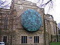 Blackburn Cathedral - Mark Jalland sculpture.jpg 2,400 × 1,800; 1.61 MB
-

-
 Briercliffe Library - geograph.org.uk - 927803.jpg 640 × 480; 19 KB
-
 Britannia Inn, Guy Street, Padiham - geograph.org.uk - 756501.jpg 640 × 480; 177 KB
-

-
 Car Park Steps - geograph.org.uk - 743548.jpg 480 × 640; 100 KB
-
 Castellated railway bridge, Turton Tower - geograph.org.uk - 745098.jpg 640 × 427; 126 KB
-
 Chipping Congregational Church, Doorway - geograph.org.uk - 753695.jpg 472 × 630; 208 KB
-
 Chorley Institute-935.JPG 2,592 × 1,944; 1.62 MB
-
 Chorley-Georgian terrace and church.JPG 2,592 × 1,944; 1.64 MB
-
 Clitheroe railway station 2.JPG 2,048 × 1,536; 1.09 MB
-
 Clitheroe railway station 3.JPG 2,048 × 1,536; 695 KB
-
 Clitheroe railway station 4.JPG 2,048 × 1,536; 1.29 MB
-
 Clitheroe railway station.JPG 2,048 × 1,536; 996 KB
-
 Doorway of No2 Church Brow, Clitheroe - geograph.org.uk - 743694.jpg 470 × 628; 213 KB
-
 Downham Mill - geograph.org.uk - 778840.jpg 640 × 480; 117 KB
-

-
 Entrance to Motorway police station - geograph.org.uk - 746349.jpg 640 × 480; 171 KB
-
 Entrance to Swan Courtyard - geograph.org.uk - 731709.jpg 640 × 480; 205 KB
-
 Fleetwood - Mar 2008 - Ash St and Tramtracks.jpg 2,048 × 1,536; 359 KB
-
 Fleetwood - Mar 2008 - Fleetwood Pier.jpg 2,048 × 1,536; 280 KB
-
 Fleetwood - Mar 2008 - Lower Lighthouse from Jubilee Gardens.jpg 2,048 × 1,536; 372 KB
-
 Fleetwood - Mar 2008 - Marine Hall and Gardens from the Mount.jpg 2,048 × 1,536; 319 KB
-
 Fleetwood - Mar 2008 - Marine Hall and Seafront.jpg 2,048 × 1,536; 163 KB
-
 Fleetwood - Mar 2008 - Mount and Esplanade.jpg 2,048 × 1,536; 329 KB
-
 Fleetwood - Mar 2008 - Mount Hotel.jpg 2,048 × 1,536; 404 KB
-
 Fleetwood - Mar 2008 - North Euston from Jubilee Gdns.jpg 2,048 × 1,536; 451 KB
-
 Fleetwood - Mar 2008 - North Euston from Jubilee Gdns2.jpg 2,048 × 1,536; 464 KB
-
 Fleetwood - Mar 2008 - North Euston Hotel.jpg 2,048 × 1,536; 466 KB
-
 Fleetwood pier - geograph.org.uk - 722653.jpg 640 × 425; 59 KB
-
 Former police station, Whalley - geograph.org.uk - 731692.jpg 640 × 480; 234 KB
-
 General Post Office - geograph.org.uk - 728811.jpg 640 × 405; 62 KB
-
 Hark to Bounty, Sign - geograph.org.uk - 739620.jpg 640 × 480; 203 KB
-
 Hole-s in the wall - geograph.org.uk - 731696.jpg 640 × 480; 198 KB
-
 Kay Street - geograph.org.uk - 728807.jpg 640 × 393; 73 KB
-
 Kay Street - geograph.org.uk - 728809.jpg 640 × 411; 91 KB
-
 Kay Street - geograph.org.uk - 728815.jpg 640 × 480; 55 KB
-
 Key Street, Lowergate, Clitheroe - geograph.org.uk - 731747.jpg 640 × 480; 198 KB
-
 Lancashire County Hall, Preston.jpg 640 × 480; 162 KB
-
 Lancashire United MPD.jpg 800 × 600; 107 KB
-
 Lancashire United Volvo B10BLE Wrightbus.jpg 800 × 600; 88 KB
-
 New Roundabout A682 Rawtenstall - geograph.org.uk - 752241.jpg 640 × 480; 72 KB
-
 North Euston Hotel - geograph.org.uk - 722638.jpg 640 × 425; 85 KB
-
 Old boiler - geograph.org.uk - 850220.jpg 640 × 480; 77 KB
-
 Old carriages - geograph.org.uk - 850248.jpg 640 × 480; 86 KB
-
 Old Girls School, Doorway - geograph.org.uk - 739603.jpg 474 × 632; 195 KB
-
 Nazareth Unitarian Church, Padiham - geograph.org.uk - 753738.jpg 480 × 640; 147 KB
-

-

-
-
 Police Station - geograph.org.uk - 728796.jpg 640 × 351; 37 KB
-
 Railway Hotel, Butler Street, Preston - geograph.org.uk - 745163.jpg 480 × 640; 172 KB
-
 Reflections - geograph.org.uk - 742985.jpg 640 × 480; 123 KB
-
 River Calder - geograph.org.uk - 753716.jpg 640 × 480; 195 KB
-
 RobertWService-plaque-Preston.jpg 1,600 × 1,200; 543 KB
-
 Sheltered seats - geograph.org.uk - 722635.jpg 640 × 425; 77 KB
-
 Ship ahoy - geograph.org.uk - 722657.jpg 640 × 425; 80 KB
-

-

-
 Sykes Farm - geograph.org.uk - 733049.jpg 608 × 456; 162 KB
-

-
 The Inn at Whitewell - geograph.org.uk - 1003494.jpg 640 × 428; 89 KB
-
 The Moorcock Inn - geograph.org.uk - 742181.jpg 640 × 480; 227 KB
-
 The NatWest Bank - geograph.org.uk - 728766.jpg 640 × 568; 102 KB
-
 The Old Vic, 80 Fishergate, Preston - geograph.org.uk - 745150.jpg 640 × 480; 160 KB
-
 The Plane Tree, Turn Village - geograph.org.uk - 721781.jpg 640 × 498; 76 KB
-
 The Rendezvous Night Club, Whalley - geograph.org.uk - 731694.jpg 640 × 480; 221 KB
-
 Tower of Blackburn Cathedral - geograph.org.uk - 1310423.jpg 480 × 640; 99 KB
-
 Training centre - geograph.org.uk - 722667.jpg 640 × 425; 81 KB
-
 Trough Road as it passes Sykes Cottage - geograph.org.uk - 733048.jpg 600 × 448; 153 KB
-
 Twiston Mill - geograph.org.uk - 778853.jpg 640 × 480; 99 KB
-
 Waddington Arms - geograph.org.uk - 742200.jpg 640 × 480; 195 KB
-
 Whalley Bus Station - geograph.org.uk - 731698.jpg 640 × 480; 169 KB
-
 Whalley Village Hall - geograph.org.uk - 731686.jpg 640 × 480; 152 KB
-
 The White Bull, Longridge - geograph.org.uk - 747325.jpg 620 × 464; 142 KB
-
 Farm Track on Plex Moss - geograph.org.uk - 737590.jpg 640 × 479; 67 KB


