Category:Barrow, Shropshire
English: Barrow is a hamlet and civil parish in Shropshire, England, some 5 miles south of Telford between Ironbridge and Much Wenlock.
Norsk bokmål: Barrow er en landsby og sogn i Bridgnorth distrikt i Shropshire, England. Den ligger rundt 11 kilometer nord for Bridgnorth, nær Telford and Wrekin. Ved folketellingen i 2001 hadde landsbyen 636 innbyggere.
village and civil parish in Shropshire, England, UK  | |||||
| Upload media | |||||
| Instance of | |||||
|---|---|---|---|---|---|
| Location | Shropshire, West Midlands, England | ||||
 | |||||
Subcategories
This category has the following 5 subcategories, out of 5 total.
Media in category "Barrow, Shropshire"
The following 200 files are in this category, out of 206 total.
(previous page) (next page)-
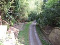
 A diverted footpath - geograph.org.uk - 2364400.jpg 1,152 × 864; 306 KB
-
 A little dell - geograph.org.uk - 2062981.jpg 683 × 1,024; 272 KB
-
 A view from St Giles - geograph.org.uk - 761399.jpg 640 × 480; 96 KB
-
 Abandoned farm at Darley - geograph.org.uk - 2368401.jpg 896 × 672; 327 KB
-
 An old green lane near Linleygreen - geograph.org.uk - 2368427.jpg 614 × 819; 338 KB
-
 Arable land on Benthall Edge - geograph.org.uk - 6337318.jpg 1,024 × 768; 292 KB
-
 Arlescott Cottage - geograph.org.uk - 1990407.jpg 768 × 576; 219 KB
-
 Arlescott farm - geograph.org.uk - 2477188.jpg 640 × 480; 95 KB
-
 Arlescott Farm - geograph.org.uk - 484135.jpg 640 × 480; 159 KB
-
 Arlescott Farm from the west - geograph.org.uk - 1990420.jpg 794 × 595; 185 KB
-
 At the edge of Bradley's Coppice - geograph.org.uk - 1810655.jpg 640 × 480; 182 KB
-
 B4373, Barrow - geograph.org.uk - 6071192.jpg 1,024 × 768; 329 KB
-
 B4376 and B4375 - geograph.org.uk - 6071834.jpg 1,024 × 768; 241 KB
-
 B4376 towards Barrow - geograph.org.uk - 6108473.jpg 800 × 600; 142 KB
-
 Barley, Ballsfoundry - geograph.org.uk - 4328678.jpg 800 × 600; 417 KB
-
 Barley, Swinney - geograph.org.uk - 4328114.jpg 800 × 600; 459 KB
-
 Barley, Swinney - geograph.org.uk - 4328115.jpg 800 × 600; 391 KB
-
 Barrow farmland - geograph.org.uk - 6071144.jpg 1,024 × 768; 294 KB
-
 Barrow House - geograph.org.uk - 418690.jpg 600 × 450; 280 KB
-
 Barrow House, Barrow - geograph.org.uk - 1990378.jpg 717 × 538; 207 KB
-
 Benthall church - geograph.org.uk - 6211990.jpg 1,024 × 768; 248 KB
-
 Benthall church - geograph.org.uk - 6211992.jpg 1,024 × 768; 372 KB
-
 Benthall Church near Ironbridge - geograph.org.uk - 6281414.jpg 640 × 483; 73 KB
-
 Benthall Hall - geograph.org.uk - 6211981.jpg 1,024 × 768; 258 KB
-
 Benthall Hall - geograph.org.uk - 6211983.jpg 1,024 × 768; 260 KB
-
 Benthall Hall - geograph.org.uk - 6211986.jpg 1,024 × 768; 253 KB
-
 Benthall Hall Farm - geograph.org.uk - 6281391.jpg 640 × 432; 66 KB
-
 Benthall Hall near Ironbridge - geograph.org.uk - 6281404.jpg 640 × 480; 86 KB
-
 Benthall Hall, Broseley - geograph.org.uk - 6070217.jpg 3,926 × 2,418; 886 KB
-
 Benthall Lane - geograph.org.uk - 6268611.jpg 1,600 × 1,067; 450 KB
-
 Benthall Lane, Broseley - geograph.org.uk - 2141678.jpg 922 × 691; 198 KB
-
 Bridge and cottage at Linley Brook - geograph.org.uk - 2231525.jpg 819 × 614; 298 KB
-
 Bridge over a brook. - geograph.org.uk - 1810673.jpg 480 × 640; 171 KB
-
 Bridge over private drive - geograph.org.uk - 1141616.jpg 640 × 480; 105 KB
-

-
 Bridleway behind Old Park Farm - geograph.org.uk - 2139949.jpg 640 × 480; 216 KB
-
 Bridleway heading for the Severn Gorge - geograph.org.uk - 2368456.jpg 653 × 870; 374 KB
-
 Bridleway in Shirlett High Park woods - geograph.org.uk - 2231535.jpg 614 × 819; 303 KB
-
 Bridleway near Deancorner - geograph.org.uk - 2230669.jpg 768 × 576; 245 KB
-
 Bridleway near Deancorner - geograph.org.uk - 2230674.jpg 768 × 576; 258 KB
-
 Bridleway near Highfield Plantation - geograph.org.uk - 2230678.jpg 768 × 576; 275 KB
-
 Bridleway to Willey, Shropshire - geograph.org.uk - 457639.jpg 480 × 640; 157 KB
-

-
 Buildings at Hillview Farm - geograph.org.uk - 1990287.jpg 896 × 672; 193 KB
-
 Caughley Farm from Caughley Road - geograph.org.uk - 2048938.jpg 845 × 634; 189 KB
-
 Caughley Road near Inett - geograph.org.uk - 2048943.jpg 870 × 653; 195 KB
-
 Church of St Bartholomew - geograph.org.uk - 5769845.jpg 5,184 × 3,888; 3.6 MB
-
 Colley's Dingle - geograph.org.uk - 347824.jpg 640 × 304; 30 KB
-
 Communications, Willey - geograph.org.uk - 6405686.jpg 683 × 1,024; 324 KB
-
 Cooling tower, Ironbridge Power Station - geograph.org.uk - 6337285.jpg 768 × 1,024; 287 KB
-
 Cooling towers at Ironbridge Power Station - geograph.org.uk - 6337322.jpg 1,024 × 768; 167 KB
-
 Cooling towers of Ironbridge Power Station - geograph.org.uk - 6337290.jpg 768 × 1,024; 253 KB
-
 Cooling towers of Ironbridge Power Station - geograph.org.uk - 6337321.jpg 1,024 × 768; 160 KB
-
 Cottage at Shirlett Farm - geograph.org.uk - 1990323.jpg 845 × 634; 188 KB
-
 Cottage in Shirlett High Park woods - geograph.org.uk - 2231538.jpg 819 × 614; 282 KB
-
 Cottage, Shirlett High Park - geograph.org.uk - 6071858.jpg 1,024 × 768; 378 KB
-
 Cottages in Willey - geograph.org.uk - 2231358.jpg 922 × 691; 215 KB
-

-
 Derelict farm buildings above the Dean Brook - geograph.org.uk - 2368392.jpg 1,152 × 864; 318 KB
-
 Derelict outbuilding at Hillview Farm - geograph.org.uk - 1990302.jpg 717 × 538; 211 KB
-
 Deserted cottage at Darley - geograph.org.uk - 2364415.jpg 973 × 730; 322 KB
-
 Detail of Benthall Hall - geograph.org.uk - 6211985.jpg 768 × 1,024; 242 KB
-
 Driveway to Broseley - geograph.org.uk - 418729.jpg 600 × 450; 310 KB
-
 Dumper track and quarry machinery - geograph.org.uk - 2048970.jpg 998 × 749; 177 KB
-
 Early growth in crops near Willey - geograph.org.uk - 2231372.jpg 819 × 614; 211 KB
-
 Edwardian wallbox at Shirlett Farm - geograph.org.uk - 1990325.jpg 557 × 742; 201 KB
-
 Farmland near Darley - geograph.org.uk - 2167832.jpg 640 × 330; 131 KB
-
 Farmland near Willey - geograph.org.uk - 2231373.jpg 870 × 653; 228 KB
-
 Field, Shirlett - geograph.org.uk - 6071856.jpg 1,024 × 768; 396 KB
-
 Field, Shirley - geograph.org.uk - 6071839.jpg 1,024 × 768; 370 KB
-
 Field, Stanbourne - geograph.org.uk - 4328100.jpg 800 × 600; 528 KB
-
 Fields and woodland, Barrow - geograph.org.uk - 6071189.jpg 1,024 × 768; 411 KB
-
 Fields of wheat - geograph.org.uk - 2477166.jpg 640 × 480; 86 KB
-
 Footbridge across the Dean Brook - geograph.org.uk - 2366670.jpg 947 × 710; 355 KB
-
 Footbridge below the old cottage - geograph.org.uk - 2366701.jpg 896 × 672; 361 KB
-
 Footpath at the edge of Thrift Coppice - geograph.org.uk - 2368435.jpg 1,024 × 768; 306 KB
-
 Footpath down to the river. - geograph.org.uk - 1810666.jpg 480 × 640; 148 KB
-

-

-
 Footpath over Arlescott Hill - geograph.org.uk - 1990435.jpg 614 × 819; 186 KB
-
 Footpath to Barrow Dingle - geograph.org.uk - 418718.jpg 600 × 450; 251 KB
-
 Green lane, Barrow - geograph.org.uk - 6071188.jpg 1,024 × 768; 506 KB
-
 Green lane, Barrow - geograph.org.uk - 6071191.jpg 1,024 × 768; 584 KB
-
 Highfield Plantation - geograph.org.uk - 6405693.jpg 1,024 × 683; 448 KB
-
 Hillview Farmhouse, near Shirlett - geograph.org.uk - 1990310.jpg 819 × 614; 195 KB
-

-
 Houses backing onto the B4376 - geograph.org.uk - 6210970.jpg 1,024 × 768; 221 KB
-
 Hungerdale Farm - geograph.org.uk - 1992089.jpg 717 × 538; 195 KB
-
 In the Dean Brook valley - geograph.org.uk - 2366660.jpg 1,152 × 864; 315 KB
-
 In the kitchen garden, Benthall Hall - geograph.org.uk - 6268614.jpg 1,600 × 1,067; 686 KB
-
 Ironbridge Power Station - geograph.org.uk - 6337315.jpg 768 × 1,024; 210 KB
-

-
 It's dark ^ gloomy in Bradley's Coppice - geograph.org.uk - 1810658.jpg 640 × 480; 160 KB
-
 Jack Mytton Way, south of Barrow - geograph.org.uk - 418705.jpg 450 × 600; 324 KB
-
 Junction of a footpath and a bridleway - geograph.org.uk - 2368444.jpg 1,024 × 768; 341 KB
-
 Kissing Gate, Benthall - geograph.org.uk - 1141544.jpg 640 × 480; 67 KB
-
 Lane between Willey and Linley - geograph.org.uk - 2231370.jpg 794 × 595; 236 KB
-
 Lane from Shirlett to Firs Farm - geograph.org.uk - 2231533.jpg 819 × 614; 268 KB
-
 Large cottage at Willey - geograph.org.uk - 2231543.jpg 819 × 614; 288 KB
-
 Linley Church - geograph.org.uk - 6071126.jpg 1,024 × 768; 462 KB
-
 Lodge Farm - geograph.org.uk - 415890.jpg 600 × 450; 213 KB
-
 Lodge Farm from Lodge Lane - geograph.org.uk - 724117.jpg 640 × 480; 104 KB
-
 Lodge Lane, off the B4376 - geograph.org.uk - 1141632.jpg 640 × 480; 81 KB
-
 Looking downstream - geograph.org.uk - 2368490.jpg 1,152 × 864; 340 KB
-
 Looking towards the Wrekin - geograph.org.uk - 2477208.jpg 640 × 480; 89 KB
-
 Lower Pool - geograph.org.uk - 6405672.jpg 1,024 × 683; 357 KB
-
 Lower Pool at Willey Park - geograph.org.uk - 2231540.jpg 819 × 614; 318 KB
-
 Mill buildings in Willey - geograph.org.uk - 2231364.jpg 819 × 614; 251 KB
-
 National Cycle Route 45 - geograph.org.uk - 5523514.jpg 800 × 541; 208 KB
-
 NCN 45 near Hifnal - geograph.org.uk - 2368481.jpg 896 × 672; 333 KB
-
 NCR 45 - geograph.org.uk - 1810669.jpg 640 × 480; 165 KB
-
 New copse in a valley - geograph.org.uk - 1990459.jpg 640 × 480; 212 KB
-

-
 Old Milepost by the B4373, Linley, Barrow parish - geograph.org.uk - 6050379.jpg 1,294 × 1,704; 435 KB
-
 Old Toll House, Broseley - geograph.org.uk - 6114886.jpg 790 × 561; 62 KB
-
 Old Toll House, Linley Green - geograph.org.uk - 6114935.jpg 782 × 563; 65 KB
-
 Old Toll House, Marsh Gates - geograph.org.uk - 6114413.jpg 731 × 533; 41 KB
-
 Old Toll House, Posenhall - geograph.org.uk - 6114753.jpg 748 × 518; 52 KB
-
 Opencast clay workings at Broseley - geograph.org.uk - 2048954.jpg 922 × 691; 178 KB
-
 Packhorse bridge over the Linley Brook - geograph.org.uk - 3475755.jpg 816 × 612; 352 KB
-
 Parkland at Willey - geograph.org.uk - 2230662.jpg 998 × 749; 212 KB
-
 Parkland near Willey - geograph.org.uk - 2167818.jpg 640 × 398; 169 KB
-
 Parkland, Willey - geograph.org.uk - 6405699.jpg 1,024 × 683; 224 KB
-
 Path approaching Benthall Hall Cottage - geograph.org.uk - 2063181.jpg 682 × 1,024; 302 KB
-
 Path junction on the Shropshire Way - geograph.org.uk - 1992094.jpg 640 × 480; 199 KB
-
 Path to Benthall Hall - geograph.org.uk - 2063158.jpg 682 × 1,024; 264 KB
-
 Path to the river - geograph.org.uk - 4328111.jpg 800 × 600; 552 KB
-
 Peacock butterfly feeding on thistle - geograph.org.uk - 1990443.jpg 730 × 973; 196 KB
-
 Pheasant pens at Honeypot houses - geograph.org.uk - 2368411.jpg 973 × 730; 333 KB
-
 Pile On - geograph.org.uk - 2396582.jpg 4,000 × 3,000; 5.81 MB
-
 Point taken - geograph.org.uk - 724105.jpg 640 × 480; 113 KB
-

-
 Private, No Fishing. - geograph.org.uk - 1141625.jpg 640 × 480; 84 KB
-
 Pump Plantation - geograph.org.uk - 6405698.jpg 1,024 × 683; 401 KB
-
 Rainbow near Barrow - geograph.org.uk - 761456.jpg 640 × 480; 65 KB
-
 Rainbow over Caughley Quarry weighbridge - geograph.org.uk - 2048987.jpg 1,050 × 787; 177 KB
-
 Rape, Poppies and a Thistle - geograph.org.uk - 2477177.jpg 640 × 480; 99 KB
-
 River Severn - geograph.org.uk - 4328103.jpg 800 × 600; 559 KB
-
 River Severn - geograph.org.uk - 4328105.jpg 800 × 600; 459 KB
-
 River Severn - geograph.org.uk - 4328107.jpg 800 × 600; 529 KB
-
 Road to Hem Farm - geograph.org.uk - 6071129.jpg 1,024 × 768; 319 KB
-
 Road, Shirlett - geograph.org.uk - 6071862.jpg 1,024 × 768; 464 KB
-
 Road, Shirlett - geograph.org.uk - 6071881.jpg 1,024 × 768; 558 KB
-
 Road, Shirlett Common - geograph.org.uk - 6071852.jpg 1,024 × 768; 445 KB
-
 Ruined cottage on the hillside - geograph.org.uk - 1990280.jpg 819 × 614; 187 KB
-
 Sand pit, Willey Park Woods - geograph.org.uk - 6071097.jpg 1,024 × 768; 475 KB
-
 Sheep country on Willey Park land - geograph.org.uk - 2231352.jpg 973 × 730; 222 KB
-
 Sheep grazing near Marsh Cottages - geograph.org.uk - 6108471.jpg 800 × 600; 110 KB
-
 Sheep, Willey - geograph.org.uk - 6405679.jpg 1,024 × 683; 257 KB
-
 Shirlett Common - geograph.org.uk - 6071848.jpg 1,024 × 768; 422 KB
-
 Shirlett High Park - geograph.org.uk - 6071861.jpg 1,024 × 768; 566 KB
-
 Small pond near Benthall - geograph.org.uk - 2749778.jpg 640 × 480; 101 KB
-

-
 South along the National Cycle Route 45 - geograph.org.uk - 5523553.jpg 800 × 548; 179 KB
-
 Speed's Field, Broseley - geograph.org.uk - 2141696.jpg 922 × 691; 185 KB
-
 St Giles, Barrow - geograph.org.uk - 6071187.jpg 1,024 × 768; 368 KB
-
 Stile and footpath towards Linley Hall - geograph.org.uk - 2231376.jpg 819 × 614; 223 KB
-
 Storage Tanks - geograph.org.uk - 484140.jpg 640 × 480; 121 KB
-
 Summer House, Benthall Hall - geograph.org.uk - 6070220.jpg 2,157 × 3,741; 1.33 MB
-
 Sunken lane, Willey - geograph.org.uk - 6405694.jpg 1,024 × 683; 400 KB
-
 Swinney Farm from the Caughley Road - geograph.org.uk - 2048927.jpg 870 × 653; 190 KB
-
 The abandoned farmhouse at Darley - geograph.org.uk - 2368406.jpg 896 × 672; 309 KB
-
 The Almshouses - geograph.org.uk - 418661.jpg 600 × 403; 200 KB
-
 The church of St Giles, Barrow - geograph.org.uk - 6281369.jpg 640 × 515; 81 KB
-
 The Church of St Giles, Barrow, Shropshire - geograph.org.uk - 6356688.jpg 4,608 × 3,456; 3.98 MB
-
 The Church of St Giles, Barrow, Shropshire - geograph.org.uk - 6356693.jpg 4,608 × 3,456; 4.06 MB
-
 The Church of St Giles, Barrow, Shropshire - geograph.org.uk - 6356697.jpg 4,608 × 3,456; 3.96 MB
-
 The Church of St Giles, Barrow, Shropshire - geograph.org.uk - 6356700.jpg 4,608 × 3,456; 3.75 MB
-
 The Church of St Giles, Barrow, Shropshire - geograph.org.uk - 6356704.jpg 4,608 × 3,456; 3.97 MB
-

-
 The Dean - geograph.org.uk - 6071175.jpg 1,024 × 768; 539 KB
-
 The Dean Brook near The Severn - geograph.org.uk - 2368464.jpg 634 × 845; 345 KB
-
 The Jack Mytton bridleway - geograph.org.uk - 1990363.jpg 819 × 614; 204 KB
-
 The Jack Mytton bridleway - geograph.org.uk - 1990373.jpg 845 × 634; 199 KB
-
 The Jack Mytton bridleway - geograph.org.uk - 1990382.jpg 819 × 614; 185 KB
-
 The Jack Mytton bridleway to Barrow - geograph.org.uk - 1990388.jpg 870 × 653; 197 KB
-
 The Marsh, Barrow - geograph.org.uk - 100519.jpg 640 × 463; 120 KB
-

-
 The remaining signs of the old village - geograph.org.uk - 1990414.jpg 819 × 614; 192 KB
-
 The River Severn at Hifnal - geograph.org.uk - 5487139.jpg 800 × 600; 98 KB
-
 Top pool, Willey Park - geograph.org.uk - 844405.jpg 640 × 426; 101 KB
-

-
 Track on Benthall Edge - geograph.org.uk - 6337320.jpg 768 × 1,024; 434 KB
-
 Trees in a hedge - geograph.org.uk - 2063224.jpg 1,024 × 682; 201 KB
-
 Upper Forge house - geograph.org.uk - 3475764.jpg 816 × 612; 350 KB
-
 Upstream on the Severn - geograph.org.uk - 2368473.jpg 1,152 × 864; 308 KB
-
 Vandalised telephone booth in Barrow, Shropshire, England..jpg 640 × 480; 88 KB
-
 Victorian wallbox at Willey - geograph.org.uk - 2231355.jpg 634 × 845; 240 KB
-

-
 View to The Wrekin and Ironbridge Power Station - geograph.org.uk - 6337297.jpg 1,024 × 768; 182 KB
-
 Village School - geograph.org.uk - 418674.jpg 600 × 450; 259 KB
-
 Walled garden, Willey - geograph.org.uk - 6405690.jpg 1,024 × 683; 362 KB
-
 Water storage tanks - geograph.org.uk - 1990432.jpg 922 × 691; 186 KB
-
 Willey Home Farm - geograph.org.uk - 2231353.jpg 947 × 710; 226 KB
-
 Willey Old Hall (geograph 6862645).jpg 1,600 × 1,200; 570 KB
-
 Willey Old Hall - geograph.org.uk - 6405684.jpg 1,024 × 683; 234 KB
-
 Willey Park, aerial 2018 - geograph.org.uk - 5841914.jpg 533 × 800; 93 KB
-
 Willey ^ District Village Hall - geograph.org.uk - 2231367.jpg 819 × 614; 252 KB
-
 Willey ^ District Village Hall - geograph.org.uk - 6405677.jpg 1,024 × 683; 349 KB
-
 Winter cereals, The Marsh - geograph.org.uk - 6071830.jpg 1,024 × 768; 286 KB


.jpg)


