Category:Bayton
Main Wikipedia article: Bayton.
village in Worcestershire, England, UK  | |||||
| Upload media | |||||
| Instance of | |||||
|---|---|---|---|---|---|
| Location | Malvern Hills, Worcestershire, West Midlands, England | ||||
| Said to be the same as | Bayton (Wikimedia duplicated page, civil parish) | ||||
 | |||||
Subcategories
This category has the following 3 subcategories, out of 3 total.
B
- Bayton Roll of Honour (1 F)
S
- Shakenhurst (2 F)
Media in category "Bayton"
The following 110 files are in this category, out of 110 total.
-
 A battered oak - geograph.org.uk - 4422252.jpg 800 × 533; 426 KB
-
 A Farm in Beach Hay - geograph.org.uk - 376095.jpg 640 × 480; 49 KB
-
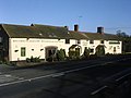
 A mixture of buildings at Clows Top - geograph.org.uk - 3488823.jpg 1,024 × 768; 100 KB
-
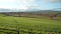
 Arable and woodland - geograph.org.uk - 3724410.jpg 800 × 450; 227 KB
-
 B4202 - Bayton Common crossroads - geograph.org.uk - 2571411.jpg 640 × 480; 80 KB
-
 B4202 approaching a rural crossroads - geograph.org.uk - 2571399.jpg 640 × 480; 72 KB
-
 B4202 at Bayton Common - geograph.org.uk - 3279943.jpg 640 × 480; 77 KB
-
 B4202 at Clows Top - geograph.org.uk - 2178864.jpg 1,024 × 681; 189 KB
-
 B4202 at Tansy Fields - geograph.org.uk - 2571404.jpg 640 × 480; 65 KB
-
 B4202 at the junction for Bayton - geograph.org.uk - 2571413.jpg 640 × 480; 78 KB
-
 B4202 near Church Hill - geograph.org.uk - 2571406.jpg 640 × 480; 83 KB
-
 B4202, Clows Top - geograph.org.uk - 5643773.jpg 1,024 × 683; 315 KB
-
 Bayton - geograph.org.uk - 4423183.jpg 800 × 533; 401 KB
-
 Bayton Church of England Primary School - geograph.org.uk - 6380360.jpg 3,648 × 2,736; 3.93 MB
-
 Bayton Common - geograph.org.uk - 496195.jpg 640 × 480; 86 KB
-
 Bayton junction off B4202 - geograph.org.uk - 3276981.jpg 640 × 471; 67 KB
-
 Bayton Playing Field - geograph.org.uk - 6380589.jpg 3,648 × 2,736; 4.66 MB
-
 Bridge buttress, Nineveh - geograph.org.uk - 4422243.jpg 800 × 533; 473 KB
-
 Bridleway at Bayton Common - geograph.org.uk - 2178915.jpg 681 × 1,024; 320 KB
-
 Bridleway over Tanner's Brook - geograph.org.uk - 2179201.jpg 1,024 × 681; 315 KB
-
 Broadmeadows Farmhouse (Bayton) - geograph.org.uk - 6380595.jpg 3,648 × 2,736; 4.01 MB
-
 Broadmeadows Farmhouse (Bayton) - geograph.org.uk - 6381051.jpg 3,648 × 2,736; 4.24 MB
-
 Brown Clee Hill (Viewed from Bayton) - geograph.org.uk - 6380984.jpg 1,610 × 907; 334 KB
-

-

-
 Churchyard at St. Bartholomew's Church (Bayton) - geograph.org.uk - 6381174.jpg 3,648 × 2,736; 4.48 MB
-
 Clows Top - geograph.org.uk - 5643780.jpg 1,024 × 683; 310 KB
-

-

-
 Clows Top Mission Room - geograph.org.uk - 2178855.jpg 1,024 × 681; 234 KB
-
 Clows Top Road - geograph.org.uk - 5643765.jpg 1,024 × 683; 351 KB
-
 Clows Top village centre - geograph.org.uk - 3241624.jpg 640 × 480; 53 KB
-
 Coneybury Bridge - geograph.org.uk - 3724405.jpg 640 × 480; 125 KB
-
 Cottages in Bayton - geograph.org.uk - 3724425.jpg 800 × 450; 227 KB
-

-
 Crossroads near Gay Meadows - geograph.org.uk - 3279947.jpg 640 × 401; 47 KB
-
 Ditch and oaktree - geograph.org.uk - 3407417.jpg 640 × 480; 377 KB
-
 Ducks in the Lake at the Old Vicarage (Bayton) - geograph.org.uk - 6381199.jpg 3,648 × 2,736; 5.01 MB
-
 Entrance Gate to St. Bartholomew's Church (Bayton) - geograph.org.uk - 6380990.jpg 3,648 × 2,736; 4.64 MB
-
 Farmland, Beach Hay - geograph.org.uk - 3406852.jpg 640 × 480; 303 KB
-
 Field, Shakenhurst - geograph.org.uk - 4423176.jpg 800 × 533; 381 KB
-
 Fields, Bayton - geograph.org.uk - 4423192.jpg 800 × 533; 373 KB
-
 Gate and stile - geograph.org.uk - 4423186.jpg 800 × 533; 500 KB
-
 Grassland, Wyre Forest - geograph.org.uk - 3406858.jpg 640 × 480; 308 KB
-
 Horse and Jockey - geograph.org.uk - 287821.jpg 640 × 480; 89 KB
-
 Houghtonspole Bridge - geograph.org.uk - 3724832.jpg 800 × 600; 353 KB
-
 House beside Bayton church - geograph.org.uk - 465480.jpg 640 × 426; 149 KB
-
 Lake at the Old Vicarage (Bayton) - geograph.org.uk - 6381195.jpg 3,648 × 2,736; 4.83 MB
-
 Lamp at St. Bartholomew's Church (Bayton) - geograph.org.uk - 6380592.jpg 3,648 × 2,736; 4.45 MB
-
 Lane junction near Beach Hay - geograph.org.uk - 2864923.jpg 633 × 436; 165 KB
-
 Lane to Far Forest - geograph.org.uk - 2864925.jpg 620 × 449; 179 KB
-
 Long straight at Tansy Fields - geograph.org.uk - 3279946.jpg 640 × 446; 46 KB
-
 Lychgate at St. Bartholomew's Church (Bayton) - geograph.org.uk - 6380590.jpg 3,648 × 2,736; 3.98 MB
-
 Lychgate at St. Bartholomew's Church (Bayton) - geograph.org.uk - 6381185.jpg 3,648 × 2,736; 4.38 MB
-
 Mill Brook and The Old Mill - geograph.org.uk - 3724399.jpg 600 × 800; 423 KB
-
 Mill Brook near Mamble - geograph.org.uk - 461165.jpg 426 × 640; 134 KB
-
 Misty morning at Beach Hay - geograph.org.uk - 2864922.jpg 614 × 449; 91 KB
-
 Norgrovesend Farm, Bayton - geograph.org.uk - 461139.jpg 640 × 426; 126 KB
-
 North out of Clows Top - geograph.org.uk - 3276978.jpg 640 × 436; 50 KB
-

-
 Parkland, Shakenhurst - geograph.org.uk - 4422262.jpg 800 × 533; 368 KB
-
 Pedestrians in road ahead - geograph.org.uk - 2178880.jpg 681 × 1,024; 203 KB
-
 Public Footpath at Bayton - geograph.org.uk - 6380723.jpg 3,648 × 2,056; 3.59 MB
-
 Public Footpath at Bayton - geograph.org.uk - 6381000.jpg 3,648 × 2,056; 3.54 MB
-
 River Rea - downstream - geograph.org.uk - 3724826.jpg 800 × 600; 357 KB
-
 River Rea - geograph.org.uk - 3724815.jpg 800 × 600; 375 KB
-
 Road end near Clows Top - geograph.org.uk - 5643776.jpg 1,024 × 683; 337 KB
-
 Road junction at Bayton Common - geograph.org.uk - 2178841.jpg 1,024 × 681; 178 KB
-
 Road to Bayton - geograph.org.uk - 5643762.jpg 1,024 × 683; 405 KB
-
 Road to Nineveh - geograph.org.uk - 3724796.jpg 800 × 452; 272 KB
-
 Road used as a footpath - geograph.org.uk - 3724788.jpg 800 × 600; 342 KB
-
 Rural crossroads, B4202 - geograph.org.uk - 2571402.jpg 640 × 480; 78 KB
-
 Shadows by St. Bartholomew's Church (Bayton) - geograph.org.uk - 6370840.jpg 4,608 × 3,456; 4.89 MB
-
 Shakenhurst Brook - geograph.org.uk - 5228352.jpg 1,024 × 683; 572 KB
-

-

-
 Summit Road - geograph.org.uk - 5643781.jpg 1,024 × 683; 393 KB
-
 Summit Road, Clows Top - geograph.org.uk - 3488798.jpg 1,024 × 469; 70 KB
-
 Tanner's Coppice - geograph.org.uk - 3406848.jpg 640 × 480; 372 KB
-

-
 The B4204 in Clows Top - geograph.org.uk - 2178831.jpg 1,024 × 681; 148 KB
-
 The Clee Hills (Viewed from Bayton) - geograph.org.uk - 6380727.jpg 3,648 × 2,056; 3.51 MB
-
 The Clee Hills (Viewed from Bayton) - geograph.org.uk - 6381163.jpg 3,648 × 2,056; 2.86 MB
-
 The Old Vicarage (Bayton) - geograph.org.uk - 6380587.jpg 3,648 × 2,736; 4.57 MB
-
 The Old Vicarage (Bayton) - geograph.org.uk - 6380598.jpg 1,994 × 1,496; 796 KB
-
 The Old Vicarage (Bayton) - geograph.org.uk - 6381056.jpg 2,048 × 1,536; 908 KB
-
 Titterstone Clee Hill (Viewed from Bayton) - geograph.org.uk - 6370725.jpg 3,648 × 2,056; 3.16 MB
-

-

-

-
 Track at Clows Top - geograph.org.uk - 2178773.jpg 1,024 × 681; 216 KB
-
 Treehouse at Broadmeadows Farmhouse (Bayton) - geograph.org.uk - 6380979.jpg 3,648 × 2,736; 4.83 MB
-
 Trees on the road south to Clows Top - geograph.org.uk - 3488812.jpg 1,024 × 767; 148 KB
-
 View over the Clees - geograph.org.uk - 5643756.jpg 1,024 × 683; 330 KB
-
 View to Church Hill - geograph.org.uk - 2179209.jpg 1,024 × 681; 182 KB
-

-
 Woodland track - geograph.org.uk - 3724414.jpg 800 × 450; 254 KB
-
 Bell Coppice, Wyre Forest - geograph.org.uk - 287823.jpg 640 × 480; 96 KB
-
 Buckridge - geograph.org.uk - 280491.jpg 640 × 480; 141 KB
-
 Clent View, looking ENE from Church Hill - geograph.org.uk - 280508.jpg 640 × 480; 105 KB
-
 Colliers Hill, Bayton - geograph.org.uk - 280511.jpg 640 × 480; 132 KB
-
 Farm drive at Nineveh - geograph.org.uk - 465302.jpg 640 × 426; 132 KB
-
 Ford on the River Rea - geograph.org.uk - 465466.jpg 640 × 426; 135 KB
-
 Mill Farm, Bayton - geograph.org.uk - 466500 (cropped).jpg 516 × 290; 91 KB
-
 Mill Farm, Bayton - geograph.org.uk - 466500.jpg 640 × 426; 121 KB
-
 Newleys Farm -grazing sheep - geograph.org.uk - 280514.jpg 640 × 480; 148 KB
-
 Oak trees in a field of barley, Bayton - geograph.org.uk - 461155.jpg 640 × 426; 108 KB
-
 Path through the wheatfield at Bayton - geograph.org.uk - 206542.jpg 480 × 640; 144 KB
-
 Road junction on B4202 - geograph.org.uk - 462959.jpg 640 × 426; 101 KB
-
 Trig point, Church Hill - geograph.org.uk - 280499.jpg 640 × 480; 164 KB


_-_geograph.org.uk_-_6380595.jpg)
_-_geograph.org.uk_-_6381051.jpg)
_-_geograph.org.uk_-_6380984.jpg)
_-_geograph.org.uk_-_6381146.jpg)
_-_geograph.org.uk_-_6381155.jpg)
_-_geograph.org.uk_-_6381174.jpg)


_-_geograph.org.uk_-_6381199.jpg)
_-_geograph.org.uk_-_6380990.jpg)


_-_geograph.org.uk_-_6381195.jpg)
_-_geograph.org.uk_-_6380592.jpg)


_-_geograph.org.uk_-_6380590.jpg)
_-_geograph.org.uk_-_6381185.jpg)


_-_geograph.org.uk_-_4761936.jpg)


_-_geograph.org.uk_-_6370840.jpg)


_-_geograph.org.uk_-_6380727.jpg)
_-_geograph.org.uk_-_6381163.jpg)
_-_geograph.org.uk_-_6380587.jpg)
_-_geograph.org.uk_-_6380598.jpg)
_-_geograph.org.uk_-_6381056.jpg)
_-_geograph.org.uk_-_6370725.jpg)
_-_geograph.org.uk_-_6380599.jpg)
_-_geograph.org.uk_-_6381128.jpg)
_-_geograph.org.uk_-_6381158.jpg)

_-_geograph.org.uk_-_6380979.jpg)


.jpg)


