Category:Beausale, Haseley, Honiley and Wroxall
English: Beausale, Haseley, Honiley and Wroxall is a civil parish in the Warwick District of Warwickshire, England. It was created in 2007 by the merger of the former civil parishes of Beausale, Haseley, Honiley and Wroxall. At the 2001 census it had a population of 565
civil parish in Warwickshire, UK | |||||
| Upload media | |||||
| Instance of | |||||
|---|---|---|---|---|---|
| Named after | |||||
| Location | Warwick, Warwickshire, West Midlands, England | ||||
| Population |
| ||||
 | |||||
Subcategories
This category has the following 5 subcategories, out of 5 total.
Media in category "Beausale, Haseley, Honiley and Wroxall"
The following 200 files are in this category, out of 235 total.
(previous page) (next page)-
 A field of wheat with wild plants around it - geograph.org.uk - 6162629.jpg 2,000 × 1,330; 2.62 MB
-
 A good day for spraying - geograph.org.uk - 1821441.jpg 640 × 480; 486 KB
-
 A4177 Birmingham Road, Fiveways - geograph.org.uk - 3520680.jpg 640 × 480; 495 KB
-
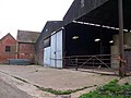
 Abattoir Entrance - geograph.org.uk - 2171004.jpg 640 × 480; 92 KB
-
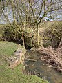
 Alders along a brook - geograph.org.uk - 1814398.jpg 640 × 480; 138 KB
-
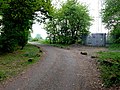
 Approaching Hatton Park - geograph.org.uk - 3147186.jpg 640 × 480; 84 KB
-
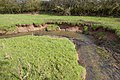 Bank erosion, Inchford Brook - geograph.org.uk - 3368364.jpg 2,000 × 1,333; 513 KB
-
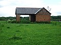
 Bannerhill Farm - geograph.org.uk - 1589332.jpg 640 × 427; 345 KB
-
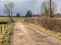
 Beausale Lane - geograph.org.uk - 3401425.jpg 2,000 × 1,500; 490 KB
-
 Berkswell ^ Balsall RFC ground - geograph.org.uk - 1874378.jpg 640 × 480; 316 KB
-
 Birmingham Road (A4177) - geograph.org.uk - 3520593.jpg 640 × 480; 490 KB
-
 Birmingham Road Lay By near Hatton Green - geograph.org.uk - 3520581.jpg 640 × 480; 470 KB
-
 Birmingham Road, Haseley Hall - geograph.org.uk - 3520589.jpg 640 × 480; 459 KB
-
 Boardwalk footpath - geograph.org.uk - 1614632.jpg 640 × 480; 136 KB
-
 Breach Wood - geograph.org.uk - 3204312.jpg 640 × 459; 62 KB
-
 Bridge over Inchford Brook - geograph.org.uk - 3369347.jpg 2,000 × 1,500; 543 KB
-
 Bridle Path - geograph.org.uk - 2171058.jpg 640 × 480; 102 KB
-
 Bridleway near Bannerhill Farm - geograph.org.uk - 3370224.jpg 2,000 × 1,500; 617 KB
-
 Bridleway near Bannerhill Farm - geograph.org.uk - 6439912.jpg 768 × 1,024; 192 KB
-
 Bridleway off Red House Farm Lane - geograph.org.uk - 3166612.jpg 640 × 480; 108 KB
-
 Bridleway to Kites Nest Lane - geograph.org.uk - 3370254.jpg 2,000 × 1,500; 579 KB
-
 Bridleway to Rouncil Lane - geograph.org.uk - 3370189.jpg 2,000 × 1,500; 560 KB
-
 Bridleway to Rouncil Lane - geograph.org.uk - 3370267.jpg 1,500 × 2,000; 565 KB
-
 Bridleway to Rouncil Lane - geograph.org.uk - 3370273.jpg 2,000 × 1,500; 632 KB
-
 Bridleway towards Deer Park Farm - geograph.org.uk - 3368161.jpg 1,500 × 2,000; 584 KB
-
 Brook at Heart of England Way crossing - geograph.org.uk - 1816453.jpg 640 × 480; 164 KB
-
 BT equipment building, Haseley Knob - geograph.org.uk - 1766527.jpg 640 × 480; 364 KB
-
-
 Bulloak Farm - geograph.org.uk - 1589284.jpg 640 × 427; 336 KB
-
 Bulloak Farm - geograph.org.uk - 1613316.jpg 640 × 480; 92 KB
-
 Bulloak Farm - geograph.org.uk - 1613328.jpg 640 × 480; 67 KB
-
 Bulloak Farm - geograph.org.uk - 6439895.jpg 1,024 × 768; 197 KB
-
 Burnt grassland below Hilltop Close - geograph.org.uk - 1821108.jpg 640 × 480; 477 KB
-

-
 Chinn's Wood - geograph.org.uk - 3401398.jpg 2,000 × 1,500; 527 KB
-
 Clattyland Wood - geograph.org.uk - 3167099.jpg 480 × 640; 139 KB
-
 Clattyland Wood, Haseley Knob - geograph.org.uk - 1766508.jpg 640 × 480; 549 KB
-
 Clay pigeon shoot site - geograph.org.uk - 1804932.jpg 640 × 480; 101 KB
-
 Clubhouse, Berkswell ^ Balsall RFC - geograph.org.uk - 1874387.jpg 640 × 480; 391 KB
-
 Communications Mast - geograph.org.uk - 2391007.jpg 640 × 480; 129 KB
-

-
 Corner of Nunley Wood - geograph.org.uk - 1804939.jpg 640 × 480; 123 KB
-
 Countryside at Haseley Knob - geograph.org.uk - 2649180.jpg 640 × 480; 132 KB
-
 Countryside near Fernwood Farm - geograph.org.uk - 2171024.jpg 640 × 480; 65 KB
-
 Countryside near Haseley - geograph.org.uk - 2171227.jpg 640 × 470; 90 KB
-
 Crop field off Manor Lane - geograph.org.uk - 3167107.jpg 640 × 480; 67 KB
-
 Crossroads at Haseley Knob - geograph.org.uk - 2649186.jpg 640 × 480; 73 KB
-
 Deciduous woodland - geograph.org.uk - 5960217.jpg 2,448 × 3,264; 3.73 MB
-
 Derelict sluice gate on Inchford Brook - geograph.org.uk - 3368086.jpg 1,500 × 2,000; 577 KB
-
 Diverted bridleway near Deer Park Farm - geograph.org.uk - 3370243.jpg 2,000 × 1,500; 522 KB
-

-
 Dogs Trust Rehoming Centre, Honiley - geograph.org.uk - 1805792.jpg 640 × 480; 114 KB
-
 Dried-up pond west of Bannerhill Farm - geograph.org.uk - 1589343.jpg 640 × 427; 402 KB
-

-
 Drive to Nunley Farm - geograph.org.uk - 1873707.jpg 640 × 480; 522 KB
-
 Drive to Wattcote Farm - geograph.org.uk - 1805747.jpg 640 × 468; 115 KB
-

-

-

-
 Entering Honiley - geograph.org.uk - 1802358.jpg 640 × 480; 143 KB
-

-
 Entrance to Prodrive. - geograph.org.uk - 2391004.jpg 640 × 480; 85 KB
-
 Entrance, Runway Farm - geograph.org.uk - 1874395.jpg 640 × 480; 328 KB
-

-
 Farm building, Kingstanding Farm - geograph.org.uk - 3166594.jpg 640 × 480; 67 KB
-
 Farm building, Kites Nest Farm - geograph.org.uk - 3166606.jpg 640 × 480; 91 KB
-
 Farm Buildings at Abbey Farm - geograph.org.uk - 3204413.jpg 640 × 507; 101 KB
-

-
 Farmland near Inchford Brook Farm - geograph.org.uk - 3166600.jpg 640 × 480; 89 KB
-
 Farmland, Kites Nest Farm - geograph.org.uk - 3166603.jpg 640 × 480; 91 KB
-
 Fence round a pond near Manor Farm - geograph.org.uk - 1805759.jpg 640 × 480; 118 KB
-
 Fenced off path through alpaca farm - geograph.org.uk - 3149992.jpg 640 × 480; 114 KB
-
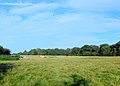
 Field at Kite's Nest Farm - geograph.org.uk - 2911953.jpg 640 × 480; 122 KB
-
 Field Boundary - geograph.org.uk - 2649168.jpg 640 × 480; 91 KB
-
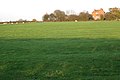
 Field east of Firs Farm - geograph.org.uk - 1777554.jpg 640 × 480; 367 KB
-
 Field east of Kites Nest Lane - geograph.org.uk - 3147229.jpg 640 × 480; 102 KB
-
 Field Margin at Turkey Farm - geograph.org.uk - 2911930.jpg 640 × 479; 112 KB
-
 Field north of Manor Lane - geograph.org.uk - 1805799.jpg 640 × 480; 142 KB
-
 Field of sheep north of Chinn's Wood - geograph.org.uk - 1777521.jpg 640 × 480; 333 KB
-
 Field on Heart of England Way - geograph.org.uk - 1816446.jpg 640 × 480; 114 KB
-
 Field south of Manor Lane - geograph.org.uk - 1805796.jpg 640 × 480; 114 KB
-
 Field southwest of Nunley Farm - geograph.org.uk - 1803678.jpg 640 × 480; 150 KB
-
 Field west of Manor Wood - geograph.org.uk - 1804041.jpg 640 × 480; 120 KB
-
 Firs Farm - geograph.org.uk - 2911112.jpg 480 × 640; 87 KB
-
 Firs Farm, Haseley Green - geograph.org.uk - 1777531.jpg 640 × 480; 361 KB
-
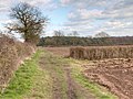
 Firs Lane crosses Inchford Brook (1) - geograph.org.uk - 1777635.jpg 640 × 480; 571 KB
-
 Follow that brook. - geograph.org.uk - 1613391.jpg 640 × 480; 91 KB
-
 Footpath near Waste Green - geograph.org.uk - 3395386.jpg 1,500 × 2,000; 541 KB
-
 Footpath to Faerie-Tale Farm - geograph.org.uk - 3368342.jpg 2,000 × 1,500; 514 KB
-
 Footpath to Kenilworth - geograph.org.uk - 6431889.jpg 1,024 × 871; 289 KB
-
 Footpath to Waste Green - geograph.org.uk - 3401440.jpg 1,500 × 2,000; 515 KB
-
 Fragment of woodland by Kite's Nest Lane - geograph.org.uk - 1768238.jpg 640 × 480; 537 KB
-
 Free-range near Fieldgate Farm - geograph.org.uk - 1766519.jpg 640 × 480; 391 KB
-
 Freshly Tilled Field - geograph.org.uk - 2649159.jpg 640 × 480; 101 KB
-
 Frosted meadow - geograph.org.uk - 5959777.jpg 3,264 × 2,448; 2.77 MB
-
 Frozen pond near Bannerhill Farm - geograph.org.uk - 3368111.jpg 2,000 × 1,332; 525 KB
-
 Frozen pond near Bannerhill Farm - geograph.org.uk - 3368748.jpg 2,000 × 1,332; 528 KB
-
 Grass crop by Heart of England Way - geograph.org.uk - 1816448.jpg 640 × 480; 98 KB
-
 Grass field at Haseley Knob - geograph.org.uk - 2911279.jpg 640 × 480; 78 KB
-

-
 Grazing, Kingstanding Farm - geograph.org.uk - 3166596.jpg 640 × 480; 75 KB
-
 Green tank south of Oldwich Lane - geograph.org.uk - 1803559.jpg 640 × 480; 121 KB
-
 Haseley Green Farm - geograph.org.uk - 4861388.jpg 1,600 × 1,200; 777 KB
-
 Haseley Green-Firs Farm - geograph.org.uk - 4861369.jpg 1,600 × 1,145; 593 KB
-
 Haseley House, Firs Lane - geograph.org.uk - 1756973.jpg 640 × 480; 489 KB
-
 Haseley Knob - geograph.org.uk - 1766523.jpg 640 × 480; 483 KB
-
 Haseley Knob Crossroads - geograph.org.uk - 4861375.jpg 1,600 × 1,200; 438 KB
-
 Haseley Underground Gravel Bed - geograph.org.uk - 2910748.jpg 640 × 480; 122 KB
-
 Haseleygreen Farm - geograph.org.uk - 1777643.jpg 640 × 480; 297 KB
-
 Heart of England Way to Oldwich Lane - geograph.org.uk - 5553309.jpg 3,072 × 2,048; 922 KB
-
 Hedge bank and grass crop - geograph.org.uk - 1805134.jpg 640 × 480; 115 KB
-

-
 Hill Farm - geograph.org.uk - 6431885.jpg 1,024 × 768; 295 KB
-
 Hilltop Close, Oldwich Lane - geograph.org.uk - 1821091.jpg 640 × 480; 362 KB
-

-
 Houses at Hilltop Close - geograph.org.uk - 1803672.jpg 640 × 480; 113 KB
-
 Inchford Brook below Haseleygreen Farm - geograph.org.uk - 1777645.jpg 640 × 454; 370 KB
-
 Inchford Brook by Inchford Brook Farm - geograph.org.uk - 1767947.jpg 640 × 480; 576 KB
-
 Inchford Brook cleaned out - geograph.org.uk - 1767918.jpg 640 × 480; 472 KB
-
 Inchford Brook near Bulloak Farm - geograph.org.uk - 1768092.jpg 640 × 480; 355 KB
-
 Inchford Brook valley below Firs Farm - geograph.org.uk - 1777538.jpg 640 × 480; 382 KB
-
 Inchford Brook west of Haseley Green - geograph.org.uk - 1777528.jpg 640 × 480; 576 KB
-

-
 Kenilworth Prodrive Circuit - geograph.org.uk - 3204297.jpg 640 × 457; 84 KB
-
 Kingstanding Farm, Kite's Nest Lane - geograph.org.uk - 1768080.jpg 640 × 480; 381 KB
-
 Kingstanding Farm, Kites Nest Lane - geograph.org.uk - 3149920.jpg 640 × 480; 109 KB
-
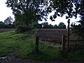
 Kissing gate and footbridge - geograph.org.uk - 1614639.jpg 640 × 480; 134 KB
-
 Kissing gate without a fence to protect. - geograph.org.uk - 1802441.jpg 640 × 480; 134 KB
-
 Kite's Nest Lane crosses Inchford Brook - geograph.org.uk - 1767943.jpg 640 × 480; 516 KB
-

-

-
 Kites Nest Lane - geograph.org.uk - 3166598.jpg 640 × 480; 93 KB
-
 Kites Nest Lane - geograph.org.uk - 3166610.jpg 640 × 480; 109 KB
-

-
 Lane by a field east of Bulloak Farm - geograph.org.uk - 1589289.jpg 640 × 427; 418 KB
-
 Lane by Clattyland Wood - geograph.org.uk - 3167105.jpg 640 × 480; 118 KB
-
 Lane heading north towards Honiley - geograph.org.uk - 3167096.jpg 640 × 480; 141 KB
-
 Lane heading towards Honiley - geograph.org.uk - 3167114.jpg 640 × 480; 84 KB
-
 Lane near Haseley Green - geograph.org.uk - 3395365.jpg 2,000 × 1,500; 517 KB
-
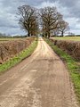
 Lane to Wroxall from Haseley Knob - geograph.org.uk - 1775384.jpg 640 × 480; 473 KB
-
 Lane towards Haseley Knob - geograph.org.uk - 3167088.jpg 640 × 480; 118 KB
-

-
 Looking south down Kites Nest Lane - geograph.org.uk - 3149909.jpg 640 × 480; 114 KB
-
 Manor Lane heading east - geograph.org.uk - 3167108.jpg 640 × 480; 114 KB
-
 Manor Lane heading for Honiley - geograph.org.uk - 1805772.jpg 640 × 480; 105 KB
-
 Meadow by a brook - geograph.org.uk - 1816450.jpg 640 × 480; 122 KB
-
 Mown meadow and field boundary, Haseley - geograph.org.uk - 6316253.jpg 1,024 × 768; 341 KB
-

-
 Narrow field west of Nunley Farm - geograph.org.uk - 1803544.jpg 640 × 480; 131 KB
-
 New bridleway gate east of Bulloak Farm - geograph.org.uk - 1589298.jpg 640 × 427; 432 KB
-

-
 North end of Firs Farm - geograph.org.uk - 1777545.jpg 640 × 480; 301 KB
-
 Northern part of Haseley Springs - geograph.org.uk - 6283865.jpg 1,024 × 614; 247 KB
-
 Nunley Farm - geograph.org.uk - 1821131.jpg 640 × 480; 385 KB
-
 Oak woodland, Nunley Pit - geograph.org.uk - 1804900.jpg 640 × 480; 207 KB
-
 Oilseed-rape at Turkey Farm - geograph.org.uk - 2911942.jpg 640 × 488; 124 KB
-
-
 One pass of the plough - geograph.org.uk - 1821139.jpg 640 × 480; 455 KB
-
 Overgrown pond south of Manor Lane - geograph.org.uk - 1805764.jpg 640 × 480; 108 KB
-
 Parkland trees near Haseley Hall Farm - geograph.org.uk - 1777516.jpg 640 × 480; 488 KB
-
 Pasture by the footpath - geograph.org.uk - 3368063.jpg 2,000 × 1,500; 503 KB
-
 Pasture on Faerie-Tale Farm - geograph.org.uk - 3368041.jpg 2,000 × 1,500; 500 KB
-
 Perimeter ride in Manor Wood - geograph.org.uk - 1805006.jpg 640 × 480; 174 KB
-
 Pipe Line Marker - geograph.org.uk - 2911964.jpg 640 × 480; 114 KB
-
 Pond at Haseley Green - geograph.org.uk - 2910772.jpg 640 × 480; 99 KB
-
 Pond in scrub near Nunley Pit - geograph.org.uk - 1804923.jpg 640 × 480; 197 KB
-
 Pond near Bulloak Farm - geograph.org.uk - 3369361.jpg 2,000 × 1,332; 579 KB
-
 Pond near Haseley Hall - geograph.org.uk - 1777513.jpg 640 × 480; 488 KB
-
 Pond north of Manor Lane - geograph.org.uk - 1805783.jpg 640 × 480; 185 KB
-
 Pond surrounded by willows. - geograph.org.uk - 6431890.jpg 1,024 × 768; 364 KB
-
 Poplar plantation, Waste Green - geograph.org.uk - 1768283.jpg 640 × 480; 439 KB
-

-
 Rape Field - geograph.org.uk - 2911339.jpg 640 × 480; 89 KB
-
 Rapeseed Field at Turkey Farm - geograph.org.uk - 2903962.jpg 640 × 517; 104 KB
-
 Reception committee - geograph.org.uk - 5959771.jpg 3,264 × 2,448; 2.72 MB
-
 Red House Farm, Red House Farm Lane - geograph.org.uk - 1768121.jpg 640 × 480; 437 KB
-
 Riley rally (1) - geograph.org.uk - 5839518.jpg 4,320 × 3,240; 3.13 MB
-
 Riley rally (2) - geograph.org.uk - 5839520.jpg 4,320 × 3,240; 3.21 MB
-
 Riley rally (3) - geograph.org.uk - 5839521.jpg 4,320 × 3,240; 3.34 MB
-
 Road from Honiley to Beausale - geograph.org.uk - 6431883.jpg 1,024 × 768; 324 KB
-
 Road to Bulloak Farm - geograph.org.uk - 6439901.jpg 898 × 1,024; 354 KB
-
 Rookery southwest of Nunley Farm - geograph.org.uk - 1803685.jpg 640 × 480; 113 KB
-
 Ropeswing and alderwood - geograph.org.uk - 1777642.jpg 640 × 480; 424 KB
-
 Rushy field west of Nunley Farm - geograph.org.uk - 1821141.jpg 640 × 480; 467 KB
-
 Scrub and security fence - geograph.org.uk - 1804981.jpg 640 × 480; 100 KB
-

-
 Set-back cottage, Haseley Knob - geograph.org.uk - 1766521.jpg 640 × 480; 489 KB
-

-
 Sign Post on Rouncil Lane - geograph.org.uk - 2171044.jpg 640 × 480; 83 KB
-
 Sluice gate - geograph.org.uk - 1613380.jpg 640 × 480; 129 KB
-
 Southeast corner of Clattyland Wood - geograph.org.uk - 1766511.jpg 640 × 480; 584 KB
-
 Southeast edge of Manor Wood - geograph.org.uk - 1804993.jpg 640 × 480; 138 KB
-
 Southern part of Haseley Springs - geograph.org.uk - 6283598.jpg 1,024 × 614; 199 KB
-
 Southwest edge of Clattyland Wood - geograph.org.uk - 1766516.jpg 640 × 480; 556 KB
-
 Spot the pheasant - geograph.org.uk - 1538053.jpg 640 × 410; 116 KB
-
 Square pond northeast of Brownley Green - geograph.org.uk - 1767934.jpg 640 × 480; 475 KB
-
 Stables off Red House Farm Lane - geograph.org.uk - 3167070.jpg 640 × 474; 75 KB
-

-
 Summer Warwickshire - geograph.org.uk - 4615956.jpg 1,800 × 1,200; 1.92 MB
-
 Sunday afternoon in Arden (1) - geograph.org.uk - 1767907.jpg 640 × 480; 560 KB


_-_geograph.org.uk_-_3520593.jpg)


_-_geograph.org.uk_-_1777635.jpg)


_-_geograph.org.uk_-_5839518.jpg)
_-_geograph.org.uk_-_5839520.jpg)
_-_geograph.org.uk_-_5839521.jpg)


_-_geograph.org.uk_-_1767907.jpg)