Category:Bildstock Weinbergstraße, Garstadt
| Object location | | View all coordinates using: OpenStreetMap |
|---|
cultural heritage monument D-6-78-115-48 (0) in Bergrheinfeld, Bavaria  | |||||
| Upload media | |||||
| Instance of | |||||
|---|---|---|---|---|---|
| Location | Bergrheinfeld, Schweinfurt, Lower Franconia, Bavaria, Germany | ||||
| Street address |
| ||||
| Heritage designation | |||||
 | |||||
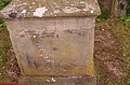
This is the category of the Bavarian Baudenkmal (cultural heritage monument) with the ID D-6-78-115-48 (Wikidata)
|
Deutsch: Bildstock, rundbogiger Reliefaufsatz mit Pietàdarstellung unter Baldachin, flankiert von Engeln, auf Rundsäule über Tischsockel mit Inschriftenfeld, Sandstein, 1824.
Weinbergstraße, Garstadt, Gemeinde Bergrheinfeld, Landkreis Schweinfurt, Unterfranken, Deutschland
Weinbergstraße, Garstadt, Gemeinde Bergrheinfeld, Landkreis Schweinfurt, Unterfranken, Deutschland
Media in category "Bildstock Weinbergstraße, Garstadt"
The following 6 files are in this category, out of 6 total.
-
 Bildstock Weinbergstraße, Garstadt 2014 1.jpg 3,264 × 4,928; 6.94 MB
-
 Bildstock Weinbergstraße, Garstadt 2014 2.jpg 3,264 × 4,928; 6.85 MB
-
 Bildstock Weinbergstraße, Garstadt 2014 3.jpg 4,928 × 3,264; 7.18 MB
-
 Bildstock Weinbergstraße, Garstadt 2014 4.jpg 3,264 × 4,928; 5.28 MB
-
 Bildstock Weinbergstraße, Garstadt 2014 5.jpg 3,264 × 4,928; 7.04 MB
-
 Bildstock Weinbergstraße, Garstadt 2014 6.jpg 3,264 × 4,928; 6.75 MB


