Category:Biogeographical maps of North America
Wikimedia category | |||||
| Upload media | |||||
| Instance of | |||||
|---|---|---|---|---|---|
| Category combines topics | |||||
| |||||
Temperate regions: North America · South America · Africa · Europe · Asia · Oceania – Polar regions: – Other regions:
Subcategories
This category has the following 5 subcategories, out of 5 total.
A
C
F
N
P
Media in category "Biogeographical maps of North America"
The following 64 files are in this category, out of 64 total.
-
 Aechmophorus occidentalis map.svg 768 × 656; 480 KB
-
 Archilochus colubris map.svg 709 × 626; 473 KB
-
 Baeolophus bicolor map.svg 709 × 626; 431 KB
-
 Biomes of North America (Rehfeldt et al. 2012) - CURRENT 01.jpg 514 × 555; 95 KB
-
 Biomes of North America (Rehfeldt et al. 2012) - PROJECTED 2060.jpg 515 × 556; 92 KB
-
 Bioregions and Biotones of North America.jpg 609 × 596; 95 KB
-
 Bioregions-of-north-america1.png 4,000 × 3,802; 16.25 MB
-
 Blue King Crab Distribution.png 586 × 457; 224 KB
-
 Cardinalis cardinalis map.svg 709 × 626; 452 KB
-
 Cascadia bioregion map.png 174 × 221; 7 KB
-
 Chocomap.jpg 190 × 191; 29 KB
-
 Colaptes auratus map.svg 916 × 626; 431 KB
-
 Cyanocitta cristata map.svg 709 × 626; 454 KB
-
 Distribution of Cynips.png 616 × 397; 33 KB
-
 Dryobates pubescens map.svg 736 × 615; 293 KB
-
 Dryocopus pileatus map.svg 592 × 579; 265 KB
-
 Dumetella carolinensis (gray catbird) map.svg 761 × 626; 296 KB
-
-
 Gavia immer map 2.svg 1,514 × 616; 796 KB
-
 US Great Plains Map.svg 959 × 593; 87 KB
-
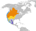
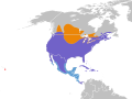
 Grizzly bear range.png 800 × 931; 203 KB
-
 Handbook of birds of the western United States BHL7576021.jpg 2,116 × 3,452; 912 KB
-

-

-
 Hawaii ecosystem today.svg 2,534 × 1,958; 985 KB
-
 Hawaii Island Ecosystem Native map-fr.svg 2,534 × 1,958; 998 KB
-
 Hemiscolopependra marginata range map.png 783 × 555; 46 KB
-
 Karte Vegetation USA.jpg 790 × 555; 102 KB
-
 Lower Shawangunk Kill habitat map.jpg 638 × 825; 159 KB
-
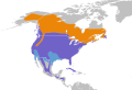
 Major habitat type CAN USA.svg 1,712 × 1,992; 772 KB
-
 Map of Darién Gap-en.svg 436 × 441; 72 KB
-
 Map of Darién Gap-es.svg 436 × 441; 72 KB
-
 Map of Darién Gap-fr.svg 436 × 441; 73 KB
-
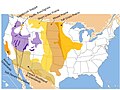
 Map of the grassland ecoregions of the United States.jpg 2,826 × 1,759; 1.97 MB
-
 Mapa del Chocó biogeográfico.svg 430 × 712; 112 KB
-
 Megaceryle alcyon map.svg 838 × 626; 443 KB
-
 Melanerpes carolinus map.svg 584 × 625; 250 KB
-
 Melanerpes erythrocephalus map.svg 684 × 587; 267 KB
-
 NAMAP.jpg 1,024 × 768; 167 KB
-
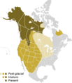 North American Grizzly Range Map.png 800 × 931; 203 KB
-
 NY-NJ Highlands.jpg 825 × 638; 175 KB
-
 On the birds of the islands of Aruba, Curaçao, and Bonaire (1893) (14563454738).jpg 3,302 × 2,398; 871 KB
-
 Phylogenetic origins in Acraspis.png 857 × 549; 52 KB
-
 Phylogenetic origins in Antron.png 320 × 512; 18 KB
-
 Phylogenetic origins in Atrusca.png 571 × 363; 22 KB
-
 Phylogenetic origins in Besbicus.png 320 × 509; 16 KB
-
 Phylogenetic origins in Philonix.png 572 × 366; 22 KB
-
 Picoides arcticus map.svg 721 × 611; 289 KB
-
 Prairie-and-Plains.png 640 × 675; 182 KB
-
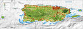 Puerto Rico ecosystems map-en.jpg 4,935 × 1,765; 2.7 MB
-
 Puerto Rico ecosystems map-en.svg 4,935 × 1,765; 12.18 MB
-
 Puerto Rico ecosystems map-fr.jpg 4,935 × 1,765; 2.7 MB
-
 Puerto Rico ecosystems map-fr.svg 4,935 × 1,765; 12.18 MB
-
 Sagenodus locations.gif 473 × 366; 26 KB
-
 Sitta carolinensis map.svg 709 × 626; 605 KB
-
 Spinus tristis map.svg 709 × 626; 582 KB
-
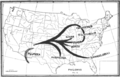
 The geographic distribution of cereals in North America (1898) (14597530369).jpg 2,236 × 1,866; 1.09 MB
-
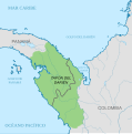
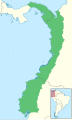
 Tumbes-Choco-Magdalena MAP.PNG 377 × 313; 7 KB
-
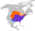
 Culture-area-Wissler.gif 504 × 309; 15 KB
-
 United States Prairies.svg 1,023 × 633; 75 KB
-
 Wschodnie USA i Kanada - Biotop.jpg 4,500 × 2,234; 554 KB
-
 Zachodnie USA i Kanada - Biotop.jpg 4,500 × 2,234; 617 KB
-
 Zenaida macroura map.svg 955 × 715; 431 KB
-
 Мапа Даријенског расцепа.svg 436 × 441; 72 KB


_-_CURRENT_01.jpg)
_-_PROJECTED_2060.jpg)


_map.svg)
_(14590073499).jpg)


_(14725495396).jpg)
_(14563004650).jpg)


_(14563454738).jpg)


_(14597530369).jpg)


