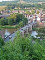
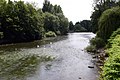
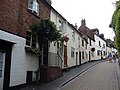
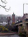
Category:Bridgnorth
town and civil parish in Shropshire, United Kingdom   | |||||
| Upload media | |||||
| Instance of | |||||
|---|---|---|---|---|---|
| Location | Shropshire, West Midlands, England | ||||
| Located in or next to body of water | |||||
| Inception |
| ||||
| Population |
| ||||
| Elevation above sea level |
| ||||
| Different from | |||||
| Said to be the same as | Bridgnorth (Wikimedia duplicated page, civil parish) | ||||
| official website | |||||
 | |||||
Subcategories
This category has the following 15 subcategories, out of 15 total.
B
- Bridgnorth Bridge (43 F)
- Bridgnorth Cemetery (9 F)
C
G
H
- The Hermitage, Bridgnorth (7 F)
M
O
- Oldbury Viaduct (8 F)
Q
R
- RAF Bridgnorth (14 F)
S
- Sport in Bridgnorth (8 F)
T
V
- Views of Bridgnorth (13 F)
Media in category "Bridgnorth"
The following 200 files are in this category, out of 929 total.
(previous page) (next page)-
 'Foremarke Hall' in the loco yard at Bridgnorth - geograph.org.uk - 6783967.jpg 1,024 × 768; 500 KB
-

-

-

-
 5-armed signpost, Bridgnorth - geograph.org.uk - 4547661.jpg 669 × 800; 150 KB
-
 80098 awaits departure at Bridgnorth Station - geograph.org.uk - 6689052.jpg 1,024 × 677; 178 KB
-

-
 A little help from the community - geograph.org.uk - 3873078.jpg 2,304 × 1,704; 1.58 MB
-
 A meadow in Dudmaston Woods - geograph.org.uk - 2529695.jpg 1,152 × 864; 314 KB
-
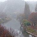 A misty River Severn near Bridgnorth in Shropshire - geograph.org.uk - 5986549.jpg 1,280 × 1,280; 1.34 MB
-
 A misty River Severn near Bridgnorth in Shropshire - geograph.org.uk - 5986557.jpg 960 × 1,280; 1.02 MB
-
 A misty River Severn near Bridgnorth in Shropshire - geograph.org.uk - 5986560.jpg 960 × 1,280; 1.28 MB
-
 A narrowing Cliff Road - geograph.org.uk - 1452944.jpg 640 × 480; 88 KB
-
 A summer morning in Listley Street - geograph.org.uk - 1454200.jpg 640 × 480; 56 KB
-
 A442 approaching High Rock - geograph.org.uk - 2713345.jpg 640 × 480; 178 KB
-
 A442 roundabout in Bridgnorth, Shropshire - geograph.org.uk - 5984851.jpg 1,440 × 960; 1.17 MB
-
 A442 southbound near High Rock - geograph.org.uk - 3552332.jpg 640 × 480; 79 KB
-
 A442, Dudmaston - geograph.org.uk - 4146264.jpg 800 × 600; 548 KB
-
 A454 Bridgnorth Island With B4363 - geograph.org.uk - 4354644.jpg 640 × 480; 40 KB
-

-
 A454 View - geograph.org.uk - 3940423.jpg 800 × 473; 55 KB
-
 A458 Bridgnorth Bypass in Shropshire - geograph.org.uk - 6312155.jpg 1,280 × 1,280; 1.18 MB
-
 A458 crosses the River Severn - geograph.org.uk - 3984141.jpg 2,000 × 1,287; 952 KB
-

-
 A458, Bridgnorth bypass - geograph.org.uk - 5496430.jpg 1,024 × 683; 298 KB
-
 Above the shop, Whitburn Street - geograph.org.uk - 6405659.jpg 1,024 × 683; 237 KB
-

-
 Access road, Severn Park, Bridgnorth - geograph.org.uk - 3281025.jpg 1,024 × 754; 256 KB
-
 Across a high footbridge, Bridgnorth - geograph.org.uk - 4520642.jpg 800 × 600; 174 KB
-
 Across the bridge to The Hermitage - geograph.org.uk - 3870344.jpg 1,704 × 2,304; 1.86 MB
-
 Across the River Severn near Bridgnorth, Shropshire - geograph.org.uk - 5986564.jpg 1,440 × 960; 1.22 MB
-

-
 Alley Katz Toy Shop, Bridgnorth - geograph.org.uk - 6497135.jpg 1,920 × 1,280; 1.56 MB
-
 Along the lane from Cross Houses - geograph.org.uk - 4410699.jpg 1,142 × 857; 313 KB
-
 Along the lane near Sandybury Farm - geograph.org.uk - 4437614.jpg 1,142 × 857; 499 KB
-
 Along the lane towards Mose - geograph.org.uk - 4437624.jpg 979 × 734; 331 KB
-
 An air raid remembered, Church Street, Bridgnorth - geograph.org.uk - 4922594.jpg 3,093 × 2,010; 1.77 MB
-
 Andy Gas in Bridgnorth - geograph.org.uk - 4054656.jpg 800 × 505; 98 KB
-
 Anonymous - Bridgenorth, Shropshire - 1997.69 - Cleveland Museum of Art.jpg 3,400 × 2,325; 1.56 MB
-
 Antique Centre, Bridgnorth - geograph.org.uk - 4192625.jpg 800 × 600; 119 KB
-
 Antiques Bridgnorth Hightown - geograph.org.uk - 4353437.jpg 763 × 800; 215 KB
-

-

-
 Approaching the roundabout - geograph.org.uk - 4636969.jpg 1,024 × 576; 143 KB
-
 Ascending Granary Steps - geograph.org.uk - 2386620.jpg 2,697 × 2,182; 3.04 MB
-
 Astbury Bridgnorth office - geograph.org.uk - 4067558.jpg 800 × 615; 130 KB
-

-
 Autumn - panoramio (68).jpg 640 × 640; 262 KB
-
 Autumn - panoramio (69).jpg 1,536 × 1,536; 1.08 MB
-
 Autumn colours - Bridgnorth - geograph.org.uk - 4748497.jpg 640 × 427; 99 KB
-
 B4363 bridge over A458 west of Bridgnorth - geograph.org.uk - 3595937.jpg 1,024 × 684; 87 KB
-
 B4363 meets the Severn Valley Railway - geograph.org.uk - 2713327.jpg 640 × 480; 133 KB
-
 B4364 at Cross Houses - geograph.org.uk - 6224956.jpg 4,112 × 2,522; 1.43 MB
-
 B4373 enters Bridgnorth - geograph.org.uk - 1477517.jpg 480 × 640; 79 KB
-

-
 Bandstand at the Castle Gardens (Bridgnorth) - geograph.org.uk - 5992302.jpg 2,048 × 1,360; 1.33 MB
-
 Bandstand at the Castle Gardens (Bridgnorth) - geograph.org.uk - 5992354.jpg 2,048 × 1,360; 1.41 MB
-
 Bank Street - geograph.org.uk - 1453446.jpg 480 × 640; 72 KB
-
 Bank Street, Bridgnorth - geograph.org.uk - 4099144.jpg 618 × 800; 111 KB
-
 Barn at Punch Bowl Farm - geograph.org.uk - 424510.jpg 600 × 450; 270 KB
-
 Bassa Villa (Bridgnorth) - geograph.org.uk - 6004946.jpg 4,096 × 4,096; 6.98 MB
-
 Beech Road, Bridgnorth - geograph.org.uk - 4054805.jpg 800 × 482; 93 KB
-
 Bench mark ^ wall tie - geograph.org.uk - 4692019.jpg 640 × 530; 135 KB
-
 Benchmark, Castle Hill Walk - geograph.org.uk - 6808312.jpg 1,024 × 768; 311 KB
-
 Benchmark, New Road - geograph.org.uk - 6783672.jpg 1,024 × 776; 240 KB
-
 Benchmark, New Road Wall, Bridgnorth - geograph.org.uk - 6781940.jpg 1,024 × 768; 282 KB
-
 Bend in Cliff Road - geograph.org.uk - 1452902.jpg 640 × 480; 89 KB
-
 Bend in New Road, Bridgnorth - geograph.org.uk - 4547475.jpg 800 × 600; 133 KB
-
 Beneath the A458 Bridgnorth bypass - geograph.org.uk - 2386695.jpg 2,793 × 2,168; 1.94 MB
-
 Bernard's Hill steps - geograph.org.uk - 717546.jpg 480 × 640; 88 KB
-
 Bernards Hill - geograph.org.uk - 2259808.jpg 1,024 × 768; 172 KB
-
 Bernards Hill - geograph.org.uk - 2259834.jpg 1,024 × 752; 159 KB
-
 Bernards Hill Steps - geograph.org.uk - 2259782.jpg 768 × 1,024; 243 KB
-
 Beware of sixes - geograph.org.uk - 5583048.jpg 1,024 × 683; 508 KB
-
 Blue - panoramio (11).jpg 2,048 × 2,048; 1.21 MB
-
 Blue - panoramio (12).jpg 2,048 × 2,048; 1.03 MB
-
 Bottom of Library Steps, Bridgnorth - geograph.org.uk - 4547558.jpg 600 × 800; 222 KB
-
 Bowers Close, Bridgnorth - geograph.org.uk - 4058724.jpg 800 × 435; 83 KB
-
 BR No. 1501 at Bridgnorth Railway Station - geograph.org.uk - 5899115.jpg 3,648 × 2,736; 3.68 MB
-
 Bridge across the River Severn at Bridgnorth - geograph.org.uk - 2386627.jpg 2,931 × 2,444; 2.26 MB
-

-
 Bridge across the Severn, Bridgnorth - geograph.org.uk - 6492145.jpg 1,862 × 1,188; 1.22 MB
-
 Bridge across the Severn, Bridgnorth - geograph.org.uk - 6492147.jpg 1,920 × 1,280; 1.07 MB
-
 Bridge at Bridgnorth - geograph.org.uk - 1915884.jpg 640 × 480; 104 KB
-
 Bridge over the River Severn - geograph.org.uk - 4000036.jpg 2,000 × 1,406; 900 KB
-
-
 Bridge over the River Severn, Bridgnorth - geograph.org.uk - 2344026.jpg 3,072 × 2,304; 5.33 MB
-
 Bridge View - geograph.org.uk - 3177138.jpg 800 × 600; 156 KB
-
 Bridgend Cottage street view.jpg 3,024 × 4,032; 3.21 MB
-
 Bridgnorth 'New' Market Hall - geograph.org.uk - 5898802.jpg 3,648 × 2,736; 3.97 MB
-
 Bridgnorth (Low Town) - geograph.org.uk - 2448331.jpg 479 × 640; 300 KB
-

-
 Bridgnorth - geograph.org.uk - 1914233.jpg 480 × 640; 128 KB
-
 Bridgnorth - geograph.org.uk - 4333738.jpg 800 × 600; 445 KB
-

-
 Bridgnorth - Northgate - geograph.org.uk - 2713754.jpg 640 × 480; 172 KB
-
 Bridgnorth - Northgate Health Centre - geograph.org.uk - 2713740.jpg 640 × 480; 148 KB
-
 Bridgnorth - panoramio (2).jpg 2,048 × 1,360; 2.21 MB
-
 Bridgnorth - panoramio - Tanya Dedyukhina (1).jpg 1,408 × 1,056; 272 KB
-
 Bridgnorth - panoramio - Tanya Dedyukhina (2).jpg 1,408 × 1,056; 266 KB
-
 Bridgnorth - panoramio - Tanya Dedyukhina (3).jpg 1,408 × 1,056; 298 KB
-
 Bridgnorth - panoramio - Tanya Dedyukhina (5).jpg 1,408 × 1,056; 353 KB
-
 Bridgnorth - panoramio - Tanya Dedyukhina.jpg 1,408 × 1,056; 313 KB
-
 Bridgnorth - River Severn bridge - geograph.org.uk - 2713782.jpg 480 × 640; 181 KB
-
 Bridgnorth - Wenlock Road - geograph.org.uk - 2945356.jpg 640 × 480; 69 KB
-
 Bridgnorth 1646 inscription.JPG 3,648 × 2,736; 2.29 MB
-
 Bridgnorth Alley - geograph.org.uk - 1374336.jpg 480 × 640; 87 KB
-
 Bridgnorth and the River Severn - geograph.org.uk - 6755936.jpg 800 × 493; 102 KB
-
 Bridgnorth Art Trail, 'Just the Ticket' - geograph.org.uk - 5992241.jpg 2,048 × 1,360; 1.44 MB
-
 Bridgnorth Art Trail, 'The Great Bear' - geograph.org.uk - 5899038.jpg 3,648 × 2,736; 4.75 MB
-
 Bridgnorth Art Trail, 'The Great Bear' - geograph.org.uk - 5899044.jpg 3,648 × 2,736; 4.31 MB
-
 Bridgnorth Bandstand - geograph.org.uk - 1374104.jpg 640 × 480; 106 KB
-
 Bridgnorth Britain in Bloom 2002 winners - geograph.org.uk - 2617622.jpg 800 × 600; 218 KB
-
 Bridgnorth by the River Severn in Shropshire - geograph.org.uk - 5988377.jpg 1,440 × 960; 1.21 MB
-
 Bridgnorth by the River Severn in Shropshire - geograph.org.uk - 5988379.jpg 1,440 × 1,056; 1.67 MB
-
 Bridgnorth by-pass - geograph.org.uk - 1914195.jpg 640 × 480; 80 KB
-
 Bridgnorth By-Pass Bridge over the River Severn - geograph.org.uk - 2318571.jpg 2,653 × 1,961; 516 KB
-
 Bridgnorth Castle Gardens - geograph.org.uk - 4678010.jpg 640 × 487; 264 KB
-
 Bridgnorth Doorstep - geograph.org.uk - 6749316.jpg 1,600 × 1,200; 502 KB
-
 Bridgnorth Endowed Leisure Centre - geograph.org.uk - 5496528.jpg 1,024 × 683; 254 KB
-
 Bridgnorth Foot Clinic - geograph.org.uk - 4068480.jpg 800 × 507; 104 KB
-
 Bridgnorth Footbridge - 53290744574.jpg 2,285 × 1,535; 2.67 MB
-
 Bridgnorth Footbridge - geograph.org.uk - 1374563.jpg 480 × 640; 63 KB
-
 Bridgnorth Footbridge - geograph.org.uk - 5990016.jpg 4,096 × 4,096; 5.7 MB
-
 Bridgnorth Footbridge - geograph.org.uk - 5992295.jpg 2,048 × 1,360; 1.44 MB
-
 Bridgnorth Footbridge - geograph.org.uk - 5992323.jpg 2,048 × 1,360; 1.39 MB
-
 Bridgnorth Footbridge.jpg 2,285 × 1,535; 2.55 MB
-
 Bridgnorth from the south - geograph.org.uk - 4344969.jpg 1,024 × 857; 107 KB
-
 Bridgnorth High Town 1998 - geograph.org.uk - 2903012.jpg 640 × 434; 113 KB
-
 Bridgnorth in Shropshire - geograph.org.uk - 5986162.jpg 960 × 1,280; 1.04 MB
-
 Bridgnorth Low Town - geograph.org.uk - 3179167.jpg 800 × 600; 130 KB
-
 Bridgnorth Market Shadows - geograph.org.uk - 4811397.jpg 800 × 572; 133 KB
-
 Bridgnorth Market View - geograph.org.uk - 4811403.jpg 800 × 583; 116 KB
-
 Bridgnorth MMB 05 River Severn anatidae.jpg 2,400 × 1,600; 3.64 MB
-
 Bridgnorth Police Station name sign - geograph.org.uk - 4065785.jpg 800 × 600; 189 KB
-
 Bridgnorth Postbox - geograph.org.uk - 3177150.jpg 800 × 600; 153 KB
-
 Bridgnorth Quay - geograph.org.uk - 5912596.jpg 4,000 × 3,000; 2.2 MB
-
 Bridgnorth Quay and bridge - geograph.org.uk - 6755931.jpg 800 × 628; 145 KB
-
 Bridgnorth Riverside (22611131604).jpg 6,016 × 4,000; 14.81 MB
-
 Bridgnorth Riverside - Flickr - c.art.jpg 6,016 × 4,000; 18.26 MB
-
 Bridgnorth Scene - geograph.org.uk - 3179163.jpg 800 × 600; 155 KB
-
 Bridgnorth Sorting Office - geograph.org.uk - 6497134.jpg 1,920 × 1,280; 1.31 MB
-
 Bridgnorth Town Hall - geograph.org.uk - 6497132.jpg 1,920 × 1,280; 1.02 MB
-
 Bridgnorth Town Hall - geograph.org.uk - 6749798.jpg 666 × 1,024; 181 KB
-
 Bridgnorth Town Hall - geograph.org.uk - 6783970.jpg 1,024 × 768; 417 KB
-
 Bridgnorth town's tower - panoramio.jpg 1,408 × 1,056; 283 KB
-
 Bridgnorth View - geograph.org.uk - 6138058.jpg 800 × 600; 183 KB
-
 Bridgnorth, Granary Steps - geograph.org.uk - 6158665.jpg 7,069 × 4,713; 6.91 MB
-
 Bridgnorth, High Town - geograph.org.uk - 3524060.jpg 640 × 424; 59 KB
-
 Bridgnorth, River Severn in Autumn - panoramio.jpg 2,592 × 1,944; 1.08 MB
-
 Bridgnorth, View from top station of the Cliff Railway - geograph.org.uk - 4560373.jpg 4,608 × 3,456; 6.6 MB
-
 Bridgnorth, Whitburn Street and St. Leonard's Church - geograph.org.uk - 4560366.jpg 4,608 × 3,456; 5.81 MB
-
 Bridgnorth-CastleHill-Rly-P1030870 (33850122673).jpg 2,304 × 3,072; 1.68 MB
-
 Bridgnorth-Shropshire-P1030899 (33817551074).jpg 2,304 × 3,072; 1.81 MB
-
 Bridgnorth-Shropshire-P1030901 (33817539824).jpg 3,072 × 2,304; 1.71 MB
-

-
-

-
 Bridleway north-east of Bridgnorth, Shropshire - geograph.org.uk - 2878338.jpg 1,024 × 724; 600 KB
-

-
 Building site, Quatford - geograph.org.uk - 6422980.jpg 1,024 × 683; 310 KB
-
 Bus stop on the B4373 - geograph.org.uk - 1454214.jpg 640 × 480; 74 KB
-
 Cann Hall Road in Bridgnorth, Shropshire - geograph.org.uk - 5984848.jpg 1,440 × 960; 1.21 MB
-
 Cannon Steps, Bridgnorth - geograph.org.uk - 1915917.jpg 640 × 480; 112 KB
-
 Cannon Steps, Bridgnorth - geograph.org.uk - 2378093.jpg 4,000 × 3,000; 3.27 MB
-
 Cannon Steps, Bridgnorth - geograph.org.uk - 4547456.jpg 800 × 719; 182 KB
-
 Cantern Brook - geograph.org.uk - 6069610.jpg 1,024 × 768; 473 KB
-
 Cartway at Bridgnorth - geograph.org.uk - 6755950.jpg 800 × 600; 153 KB
-
 Castle gardens - geograph.org.uk - 4901487.jpg 2,048 × 1,536; 1.53 MB
-
 Castle Hill - geograph.org.uk - 3436206.jpg 1,024 × 768; 139 KB
-
 Castle Hill - geograph.org.uk - 5496462.jpg 1,024 × 683; 439 KB
-
 Castle Hill - geograph.org.uk - 5496465.jpg 1,024 × 683; 485 KB
-

-

-
 Castle Walk - geograph.org.uk - 5496413.jpg 1,024 × 1,024; 548 KB
-
 Cat in Station Street (1) - geograph.org.uk - 1454202.jpg 480 × 640; 62 KB
-
 Cat in Station Street (2) - geograph.org.uk - 1454217.jpg 640 × 458; 69 KB
-
 Catch Me Who Can - geograph.org.uk - 6138073.jpg 800 × 600; 121 KB
-

-
 CCTV, Bridgnorth - geograph.org.uk - 5497007.jpg 1,024 × 1,024; 334 KB
-
 Central Court - geograph.org.uk - 1374350.jpg 480 × 640; 77 KB
-

-
 Chapel Lane View - geograph.org.uk - 1842327.jpg 640 × 480; 80 KB
-

-

-
 City of Truro - geograph.org.uk - 1578905.jpg 640 × 435; 51 KB
-
 Civil threat - geograph.org.uk - 3873101.jpg 2,304 × 1,704; 1.81 MB
-
 Clee View Road, Bridgnorth - geograph.org.uk - 4065622.jpg 800 × 593; 102 KB
-
 Cliff Bridgnorth - panoramio.jpg 1,408 × 1,056; 556 KB
-
 Cliff Railway - geograph.org.uk - 5496483.jpg 1,024 × 1,024; 321 KB
-
 Cliff Railway Station - geograph.org.uk - 6749313.jpg 1,078 × 1,600; 754 KB
-
 Cliff Road houses in Bridgnorth - geograph.org.uk - 4067820.jpg 718 × 717; 136 KB
-

-
 Coat of Arms of Bridgnorth.png 467 × 536; 175 KB
-
 Conduit Head, East Castle Street, Bridgnorth.jpg 1,102 × 1,469; 613 KB
-

-
 Corral - panoramio (6).jpg 2,448 × 2,448; 2.06 MB
-
 Corral - panoramio (7).jpg 2,448 × 2,448; 2.02 MB
-
 Corral - panoramio (8).jpg 2,448 × 2,448; 2.8 MB
-
 Country Lane - geograph.org.uk - 442155.jpg 480 × 640; 173 KB


.jpg)
.jpg)


_-_geograph.org.uk_-_5992302.jpg)
_-_geograph.org.uk_-_5992354.jpg)


_-_geograph.org.uk_-_6004946.jpg)


.jpg)
.jpg)


_-_geograph.org.uk_-_2448331.jpg)


.jpg)
.jpg)
.jpg)
.jpg)
.jpg)


.jpg)


.jpg)
.jpg)
.jpg)


_-_geograph.org.uk_-_1454202.jpg)
_-_geograph.org.uk_-_1454217.jpg)


.jpg)
.jpg)
.jpg)
