Category:Brookmans Park
English: Brookmans Park is a village, located in the civil parish of North Mymms, in Hertfordshire, southeast England. It is known for its varied and interesting local history, including an ancient historic estate that used to exist within its boundaries, its BBC transmitter station, and excellent local amenities. The village website, The Brookmans Park Newsletter has more than 20 complete history books and 40 in-depth features, as well as a half-hour video about the history of the area. Brookmans Park railway station is on the East Coast Mainline, operated by First Capital Connect.
village in United Kingdom  | |||||
| Upload media | |||||
| Instance of | |||||
|---|---|---|---|---|---|
| Location | North Mymms, Welwyn Hatfield, Hertfordshire, East of England, England | ||||
 | |||||
Subcategories
This category has the following 2 subcategories, out of 2 total.
G
- Gobions Wood (7 F)
R
- Brookmans Park railway station (32 F)
Media in category "Brookmans Park"
The following 36 files are in this category, out of 36 total.
-
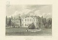 Neale(1818) p2.122 - Gubbins, Hertfordshire.jpg 1,840 × 1,262; 541 KB
-
 Afternoon vans - geograph.org.uk - 1014381.jpg 640 × 439; 73 KB
-
 Bradmore Way, Brookmans Park - geograph.org.uk - 1099415.jpg 640 × 480; 84 KB
-
 Brians Home Centre Brookmans Park.jpg 1,297 × 1,154; 593 KB
-
 Brookmans Avenue - geograph.org.uk - 1088731.jpg 640 × 480; 97 KB
-
 Brookmans Park Family Butchers.jpg 766 × 1,155; 353 KB
-
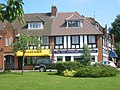
 Brookmans Park Hotel - geograph.org.uk - 33153.jpg 640 × 480; 24 KB
-
 Brookmans Park post office.jpg 2,304 × 3,072; 1.44 MB
-
 Brookmans Park transmitting station.jpg 783 × 504; 93 KB
-
 Brookmans Park United Reformed Church - geograph.org.uk - 986960.jpg 640 × 446; 57 KB
-
 Brookmans Park Village Green and shops - geograph.org.uk - 8909.jpg 640 × 480; 112 KB
-
 Brookmans Park Wikivoyage Banner.jpg 8,191 × 1,170; 3.37 MB
-
 Brookmans Park, Bradmore Green - geograph.org.uk - 986812.jpg 640 × 480; 79 KB
-
 Brookmans Park, The estate office - geograph.org.uk - 986914.jpg 640 × 488; 99 KB
-
 Brookmans Tennis Table.jpg 1,479 × 1,049; 693 KB
-
 Bungalettes 28-30 Georges Wood Road.jpg 1,280 × 862; 355 KB
-
 Co-operative, Brookmans Park.jpg 3,072 × 2,304; 1.34 MB
-
 Cock of the North Brookmans Park.jpg 1,806 × 722; 455 KB
-
 East Coast Main Line at Brookmans Park - geograph.org.uk - 986690.jpg 640 × 480; 105 KB
-
 Fast to King's Cross - geograph.org.uk - 141028.jpg 640 × 480; 119 KB
-
 GOC Brookmans Park 073 Brookmans Park United Reformed Church (26714286632).jpg 3,834 × 2,876; 2.94 MB
-
 Hammersley fishmonger.jpg 2,066 × 1,944; 1.48 MB
-
 Hawkshead Lane, Brookmans Park - geograph.org.uk - 1099943.jpg 640 × 480; 77 KB
-
 Houses at Water End - geograph.org.uk - 32828.jpg 640 × 480; 29 KB
-
 Kentish Lane - geograph.org.uk - 140110.jpg 640 × 480; 104 KB
-
 Last Summer's Crop - geograph.org.uk - 141032.jpg 640 × 480; 112 KB
-
 Lower Farm, Bell Bar - geograph.org.uk - 141040.jpg 640 × 480; 143 KB
-
 Miller Carter Brookmans Park.jpg 1,908 × 1,330; 664 KB
-
 Pearl Brookmans Park.jpg 1,341 × 1,100; 347 KB
-
 Pre-Worboys sign Brookmans Park - geograph.org.uk - 1100061.jpg 640 × 480; 96 KB
-
 Queenswood School - geograph.org.uk - 32868.jpg 640 × 480; 22 KB
-
 Royal Veterinary College Water End - geograph.org.uk - 32826.jpg 640 × 480; 28 KB
-
 Shopping Parade at Brookmans Park - geograph.org.uk - 33156.jpg 640 × 480; 38 KB
-
 Shops at Brookmans Park - geograph.org.uk - 33154.jpg 640 × 480; 31 KB
-
 Tealicious Brookmans Park.jpg 1,735 × 1,131; 318 KB
-
 Transmission Station east of Bell Bar - geograph.org.uk - 35204.jpg 640 × 480; 19 KB
_p2.122_-_Gubbins,_Hertfordshire.jpg)


.jpg)


