Category:Brunnen „Hinter Hoben I" (Dottendorf)
| Object location | | View all coordinates using: OpenStreetMap |
|---|
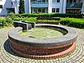
fountain in Bonn, Germany  | |||||
| Upload media | |||||
| Instance of | |||||
|---|---|---|---|---|---|
| Location | Dottendorf, Bonn, Cologne Government Region, North Rhine-Westphalia, Germany | ||||
 | |||||
Media in category "Brunnen „Hinter Hoben I" (Dottendorf)"
The following 3 files are in this category, out of 3 total.
-
 2020-06-22-bonn-hinter-hoben-179-altenheim-brunnen-01.jpg 3,648 × 2,736; 5.01 MB
-
 2020-06-22-bonn-hinter-hoben-179-altenheim-brunnen-02.jpg 4,000 × 3,000; 4.79 MB
-
 2020-06-22-bonn-hinter-hoben-179-altenheim-brunnen-03.jpg 4,000 × 3,000; 5.09 MB

