Category:Burntwood
English: Burntwood is a town in Staffordshire, England, lying in the Cannock Chase area approximately west of Lichfield. The town had a population of 25,674 at the time of the 2001 census and forms part of Lichfield district. The town forms one of the largest urbanised parishes in England.
Italiano: Burntwood è una cittadina di 26.035 abitanti, situata nella contea dello Staffordshire in Inghilterra.
Nederlands: Burntwood is een plaats in het bestuurlijke gebied Lichfield, in het Engelse graafschap Staffordshire. De plaats telt 26.035 inwoners.
Polski: Burntwood - miasto w Wielkiej Brytanii, w Anglii, w regionie West Midlands, w hrabstwie Staffordshire. W 2001r. miasto to zamieszkiwało 26 035 osób.
Română: Burntwood este un oraş în comitatul Staffordshire, regiunea West Midlands, Anglia. Oraşul se află în districtul Lichfield.
town in Staffordshire, England  | |||||
| Upload media | |||||
| Instance of | |||||
|---|---|---|---|---|---|
| Location | Lichfield, Staffordshire, West Midlands, England | ||||
| Said to be the same as | Burntwood (Wikimedia duplicated page, civil parish) | ||||
| official website | |||||
 | |||||
Subcategories
This category has the following 5 subcategories, out of 5 total.
Media in category "Burntwood"
The following 200 files are in this category, out of 333 total.
(previous page) (next page)-
 A cyclist rides parallel to Miners Way, Chasetown - geograph.org.uk - 4811134.jpg 1,280 × 960; 1.17 MB
-
 A foretaste of summer – on the beach at Chasewater - geograph.org.uk - 4811380.jpg 1,280 × 960; 1.71 MB
-
 A5190 approaching roundabout - geograph.org.uk - 3419943.jpg 640 × 480; 47 KB
-
 A5190 heading towards Cannock - geograph.org.uk - 3419945.jpg 640 × 480; 52 KB
-
 A5190 heading towards Cannock. - geograph.org.uk - 3419934.jpg 640 × 480; 47 KB
-
 A5190 heading west - geograph.org.uk - 3419925.jpg 640 × 480; 69 KB
-
 A5190 heading west through Burntwood - geograph.org.uk - 3419876.jpg 640 × 480; 71 KB
-
 Abnalls Lane - geograph.org.uk - 3553746.jpg 640 × 480; 90 KB
-
 Abnalls Lane - geograph.org.uk - 6278778.jpg 6,000 × 4,000; 5.89 MB
-
 Abnalls Lane - geograph.org.uk - 6278903.jpg 6,000 × 4,000; 6.21 MB
-
 Abnalls Lane - geograph.org.uk - 6278930.jpg 6,000 × 4,000; 5.65 MB
-
 Abnalls Lane, Spade Green - geograph.org.uk - 3553760.jpg 640 × 480; 106 KB
-
 Acorn Ford, Chasetown - geograph.org.uk - 2516565.jpg 640 × 428; 58 KB
-
 Aldridge Brownhills Railway - geograph.org.uk - 2677458.jpg 3,648 × 2,736; 1.02 MB
-
 Anglesey Basin - geograph.org.uk - 4910557.jpg 1,280 × 851; 286 KB
-
 Anglesey Basin - geograph.org.uk - 4914745.jpg 1,280 × 851; 332 KB
-
 Anglesey Basin, Anglesey Branch - geograph.org.uk - 5787366.jpg 1,024 × 768; 228 KB
-
 Anglesey Branch, in Chasewater Country Park - geograph.org.uk - 5787356.jpg 1,024 × 767; 138 KB
-
 Another roundabout on Cannock Road - geograph.org.uk - 3601990.jpg 1,142 × 857; 253 KB
-
 Bells Lane - geograph.org.uk - 3553812.jpg 640 × 480; 50 KB
-
 Between the lines at Coney Lodge Farm - geograph.org.uk - 3601910.jpg 1,142 × 857; 338 KB
-

-

-

-
 Boardwalk through a swamp, Chasewater country park - geograph.org.uk - 4811078.jpg 1,280 × 960; 1.88 MB
-

-
 Boney Hay Primary School-plaque 02.jpg 2,931 × 1,544; 834 KB
-
 Botts Pond - geograph.org.uk - 6276331.jpg 6,000 × 4,000; 5.22 MB
-

-
 Bridge over the A5195 - geograph.org.uk - 4030780.jpg 3,253 × 2,455; 3.22 MB
-

-
 Bridleway to Green Lane Farm - geograph.org.uk - 4860455.jpg 640 × 640; 156 KB
-
 Bridleway to Green Lane Farm - geograph.org.uk - 4860457.jpg 640 × 640; 160 KB
-
 Bridleway to Green Lane Farm - geograph.org.uk - 4860458.jpg 640 × 640; 139 KB
-
 Bridleway to Green Lane Farm - geograph.org.uk - 4860461.jpg 640 × 640; 135 KB
-
 Bridleway towards Moor View - geograph.org.uk - 4860479.jpg 640 × 640; 96 KB
-
 Bridleway towards Moor View - geograph.org.uk - 4860481.jpg 640 × 640; 123 KB
-
 Bridleway towards Moor View - geograph.org.uk - 4860484.jpg 640 × 640; 163 KB
-

-
 Brownhills Road - geograph.org.uk - 3687417.jpg 640 × 480; 51 KB
-
 Brownhills West Station - geograph.org.uk - 4366757.jpg 640 × 427; 86 KB
-
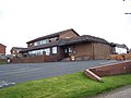
 Burntwood Library - geograph.org.uk - 3676369.jpg 1,600 × 1,200; 425 KB
-

-
 Burntwood Post Office - geograph.org.uk - 1244522.jpg 640 × 480; 71 KB
-
 Burntwood Road - geograph.org.uk - 3419974.jpg 640 × 480; 79 KB
-
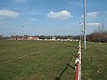 Burntwood Rugby Football Club ground, near Chasetown - geograph.org.uk - 4811123.jpg 1,280 × 960; 1.17 MB
-
 Cafe, Chasewater Heaths Station - geograph.org.uk - 3419941.jpg 1,024 × 768; 113 KB
-
 Cannock Road (A5190) - geograph.org.uk - 3419911.jpg 640 × 480; 47 KB
-
 Chase Park Industrial Estate - geograph.org.uk - 4097448.jpg 640 × 436; 36 KB
-
 Chase Terrace fire station - geograph.org.uk - 266834.jpg 640 × 427; 240 KB
-
 Chase Terrace Shopping Centre - geograph.org.uk - 2516595.jpg 640 × 428; 61 KB
-
 Chase Terrace Shopping Centre 2 - geograph.org.uk - 2516602.jpg 640 × 428; 70 KB
-

-
 Chasetown Heaths Station - geograph.org.uk - 5102846.jpg 427 × 640; 88 KB
-
 Chasetown Methodist Church - geograph.org.uk - 1065493.jpg 640 × 480; 112 KB
-

-

-
 Chasewater - Fetch boy^ - geograph.org.uk - 4367318.jpg 640 × 427; 62 KB
-
 Chasewater - geograph.org.uk - 4910765.jpg 1,280 × 851; 296 KB
-
 Chasewater and cyclist - geograph.org.uk - 4368585.jpg 640 × 427; 67 KB
-

-

-

-

-

-

-

-

-

-

-
 Chasewater Railway - 08 shunter - geograph.org.uk - 5103185.jpg 640 × 427; 96 KB
-

-

-
 Chasewater Railway - Rosyth No. 1 - geograph.org.uk - 5102755.jpg 640 × 427; 79 KB
-
 Chasewater Railway - steam crane - geograph.org.uk - 5102939.jpg 640 × 427; 84 KB
-
 Chasewater Railway - steam crane - geograph.org.uk - 5102959.jpg 640 × 427; 84 KB
-

-

-
 Church on Cannock Road, Burntwood - geograph.org.uk - 3419895.jpg 640 × 480; 88 KB
-
 Church Street - geograph.org.uk - 1265368.jpg 640 × 480; 89 KB
-
 Co-op, Morley Road - geograph.org.uk - 1265380.jpg 640 × 480; 70 KB
-
 Coal tipplers, Anglesey Wharf, Anglesey Branch - geograph.org.uk - 5787349.jpg 1,024 × 768; 163 KB
-
 Coal train approaching - geograph.org.uk - 4366809.jpg 640 × 365; 77 KB
-
 Costcutter, Chorley Road - geograph.org.uk - 2461744.jpg 640 × 428; 48 KB
-
 Cottage on Green Lane - geograph.org.uk - 3553787.jpg 640 × 480; 68 KB
-
 Cottages on Coulter Lane - geograph.org.uk - 6278063.jpg 6,000 × 4,000; 5.55 MB
-
 Coulter Lane - geograph.org.uk - 3553778.jpg 640 × 480; 93 KB
-
 Coulter Lane crosses a brook - geograph.org.uk - 1244571.jpg 640 × 480; 89 KB
-
 Coulter Lane, Cresswell Green - geograph.org.uk - 4860452.jpg 640 × 640; 89 KB
-
 Creswell Green - geograph.org.uk - 6278078.jpg 6,000 × 4,000; 4.77 MB
-
 Crop field off Hobstone Hill Lane - geograph.org.uk - 3553765.jpg 640 × 480; 93 KB
-
 Cumberledge Hill, Cannock Wood - geograph.org.uk - 726523.jpg 640 × 480; 85 KB
-
 CW 20120709.jpg 10,784 × 2,015; 6.71 MB
-
 Cycle track beside Miners Way - geograph.org.uk - 3419950.jpg 640 × 480; 80 KB
-

-
 Departure from Chasetown Halt - geograph.org.uk - 5103182.jpg 640 × 427; 100 KB
-

-

-

-
 East Entrance to Pipe Hall - geograph.org.uk - 2462516.jpg 640 × 428; 75 KB
-
 Electricity sub station, Plant Lane - geograph.org.uk - 4097451.jpg 640 × 466; 93 KB
-

-

-

-
 Entrance to Darwin Park, The Abnalls - geograph.org.uk - 2462609.jpg 640 × 428; 121 KB
-
 Farmland off Abnalls Lane - geograph.org.uk - 3553740.jpg 640 × 480; 64 KB
-
 Farmland, Spade Green - geograph.org.uk - 3553755.jpg 640 × 480; 79 KB
-
 Farmshop, Ironstone Road Farm. - geograph.org.uk - 2444759.jpg 640 × 428; 89 KB
-
 Field edge near Pipe Hall - geograph.org.uk - 6278960.jpg 6,000 × 4,000; 7.02 MB
-
 Field of Wheat and Poppies - geograph.org.uk - 2516311.jpg 640 × 428; 89 KB
-
 Fields and paddocks above Boney Hay - geograph.org.uk - 6276274.jpg 6,000 × 4,000; 5.85 MB
-
 Fingerpost not far from Chasewater Heaths station, Chasetown - geograph.org.uk - 4810898.jpg 1,024 × 1,280; 1.16 MB
-
 Fishing Pond, Green Lane Farm - geograph.org.uk - 4860460.jpg 640 × 640; 150 KB
-
 Footpath crossing Chasewater Railway - geograph.org.uk - 6469279.jpg 3,264 × 2,448; 2.16 MB
-
 Footpath crossing railway - geograph.org.uk - 4366762.jpg 640 × 427; 98 KB
-

-
 Foresters Tavern, Boney Hay - geograph.org.uk - 716297.jpg 640 × 480; 57 KB
-
 Former railway bridge near Chasewater - geograph.org.uk - 6469241.jpg 3,264 × 2,448; 4.28 MB
-

-
 Gantry above the M6 Toll - geograph.org.uk - 3195418.jpg 4,520 × 2,151; 1.84 MB
-
 Gantry over the M6 Toll - geograph.org.uk - 3717843.jpg 2,920 × 2,272; 1.16 MB
-
 Gentleshaw Common, Burntwood, England - 49742963488.jpg 4,000 × 3,000; 6.56 MB
-
 Gentleshaw Common, Burntwood, England - 49743483636.jpg 3,759 × 2,819; 1.14 MB
-
 Gentleshaw Common, Burntwood, England - 49744341941.jpg 3,979 × 2,985; 3.26 MB
-
 Gentleshaw Common, Burntwood, England - 49744355212.jpg 3,969 × 2,977; 2.27 MB
-
 Gentleshaw Common, Burntwood, England - Explore - Flickr - cattan2011.jpg 3,709 × 2,783; 5.08 MB
-
 Gentleshaw Common, Burntwood, England.jpg 4,000 × 3,000; 3.24 MB
-
 Gentleshaw Common.jpg 3,268 × 2,848; 2.63 MB
-
 Grangemoor Working Mens Club - geograph.org.uk - 3419904.jpg 640 × 501; 59 KB
-
-
 Grazing off Burntwood Road - geograph.org.uk - 3419967.jpg 640 × 480; 60 KB
-
 Grazing off Coulter Lane - geograph.org.uk - 3553776.jpg 640 × 480; 103 KB
-
 Grazing, Boney Hay - geograph.org.uk - 3553796.jpg 640 × 579; 126 KB
-
 Green field near The Abnalls - geograph.org.uk - 6278947.jpg 5,669 × 3,779; 4.5 MB
-
 Green Lane - geograph.org.uk - 6278070.jpg 6,000 × 4,000; 5.43 MB
-
 Green Lane Farm - geograph.org.uk - 4860471.jpg 640 × 640; 106 KB
-
 Harvested field near Burntwood - geograph.org.uk - 6276315.jpg 5,746 × 3,835; 6.88 MB
-
 Hazelwood House, Chase Terrace - geograph.org.uk - 838136.jpg 640 × 480; 53 KB
-
 Hednesford Road near Brownhills West - geograph.org.uk - 4809036.jpg 640 × 480; 97 KB
-
 High and dry ^ - geograph.org.uk - 4669352.jpg 3,264 × 2,448; 2.39 MB
-
 High Street, Chase Terrace - geograph.org.uk - 1265376.jpg 640 × 480; 79 KB
-
 Hobstone Hill Lane - geograph.org.uk - 3553767.jpg 640 × 480; 109 KB
-
 Horse fields - geograph.org.uk - 4860486.jpg 640 × 640; 86 KB
-
 House on Lichfield Road - geograph.org.uk - 3419872.jpg 640 × 480; 44 KB
-
 Houses - geograph.org.uk - 4860474.jpg 640 × 640; 123 KB
-

-
 Industrial buildings, Chasetown - geograph.org.uk - 3419928.jpg 640 × 480; 51 KB
-

-
 Innovation Centre, Chasewater country park - geograph.org.uk - 4813547.jpg 1,280 × 960; 1.31 MB
-

-

-
 Junction of Meg Lane and Rake Hill - geograph.org.uk - 1244556.jpg 640 × 480; 116 KB
-

-

-

-

-

-

-
 Local Shops, Burntwood - geograph.org.uk - 2516586.jpg 640 × 428; 54 KB
-

-

-
 M6 (Toll) - geograph.org.uk - 2659539.jpg 640 × 399; 44 KB
-
 M6 (Toll) - geograph.org.uk - 2659550.jpg 640 × 575; 53 KB
-

-
 M6 Toll east of footbridge - geograph.org.uk - 4564422.jpg 640 × 410; 36 KB
-
 M6 Toll near Chacewater - geograph.org.uk - 2825070.jpg 640 × 481; 34 KB
-
 M6 Toll near Chasewater - geograph.org.uk - 3195416.jpg 4,550 × 2,051; 1.94 MB
-
 M6 Toll Road, Brownhills - geograph.org.uk - 3671561.jpg 640 × 480; 250 KB
-

-

-
 Maple Brook Pumping Station - geograph.org.uk - 156469.jpg 640 × 411; 64 KB
-
 Maple Brook Pumping Station - geograph.org.uk - 2724478.jpg 427 × 640; 93 KB
-
 Maple Brook Pumping Station - geograph.org.uk - 475449.jpg 640 × 427; 107 KB
-

-

-

-

-

-

-

-

-

-

-
 Maple Hayes School.png 3,608 × 2,704; 17.29 MB
-
 Meg Lane, Boney Hay - geograph.org.uk - 3553799.jpg 640 × 480; 121 KB
-
 Miner and Pony - geograph.org.uk - 3676354.jpg 1,200 × 1,600; 217 KB
-
 Nether Lane Farm - geograph.org.uk - 6276342.jpg 5,746 × 3,835; 5.61 MB
-
 New Bypass - geograph.org.uk - 2461676.jpg 640 × 428; 51 KB
-
 New Road, Burntwood - geograph.org.uk - 3419892.jpg 640 × 480; 57 KB
-
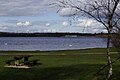
 North on Chasewater - geograph.org.uk - 4715815.jpg 640 × 480; 47 KB
-

-

-
 Norton Pool early 1900s.png 420 × 297; 127 KB
-
 Number 2 Pit-plaque 02.jpg 3,138 × 1,085; 327 KB
-
 Office block off Miners Way - geograph.org.uk - 3419953.jpg 640 × 480; 76 KB
-

-

-

-

-
 Overflow culverts and a cableway pylon, Chasewater - geograph.org.uk - 4813538.jpg 1,280 × 960; 1.06 MB


_-_geograph.org.uk_-_3419911.jpg)


_-_geograph.org.uk_-_2659539.jpg)
_-_geograph.org.uk_-_2659550.jpg)


