Category:Buttresses in Buckinghamshire
Ceremonial counties of England: Bedfordshire · Berkshire · Buckinghamshire · Cambridgeshire · Cheshire · Cornwall · Cumbria · Derbyshire · Devon · Dorset · Durham · East Riding of Yorkshire · East Sussex · Essex · Gloucestershire · Greater London · Greater Manchester · Hampshire · Herefordshire · Hertfordshire · Isle of Wight · Kent · Lancashire · Leicestershire · Lincolnshire · Merseyside · Norfolk · North Yorkshire · Northamptonshire · Northumberland · Nottinghamshire · Oxfordshire · Rutland · Shropshire · Somerset · South Yorkshire · Staffordshire · Suffolk · Surrey · Tyne and Wear · Warwickshire · West Midlands · West Sussex · West Yorkshire · Wiltshire · Worcestershire
City-counties: Bristol ·
Former historic counties:
Other former counties:
City-counties: Bristol ·
Former historic counties:
Other former counties:
Media in category "Buttresses in Buckinghamshire"
The following 72 files are in this category, out of 72 total.
-

-
 All Saints Church, Middle Claydon, Bucks, England - chancel south door.jpg 3,456 × 4,608; 17.57 MB
-
 All Saints Church, Middle Claydon, Bucks, England - nave and south porch.jpg 4,335 × 3,250; 15.14 MB
-
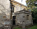
 All Saints Church, Middle Claydon, Bucks, England - vestry from south.jpg 4,022 × 3,230; 14.91 MB
-
 All Saints Church, Middle Claydon, Bucks, England - vestry.jpg 4,320 × 3,456; 16.87 MB
-
 St Michael and All Angels Church, Beaconsfield, Buckinghamshire.jpg 2,716 × 1,528; 1.84 MB
-
 Parish church, Bledlow Ridge (geograph 4141712).jpg 1,024 × 768; 187 KB
-
 St Paul Church, Bledlow Ridge - geograph.org.uk - 100957.jpg 640 × 480; 146 KB
-
 St Mary Magdalene, Boveney - geograph.org.uk - 93760.jpg 640 × 480; 102 KB
-
 St. Mary Magdalene, Boveney - geograph.org.uk - 665231.jpg 640 × 474; 123 KB
-
 Western elevation of Boveney church-geograph-3630333-by-Shazz.jpg 600 × 800; 124 KB
-

-
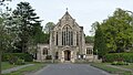
 Buckingham RadcliffeCentre01.JPG 1,536 × 2,304; 687 KB
-
 Burnham, St Peter's Church - geograph.org.uk - 1118895.jpg 640 × 480; 69 KB
-
 St. Giles, Cheddington - The Tower - geograph.org.uk - 330028.jpg 529 × 640; 80 KB
-
 Yew avenue to St. Giles - geograph.org.uk - 330024.jpg 640 × 480; 77 KB
-
 Midday Christmas 2009 Cublington Church - geograph.org.uk - 1635175.jpg 640 × 480; 124 KB
-
 St. Nicholas, Cublington - geograph.org.uk - 234801.jpg 640 × 480; 111 KB
-
 St. Michael and All Angels - Tower end - geograph.org.uk - 658862.jpg 640 × 492; 192 KB
-
 FleetMarston StMary SE.jpg 1,280 × 720; 630 KB
-
 Great Kimble Church - geograph.org.uk - 94812.jpg 640 × 427; 123 KB
-
 St. Leonards from the churchyard - geograph.org.uk - 658111.jpg 640 × 301; 185 KB
-
 St. Leonards, Grendon Underwood - geograph.org.uk - 658098.jpg 640 × 458; 202 KB
-
 Grendon Underwood Church - geograph.org.uk - 717061.jpg 640 × 425; 70 KB
-

-
 St James the Great, Hanslope, Bucks - geograph.org.uk - 333065.jpg 425 × 640; 75 KB
-
 Hanslope Church - geograph.org.uk - 1596188.jpg 640 × 480; 54 KB
-
 Hanslope Church - geograph.org.uk - 38747.jpg 450 × 604; 131 KB
-
 Hardwick Church - geograph.org.uk - 1635031.jpg 480 × 640; 65 KB
-
 St Mary's Hardwick - geograph.org.uk - 904434.jpg 640 × 426; 62 KB
-
 St Mary's, Hardwick - geograph.org.uk - 134873.jpg 360 × 480; 69 KB
-

-
 Church of St Mary the Virgin, Hedgerley (geograph 3877570).jpg 4,320 × 3,240; 2.86 MB
-
 Church of St Mary the Virgin, Hedgerley (geograph 3877578).jpg 3,240 × 4,320; 4.14 MB
-
 Church of St Mary the Virgin, Hedgerley (geograph 3877579).jpg 3,240 × 4,320; 4.84 MB
-
 St John the Baptist Church The Lee.JPG 2,742 × 1,828; 771 KB
-
 St Mary Magdalen, Little Brickhill - geograph.org.uk - 228887.jpg 480 × 640; 93 KB
-
 St. Nicholas' tower, Little Horwood - geograph.org.uk - 791280.jpg 480 × 640; 93 KB
-
 Igreja Missenden.jpg 800 × 600; 121 KB
-
 LittleBrickhill ParishChurch01.JPG 2,304 × 1,536; 854 KB
-
 Maid's Moreton (Bucks) St Edmund's Church - geograph.org.uk - 68617.jpg 640 × 480; 125 KB
-
 Maids Moreton Church.JPG 2,272 × 1,704; 418 KB
-
 All Saints Church at Marsworth - geograph.org.uk - 1516367.jpg 640 × 480; 99 KB
-
 All Saints Church at Marsworth - geograph.org.uk - 1516374.jpg 480 × 640; 100 KB
-
 All Saints Church at Marsworth - geograph.org.uk - 1516399.jpg 458 × 640; 128 KB
-
 All Saints Church at Marsworth - geograph.org.uk - 1526560.jpg 640 × 489; 133 KB
-
 Church Tower, Marsworth Parish Church - geograph.org.uk - 1198515.jpg 480 × 640; 135 KB
-
-

-
 Parish church Marsworth - geograph.org.uk - 649028.jpg 640 × 480; 73 KB
-

-

-
 St Mary the Virgin Church, East Claydon - geograph.org.uk - 410028.jpg 480 × 640; 134 KB
-
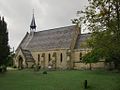
 Mentmore, The Church of St Mary the Virgin - geograph.org.uk - 97118.jpg 640 × 480; 104 KB
-
 St Michaels Church, Horsenden - geograph.org.uk - 32880.jpg 640 × 480; 157 KB
-
 All Saints Church, Middle Claydon, Bucks, England - nave from NW.jpg 3,818 × 3,054; 12.37 MB
-
 All Saints Church, Middle Claydon, Bucks, England - tower from NE.jpg 3,456 × 3,456; 12.41 MB
-
 All Saints Church, Middle Claydon, Bucks, England - tower from NW.jpg 3,158 × 3,948; 13.2 MB
-
 All Saints Church, Middle Claydon, Bucks, England - tower from south.jpg 3,456 × 4,608; 17.6 MB
-
 All Saints Church, Middle Claydon, Bucks, England - tower from west.jpg 3,233 × 4,313; 14.11 MB
-
 Church Tower, Pitstone Church End - geograph.org.uk - 116139.jpg 480 × 640; 81 KB
-
 St. John the Evangelist, Radclive - geograph.org.uk - 348023.jpg 640 × 480; 188 KB
-
-
 St. Leonard's Church - geograph.org.uk - 89809.jpg 640 × 480; 73 KB
-
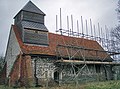
 Church of St Luke, Stoke Hammond.jpg 4,000 × 3,000; 3.37 MB
-
 St Peter and St Paul's church, Stokenchurch-geograph.org.uk-1159570.jpg 480 × 640; 114 KB
-
 St Mary's, Thornborough - geograph.org.uk - 337732.jpg 640 × 480; 111 KB
-
 St Michael and all Saints church (geograph 4514377).jpg 1,600 × 1,066; 406 KB
-

-
 St. Michael's Church - geograph.org.uk - 1447273.jpg 603 × 346; 286 KB
-
 St Paul's West Wycombe.JPG 2,048 × 1,536; 822 KB
-
 Wing Saxon Church Winter Time - geograph.org.uk - 363151.jpg 640 × 480; 94 KB


.jpg)


.jpg)
.jpg)
.jpg)


_St_Edmund%27s_Church_-_geograph.org.uk_-_68617.jpg)


.jpg)
.jpg)


