Category:Buttresses in Oxfordshire
Ceremonial counties of England: Bedfordshire · Berkshire · Buckinghamshire · Cambridgeshire · Cheshire · Cornwall · Cumbria · Derbyshire · Devon · Dorset · Durham · East Riding of Yorkshire · East Sussex · Essex · Gloucestershire · Greater London · Greater Manchester · Hampshire · Herefordshire · Hertfordshire · Isle of Wight · Kent · Lancashire · Leicestershire · Lincolnshire · Merseyside · Norfolk · North Yorkshire · Northamptonshire · Northumberland · Nottinghamshire · Oxfordshire · Rutland · Shropshire · Somerset · South Yorkshire · Staffordshire · Suffolk · Surrey · Tyne and Wear · Warwickshire · West Midlands · West Sussex · West Yorkshire · Wiltshire · Worcestershire
City-counties: Bristol ·
Former historic counties:
Other former counties:
City-counties: Bristol ·
Former historic counties:
Other former counties:
Media in category "Buttresses in Oxfordshire"
The following 200 files are in this category, out of 367 total.
(previous page) (next page)-
 St Mary's Church Pyrton Oxfordshire England chancel at east.jpg 6,240 × 4,160; 37.67 MB
-
 St Mary's Church Pyrton Oxfordshire England from south-east.jpg 6,240 × 4,160; 36.24 MB
-
 St Bartholomew's Church Brightwell Baldwin Oxfordshire England 01 less contrast.jpg 6,024 × 4,017; 33.45 MB
-
 St Bartholomew's Church Brightwell Baldwin Oxfordshire England 01 more contrast.jpg 6,024 × 4,017; 36.34 MB
-
 St Bartholomew's Church Brightwell Baldwin Oxfordshire England 02.jpg 3,800 × 5,700; 29.06 MB
-
 St Bartholomew's Church Brightwell Baldwin Oxfordshire England 03.jpg 3,808 × 5,713; 31.26 MB
-
 St Bartholomew's Church Brightwell Baldwin Oxfordshire England 04.jpg 4,030 × 5,375; 31.22 MB
-
 Holy Trinity Church Nuffield, Oxon, England - from the NW.jpg 3,456 × 3,456; 14.52 MB
-
 Abingdon Berks St Helens.jpg 1,989 × 1,459; 1.01 MB
-
 Abingdon ChristChurch WSW.jpg 1,280 × 719; 555 KB
-
 Abingdon OurLady&StEdmund east.jpg 1,255 × 1,280; 704 KB
-
 Abingdon OurLady&StEdmund EastGables.jpg 1,280 × 1,280; 827 KB
-
 Abingdon OurLady&StEdmund SE.jpg 1,280 × 913; 725 KB
-
 Abingdon OurLady&StEdmund south.jpg 1,280 × 719; 500 KB
-
 Abingdon OurLady&StEdmund.JPG 2,440 × 1,830; 498 KB
-
 Abingdon SSMichael&AllAngels NW.jpg 1,278 × 1,280; 746 KB
-
 Abingdon StHelen OrganBlowingChamber.jpg 961 × 1,280; 919 KB
-
 Abingdon StHelen SpirePinnacles.jpg 1,280 × 854; 760 KB
-
 Abingdon StHelen WestPorch.jpg 961 × 1,280; 943 KB
-
 Abingdon StMichael&AllAngels north.jpg 1,280 × 851; 641 KB
-
-
-
 Trinity church hall - geograph.org.uk - 1299858.jpg 640 × 427; 88 KB
-
 Adwell Church, Oxfordshire-5846398356.jpg 1,920 × 2,560; 2.74 MB
-
 Adwell StMary.jpg 2,640 × 1,980; 2.61 MB
-
 Alvescot StPeter south.jpg 1,280 × 1,023; 696 KB
-
 Alvescot StPeter SSE.jpg 1,280 × 853; 749 KB
-
 Ambrosden StMaryV SE.JPG 2,975 × 1,785; 754 KB
-
 A view up the tower - geograph.org.uk - 1598301.jpg 426 × 640; 69 KB
-
 St Peter and St Paul, Appleford - geograph.org.uk - 1540692.jpg 495 × 640; 73 KB
-
 Thatched wall along the lane - geograph.org.uk - 1597443.jpg 640 × 427; 95 KB
-
 Tower on the church - geograph.org.uk - 1597478.jpg 426 × 640; 75 KB
-
 St Lawrence, Appleton - geograph.org.uk - 1540710.jpg 640 × 455; 82 KB
-
 Appleton StLawrence south.JPG 2,902 × 1,932; 2.14 MB
-
 Holy Trinity Church in Ardington - geograph.org.uk - 1769609.jpg 1,500 × 1,000; 169 KB
-
 Mark on the buttress - geograph.org.uk - 1561442.jpg 426 × 640; 123 KB
-
 Aston&Cote SchoolSE.jpg 1,280 × 719; 467 KB
-
 Aston&Cote SchoolSouth.jpg 1,280 × 844; 572 KB
-
 AstonTirrold StMichael&AllAngels TowerS.jpg 683 × 1,024; 408 KB
-
 Banbury StJohnE belfry.jpg 853 × 1,280; 705 KB
-
 Banbury StJohnE WNW.jpg 713 × 1,280; 375 KB
-
 Baulking StNicholas NE.jpg 1,280 × 1,280; 821 KB
-
 Baulking StNicholas NNE.jpg 1,280 × 738; 589 KB
-
 Baulking StNicholas north.jpg 1,280 × 719; 660 KB
-
 Begbroke Church - geograph.org.uk - 1386361.jpg 640 × 426; 91 KB
-
 Benchmark on buttress of barn in Mackney - geograph.org.uk - 2030811.jpg 768 × 1,024; 290 KB
-
 Benson StHelen SE.jpg 1,280 × 914; 582 KB
-
 Benson StHelen South.jpg 1,280 × 914; 581 KB
-
 Benson StHelen SouthSquare.jpg 1,280 × 1,280; 711 KB
-
 BlackBourton StMaryV east.jpg 915 × 1,280; 810 KB
-
 BlackBourton StMaryV SE.jpg 1,280 × 719; 590 KB
-
 BlackBourton StMaryV south.jpg 1,280 × 720; 613 KB
-

-
 Church spire at St Mary's, Bloxham - geograph.org.uk - 1461096.jpg 464 × 640; 78 KB
-
 Bodicote StJohnB ChancelEast.jpg 852 × 1,280; 827 KB
-
 Bodicote StJohnB east.jpg 1,280 × 625; 547 KB
-
 Bodicote StJohnB ESE.jpg 1,280 × 653; 494 KB
-
 Bodicote StJohnB southeast.jpg 1,280 × 721; 640 KB
-
 Bodicote StJohnB SSW.jpg 1,280 × 852; 766 KB
-
 Chapel by the hut - geograph.org.uk - 1633767.jpg 640 × 480; 87 KB
-
 North side of the chapel - geograph.org.uk - 1633810.jpg 640 × 480; 73 KB
-
 Notice board by the window - geograph.org.uk - 1634789.jpg 480 × 640; 91 KB
-
 BotleyCemetery chapel south.jpg 1,280 × 792; 770 KB
-
 Bourton StJames.JPG 840 × 1,280; 484 KB
-
 St Agatha, Brightwell - geograph.org.uk - 1540814.jpg 640 × 441; 116 KB
-
 Discs along the wall - geograph.org.uk - 1671120.jpg 1,024 × 683; 168 KB
-
 BrightwellBaldwin StBartholomew SE.jpg 1,280 × 851; 783 KB
-
 Spire of St Mary, Broughton.JPG 3,456 × 4,608; 3.27 MB
-
 Broughton StMaryV ESE wide.jpg 1,280 × 670; 517 KB
-
 Broughton StMaryV ESE.jpg 1,280 × 1,279; 807 KB
-
 Broughton StMaryV SE 1.jpg 1,280 × 1,280; 780 KB
-
 Broughton StMaryV SE 2.jpg 1,280 × 1,278; 712 KB
-
 Broughton StMaryV south wide.jpg 1,280 × 719; 480 KB
-
 Broughton StMaryV south.jpg 1,279 × 1,280; 760 KB
-
 Broughton StMaryV SSW.jpg 1,268 × 1,280; 759 KB
-
 Bucknell StPeter ChancelNorth.jpg 1,280 × 852; 793 KB
-
 Bucknell StPeter ChancelNW.jpg 853 × 1,280; 695 KB
-
 Bucknell StPeter NW.jpg 1,280 × 1,024; 652 KB
-
 Buttress with a bench mark - geograph.org.uk - 1653468.jpg 426 × 640; 103 KB
-
 Buttresses in the river - geograph.org.uk - 1451018.jpg 640 × 427; 77 KB
-
 Chalgrove StMaryV chancel ENE.jpg 1,279 × 1,280; 756 KB
-
 Chalgrove StMaryV chancel SSE.jpg 1,280 × 1,280; 856 KB
-
 Chalgrove StMaryV east.jpg 1,133 × 1,280; 752 KB
-
 Chalgrove StMaryV ESE.jpg 1,280 × 720; 491 KB
-
 Chalgrove StMaryV MassDials.JPG 1,960 × 2,940; 2.37 MB
-
 St. Mary's, Chesterton.jpg 2,048 × 1,536; 675 KB
-
 Childrey StMaryTheVirgin.JPG 2,974 × 1,950; 2.46 MB
-
 Childrey StMaryV porch transept west.jpg 1,280 × 719; 602 KB
-
 Buttress on the end - geograph.org.uk - 1700743.jpg 533 × 800; 116 KB
-
 St Stephen, Clanfield, tower.JPG 1,481 × 1,975; 747 KB
-
 Combe StLaurence SE.JPG 2,660 × 1,900; 695 KB
-
 Cowley StLuke south.jpg 1,280 × 1,023; 611 KB
-
 Cowley UnitedReformedChurch south.jpg 1,280 × 1,280; 923 KB
-
 Cuddesdon AllSaints SouthEast.JPG 3,000 × 2,000; 2.7 MB
-
 Northbourne Community Centre - geograph.org.uk - 64062.jpg 640 × 480; 103 KB
-
 Tower and porch - geograph.org.uk - 1724291.jpg 600 × 800; 85 KB
-
 Didcot AllSaints ESE.jpg 1,280 × 715; 495 KB
-
 Didcot AllSaints SSE.jpg 1,280 × 720; 604 KB
-
 Didcot Northbourne Centre east.jpg 1,280 × 1,232; 837 KB
-
 Didcot NorthbourneCentre west.jpg 1,269 × 1,280; 776 KB
-
 Drayton StPeter southeast.jpg 1,024 × 759; 461 KB
-
 Drayton StPeter transept.jpg 1,024 × 768; 412 KB
-
 St Mary Magdalene, Duns Tew, Oxon - geograph.org.uk - 1615245.jpg 490 × 640; 117 KB
-
 Dunsden church (geograph 5512854).jpg 640 × 480; 141 KB
-
 DunsTew StMaryMagdalene Grotesque.JPG 1,770 × 2,950; 2.18 MB
-

-
 St Mary, East Hendred - geograph.org.uk - 1547791.jpg 640 × 426; 98 KB
-
 East Hendred St Augustine's of Canterbury church.jpg 640 × 480; 259 KB
-
 East Hendred St Mary's church.jpg 640 × 480; 230 KB
-
 EastHendred StAugustine south.jpg 1,280 × 1,280; 1.01 MB
-
 EastHendred StAugustine west.jpg 1,026 × 1,280; 601 KB
-
 EastHendred StMary NaveWest.jpg 960 × 1,280; 655 KB
-
 EastHendred StMary south.jpg 1,279 × 1,280; 785 KB
-
 EastHendred StMary southwest.jpg 1,280 × 961; 648 KB
-
 EastHendred StMary west.jpg 1,280 × 720; 459 KB
-
 Elsfield StThomasC MassDial.JPG 2,955 × 1,970; 2.44 MB
-
 Freeland StMaryTheVirgin south.JPG 3,000 × 2,000; 684 KB
-
 Great Barn - geograph.org.uk - 1093075.jpg 640 × 347; 74 KB
-
 Great Barn - geograph.org.uk - 1093081.jpg 640 × 380; 95 KB
-
 Greatbarn-greatcoxwell-01.jpg 800 × 600; 343 KB
-
 St Giles Great Coxwell Geograph-2298159-by-Gareth-James.jpg 2,816 × 2,112; 2.03 MB
-
 The Barn, Great Coxwell - geograph.org.uk - 1224062.jpg 640 × 427; 66 KB
-
 The Great Barn, Great Coxwell - geograph.org.uk - 871132.jpg 640 × 438; 90 KB
-
 The Great Barn, Great Coxwell - geograph.org.uk - 871136.jpg 640 × 434; 85 KB
-
 Tithe Barn at Great Coxwell - geograph.org.uk - 58275.jpg 640 × 480; 102 KB
-
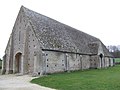
 Great Coxwell Barn - geograph.org.uk - 1750413.jpg 3,008 × 2,000; 2.46 MB
-
 Great Coxwell Barn - geograph.org.uk - 307442.jpg 640 × 480; 82 KB
-
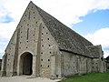
 Great Coxwell Tithe Barn c.jpg 2,437 × 1,419; 1.94 MB
-
 Great Coxwell Tithe Barn, Oxfordshire (geograph 1934677).jpg 1,024 × 714; 175 KB
-
 Great-Milton-Church.jpg 1,240 × 826; 899 KB
-

-
 Greatbarn-greatcoxwell-02.jpg 599 × 800; 112 KB
-
 GreatCoxwell Barn SSE.jpg 1,229 × 1,280; 765 KB
-
 GreatCoxwell Barn SW.jpg 1,280 × 1,280; 707 KB
-
 GreatCoxwell Barn WestPorch SSE.jpg 1,018 × 1,280; 912 KB
-
 GreatCoxwell Barn WSW.jpg 1,280 × 1,280; 691 KB
-
 GreatCoxwell StGiles ChancelSouth.jpg 1,024 × 1,280; 913 KB
-
 GreatCoxwell StGiles NaveSE.jpg 1,280 × 853; 728 KB
-
 GreatCoxwell StGiles NaveSW.jpg 1,280 × 845; 632 KB
-
 GreatCoxwell StGiles south.jpg 1,280 × 1,280; 700 KB
-
 GreatCoxwell StGiles SW.jpg 1,280 × 1,280; 680 KB
-
 GreatCoxwell StGiles west.jpg 960 × 1,280; 681 KB
-
 Grimsbury StLeonard NW.jpg 1,280 × 790; 784 KB
-
 Grimsbury StLeonard west.jpg 1,280 × 959; 668 KB
-
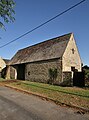 HamptonPoyle ChurchFarm barn ESE.jpg 947 × 1,280; 831 KB
-
 HamptonPoyle StMary north.jpg 1,280 × 719; 578 KB
-
 HamptonPoyle StMary northeast.jpg 1,280 × 720; 512 KB
-
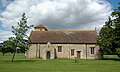
 Hardwick StMaryV north.jpg 1,280 × 719; 619 KB
-
 HardwickCokethorpe StMary south.jpg 3,000 × 1,800; 2.24 MB
-
 HardwickCokethorpe StMary southwest.jpg 2,750 × 1,650; 1.7 MB
-
 Headington AllSaints FoundationStone.jpg 1,024 × 1,280; 816 KB
-
 Church Of The Holy Trinity 1.jpg 4,000 × 3,000; 5.62 MB
-
 Church Of The Holy Trinity 2.jpg 4,000 × 3,000; 4.88 MB
-
 Sacred Heart Church, Henley-on-Thames by Michael Ford Geograph 3663034.jpg 3,648 × 2,736; 2.77 MB
-
 Henley-on-Thames ChristChurch east.jpg 1,232 × 1,280; 712 KB
-
 Henley-on-Thames HolyTrinity ENE.jpg 1,280 × 1,280; 811 KB
-
 Henley-on-Thames HolyTrinity SouthAisle WestWindow.jpg 1,025 × 1,280; 1.1 MB
-
 Henley-on-Thames SacredHeart windows.jpg 1,280 × 913; 876 KB
-
 Henley-on-Thames StMary SouthAisle east.jpg 1,280 × 1,280; 827 KB
-
 Henley-on-Thames StMary SouthAisle west.jpg 1,222 × 1,280; 986 KB
-
 Henley-on-Thames StMary SouthAisle WestTower.jpg 916 × 1,280; 654 KB
-
 Henley-on-Thames StMary west.jpg 911 × 1,280; 654 KB
-
 Henley-on-Thames StMary WSW.jpg 1,280 × 1,280; 811 KB
-
 Holy Trinity RC church, Hethe - geograph.org.uk - 832566.jpg 640 × 426; 123 KB
-
 St Nicholas, Heythrop - geograph.org.uk - 350634.jpg 427 × 640; 82 KB
-
 HintonWaldrist StMargaretV SE.jpg 1,280 × 853; 738 KB
-
 HintonWaldrist StMargaretV south.jpg 1,280 × 850; 655 KB
-
 HintonWaldrist StMargaretV SSE.jpg 1,280 × 720; 583 KB
-
 Holwell StMaryV east.jpg 1,101 × 1,280; 904 KB
-
 Holwell StMaryV SSE.jpg 1,280 × 701; 631 KB
-
 Holwell StMaryV SSW.jpg 1,192 × 1,280; 776 KB
-
 Holy Trinity Church Nuffield, Oxon, England - chancel from east.jpg 3,456 × 3,456; 12.13 MB
-
 Holy Trinity Church Nuffield, Oxon, England - chancel south wall.jpg 4,608 × 3,456; 19.04 MB
-
 Holy Trinity Church Nuffield, Oxon, England - from the NE.jpg 4,608 × 3,456; 17.6 MB
-
 Holy Trinity Church Nuffield, Oxon, England - from the SW.jpg 3,456 × 3,456; 14.08 MB
-
 Holy Trinity Church Nuffield, Oxon, England - nave south wall.jpg 4,555 × 3,415; 18.15 MB
-
 HookNorton FireStation WSW.jpg 1,280 × 853; 389 KB
-
 HookNorton StPeter NNW.jpg 1,280 × 1,243; 708 KB
-
 Methodist chapel, Hornton - geograph.org.uk - 1568025.jpg 640 × 429; 71 KB
-
 Village Church.jpg 1,280 × 960; 146 KB
-
 Iffley StMaryV E1.jpg 768 × 960; 411 KB
-
 Iffley StMaryV E2.jpg 960 × 768; 381 KB
-
 Iffley StMaryV SE.jpg 768 × 1,024; 479 KB
-
 Kencot StGeorge SSE.jpg 1,280 × 849; 671 KB
-
 Kencot, St. George's Church - geograph.org.uk - 381300.jpg 640 × 432; 145 KB
-
 Kidlington StMaryV east.jpg 1,040 × 1,280; 914 KB
-
 St John the Baptist, Kidmore End - geograph.org.uk - 1549444.jpg 640 × 471; 81 KB
-
 Parish Hall, Kingham - geograph.org.uk - 899667.jpg 640 × 426; 63 KB
-
 Kingham StAndrew south.jpg 1,024 × 1,280; 687 KB
-
 St Mary's Church, Launton - geograph.org.uk - 61239.jpg 640 × 480; 116 KB
-
 Launton AssumptionBVM NNW.jpg 1,280 × 1,280; 680 KB
-
 St Phillips, LittleRollright, 2011-04-29.JPG 4,000 × 3,000; 2.5 MB
-
 St Dominic Barberi Church Littlemore 11 Feb 2007.JPG 1,536 × 2,048; 772 KB
-
 St Mary and St Nicholas's, Littlemore - geograph.org.uk - 118822.jpg 640 × 480; 77 KB
-
 Littlemore SSMary&Nicholas TowerEast.jpg 722 × 1,280; 718 KB
-
 Littlemore SSMary&Nicholas west.jpg 1,280 × 836; 867 KB
-
 LittleTew StJohnEv southeast.jpg 1,023 × 1,280; 653 KB
-
 LongWittenham StMaryV east.jpg 1,280 × 853; 665 KB
-
 St Mary, Longworth - geograph.org.uk - 1545681.jpg 640 × 441; 103 KB
-
 Longworth StMary SE2.jpg 1,280 × 720; 570 KB


.jpg)


.jpg)

_-_geograph.org.uk_-_407562.jpg)


