Category:CIA World Factbook maps of the United Kingdom
Countries of Europe: Albania · Andorra · Armenia‡ · Austria · Azerbaijan‡ · Belarus · Belgium · Bosnia and Herzegovina · Bulgaria · Croatia · Cyprus‡ · Czech Republic · Denmark · Estonia · Finland · France‡ · Georgia‡ · Germany · Greece · Hungary · Iceland · Republic of Ireland · Italy · Kazakhstan‡ · Latvia · Liechtenstein · Lithuania · Luxembourg · Malta · Moldova · Monaco · Montenegro · Netherlands‡ · North Macedonia · Norway · Poland · Portugal‡ · Romania · Russia‡ · San Marino · Serbia · Slovakia · Slovenia · Spain‡ · Sweden · Switzerland · Turkey‡ · Ukraine · United Kingdom · Vatican City
Specific status: Akrotiri and Dhekelia‡ · Faroe Islands · Gibraltar · Bailiwick of Guernsey · Isle of Man · Jersey – Limited recognition: Kosovo
‡: partly located in Europe
Specific status: Akrotiri and Dhekelia‡ · Faroe Islands · Gibraltar · Bailiwick of Guernsey · Isle of Man · Jersey – Limited recognition: Kosovo
‡: partly located in Europe
Media in category "CIA World Factbook maps of the United Kingdom"
The following 16 files are in this category, out of 16 total.
-
 Cork location with Great Britain and Ireland.png 1,300 × 793; 424 KB
-
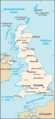
 Grossbritannien administrativ.gif 1,000 × 1,216; 310 KB
-
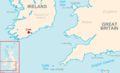
 Irsko morje.png 308 × 291; 13 KB
-
 Kaart Verenigd Koninkrijk.jpg 347 × 752; 37 KB
-
 Scilly Isles Locator Map.png 1,000 × 1,665; 246 KB
-
 UK Kaart cia.png 310 × 674; 23 KB
-
 Uk-map vide.png 312 × 676; 11 KB
-
 Uk-map-de.png 312 × 676; 27 KB
-
 Uk-map-es.png 312 × 676; 32 KB
-
 Uk-map-ja.png 312 × 676; 24 KB
-
 Uk-map.png 312 × 676; 17 KB
-
 UK~.PNG 312 × 676; 30 KB
-
 United Kingdom map in Armenian.png 276 × 598; 84 KB
-
 United Kingdom – U.S. area comparison.jpg 701 × 821; 507 KB
-
 United Kingdom-CIA WFB Map.png 312 × 676; 20 KB
-
 United Kingdom-CIA WFB RU.png 312 × 676; 23 KB


