Category:Causeway Street Elevated
railway line in the United States of America  | |||||
| Upload media | |||||
| Instance of | |||||
|---|---|---|---|---|---|
| Part of | |||||
| Location | Boston, Suffolk County, Massachusetts | ||||
| Date of official opening |
| ||||
| Date of official closure |
| ||||
| |||||
Subcategories
This category has the following 3 subcategories, out of 3 total.
Media in category "Causeway Street Elevated"
The following 14 files are in this category, out of 14 total.
-
 North Station incline (15760439537).jpg 6,087 × 4,627; 3.43 MB
-
 Causeway and Haverhill Streets (15760415817).jpg 6,031 × 4,839; 3 MB
-
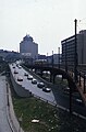
 Causeway Elevated and Boston Garden.jpg 402 × 342; 87 KB
-
 Causeway Street Elevated under deconstruction, September 2004.jpg 850 × 638; 136 KB
-
 Corner of Lowell and Causeway Streets, May 1912.jpg 5,946 × 4,853; 3.86 MB
-
 Green Line trolley next to Central Artery 2.jpg 509 × 776; 93 KB
-
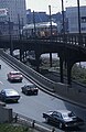 Green Line trolley next to Central Artery.jpg 506 × 776; 119 KB
-
 Lipofsky-Boston-Garden.jpg 399 × 265; 150 KB
-
 Lowell Street and Causeway Street Elevated, December 1952.jpg 5,963 × 4,861; 1.93 MB
-
 MBTA 3302 approaching North Station, August 1968.jpg 2,000 × 1,579; 1.26 MB
-
 North Station and West End redevelopment aerial view.jpg 3,581 × 2,212; 696 KB
-
 North Station Elevated 1922.png 724 × 560; 435 KB
-
 North Station elevated tracks facing south, 1912.jpg 2,436 × 1,148; 772 KB
-
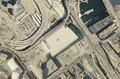 TD Fleet Centre satellite view.png 992 × 653; 1.17 MB
.jpg)
.jpg)


