Category:Cedar Breaks Scenic Byway
scenic byway in Iron County, Utah, United States  | |||||
| Upload media | |||||
| Instance of | |||||
|---|---|---|---|---|---|
| Named after |
| ||||
| Location | Iron County, Utah | ||||
| Transport network | |||||
| Has part(s) | |||||
| Inception |
| ||||
| Length |
| ||||
| Terminus | |||||
 | |||||
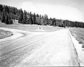
English: Media related to the Cedar Breaks Scenic Byway, a 5.1129-mile (8.2284 km) Utah Scenic Byway in the Dixie National Forest and Cedar Breaks National Monument in eastern Iron County, Utah, United States, that was established April 9, 1990 and connects Utah State Route 14 at Cedar Breaks Junction with Utah State Route 143 in the Cedar Breaks National Monument. From it southenrn terminus to the national monument southern border, the byway runs concurrent with the entire length of Utah State Route 148. The remainder (northern part) is Federal Aid Route 1800.
Subcategories
This category has the following 3 subcategories, out of 3 total.
C
- Cedar Breaks Junction (2 F)
S
Media in category "Cedar Breaks Scenic Byway"
The following 3 files are in this category, out of 3 total.
-
 Begin North UT-148 to Cedar Breaks, Brian Head - panoramio.jpg 1,600 × 1,200; 801 KB
-
-
 South UT-148 near Cedar Breaks - panoramio.jpg 1,600 × 1,200; 744 KB
._;_ZION_Museum_(84485425568d493da8ac251897f08488).jpg)
