Category:Utah State Route 148
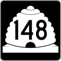
 | number: | (one hundred fourty-eight) |
|---|---|---|
| State highways in Utah: | 128 · 129 · 130 · 131 · 132 · 133 · 134 · 135 · 136 · 137 · 138 · 139 · 140 · 141 · 142 · 143 · 144 · 145 · 146 · 147 · 148 · 149 · 150 · 151 · 152 · 153 · 154 · 155 · 156 · 157 · 158 · 159 · 160 · 161 · 162 · 163 · 164 · 165 · 166 · 167 · 168 |
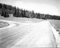
state highway in the Dixie National Forest in Iron County, Utah, United States  | |||||
| Upload media | |||||
| Instance of | |||||
|---|---|---|---|---|---|
| Part of | |||||
| Located in protected area | |||||
| Location | Iron County, Utah | ||||
| Transport network | |||||
| Owned by | |||||
| Maintained by | |||||
| Inception |
| ||||
| Length |
| ||||
| Terminus | |||||
 | |||||
English: Media related to Utah State Route 148 (Cedar Breaks Scenic Byway), a 2.5114-mile (4.0417 km) state highway in the Dixie National Forest in southeastern Iron County, Utah, United States, that connects Utah State Route 14 in the Midway Valley with the southern entrance to Cedar Breaks National Monument. (Most maps incorrectly show Utah State Route continuing north through the national monument to connect with Utah State Route 143.)
Subcategories
This category has the following 5 subcategories, out of 5 total.
Media in category "Utah State Route 148"
The following 5 files are in this category, out of 5 total.
-
 Begin North UT-148 to Cedar Breaks, Brian Head - panoramio.jpg 1,600 × 1,200; 801 KB
-
-
 Utah 148.svg 750 × 600; 73 KB
-
 Utah SR 148.svg 385 × 385; 8 KB
-
 Utah State Routes 148 at 14.jpg 2,724 × 1,407; 3.78 MB
._;_ZION_Museum_(84485425568d493da8ac251897f08488).jpg)

