Category:Chaddesley Corbett
village in Worcestershire, England, UK  | |||||
| Upload media | |||||
| Instance of | |||||
|---|---|---|---|---|---|
| Location | Wyre Forest, Worcestershire, West Midlands, England | ||||
 | |||||
Subcategories
This category has the following 5 subcategories, out of 5 total.
Media in category "Chaddesley Corbett"
The following 200 files are in this category, out of 278 total.
(previous page) (next page)-
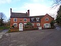
 A cottage in Chaddesley Corbett - geograph.org.uk - 6087506.jpg 1,600 × 1,200; 431 KB
-
 A field near Drayton, Worcestershire - geograph.org.uk - 6086320.jpg 1,600 × 1,200; 437 KB
-
 A448 at Brockencote - geograph.org.uk - 6501884.jpg 640 × 480; 74 KB
-
 A448 at Outwood - geograph.org.uk - 3702712.jpg 800 × 451; 196 KB
-

-
-
 A450 Worcester Road - geograph.org.uk - 3199920.jpg 2,816 × 2,112; 2.15 MB
-
 Access is limited - geograph.org.uk - 2050037.jpg 480 × 640; 100 KB
-
 Across the field to Monks - geograph.org.uk - 6084344.jpg 1,600 × 1,200; 513 KB
-
 An entrance to Chaddesley Wood - geograph.org.uk - 2050048.jpg 640 × 480; 138 KB
-
 Approaching Bluntington - geograph.org.uk - 6501860.jpg 640 × 480; 78 KB
-
 ArmsOfCorbetOfChadesleyCorbet.JPG 276 × 304; 16 KB
-
 Avenue up to Brockencote Hall, Chaddesley Corbett - geograph.org.uk - 5121871.jpg 1,600 × 1,200; 660 KB
-
 Back street - geograph.org.uk - 2050028.jpg 480 × 640; 94 KB
-
 Barn Close Cottage, The Holloway having work done - geograph.org.uk - 6087490.jpg 1,600 × 1,200; 409 KB
-
 Barnett Hill View - geograph.org.uk - 951203.jpg 640 × 480; 50 KB
-
 Batch Cottages, Chaddesley Corbett - geograph.org.uk - 6331146.jpg 4,000 × 3,000; 2.31 MB
-
 Beam's End, Chaddesley Corbett - geograph.org.uk - 6331148.jpg 4,000 × 3,000; 2.52 MB
-
 Beauty Bank Cottage, The Holloway, Chaddesley Corbett - geograph.org.uk - 6087497.jpg 1,600 × 1,200; 485 KB
-
 Bedding arrangement at Rowberry's nursery - geograph.org.uk - 5562164.jpg 1,600 × 1,200; 578 KB
-
 Beer garden at The Swan - geograph.org.uk - 5287163.jpg 3,648 × 2,736; 2.69 MB
-
 Belne brook passes under the road at Hillpool - geograph.org.uk - 6085039.jpg 1,600 × 1,200; 660 KB
-
 Bluebells at entrance to Chaddesley Wood - geograph.org.uk - 6139259.jpg 1,600 × 1,200; 782 KB
-
 Bluntington - geograph.org.uk - 6501864.jpg 640 × 480; 65 KB
-
 Bluntington crossroads - geograph.org.uk - 6501861.jpg 640 × 480; 76 KB
-
 Briar Hill, Chaddesley Corbett - geograph.org.uk - 3945953.jpg 3,488 × 2,616; 2.12 MB
-
 Briar Hill, Chaddesley Corbett - geograph.org.uk - 3945974.jpg 3,488 × 2,616; 2.18 MB
-
 Briar Hill, Chaddesley Corbett - geograph.org.uk - 5083311.jpg 1,600 × 1,200; 769 KB
-
 Bridge over Elmley Brook, Cakebole Lane - geograph.org.uk - 5102572.jpg 1,600 × 1,200; 511 KB
-
 Bridge over Hockley Brook - geograph.org.uk - 385597.jpg 640 × 426; 144 KB
-
 Bridge over Hockley Brook near Bournes Green - geograph.org.uk - 2523923.jpg 1,024 × 667; 226 KB
-
 Bridleway and field headland - geograph.org.uk - 3055231.jpg 1,024 × 680; 264 KB
-
 Brockencote Hall Hotel and Restaurant - geograph.org.uk - 5121856.jpg 1,600 × 1,200; 470 KB
-
 Bromsgrove Road, Mustow Green - geograph.org.uk - 6508198.jpg 1,906 × 1,260; 962 KB
-
 Cakebole Cottage at Cakebole, Worcestershire - geograph.org.uk - 5102578.jpg 1,600 × 1,200; 478 KB
-
 Cakebole House Farm, Chaddesley Corbett - geograph.org.uk - 5121908.jpg 1,200 × 1,600; 549 KB
-
 Cakebole Lane - geograph.org.uk - 3065842.jpg 680 × 1,024; 288 KB
-
 Cakebole Lane at Cakebole, Worcestershire - geograph.org.uk - 5102581.jpg 1,600 × 1,200; 656 KB
-
 Chaddesley Corbett - geograph.org.uk - 472332.jpg 640 × 480; 151 KB
-
 Chaddesley Corbett - geograph.org.uk - 553868.jpg 640 × 480; 64 KB
-
 Chaddesley Corbett - geograph.org.uk - 6220483.jpg 1,280 × 851; 479 KB
-
 Chaddesley Corbett 01.jpg 3,264 × 2,448; 2.38 MB
-
 Chaddesley Corbett Beams End.JPG 4,000 × 3,000; 2.73 MB
-
 Chaddesley Corbett Brook Cottage.JPG 2,668 × 2,000; 932 KB
-
 Chaddesley Corbett Broughton Cottages.JPG 4,000 × 3,000; 2.99 MB
-
 Chaddesley Corbett Charity Houses.JPG 4,000 × 3,000; 3.73 MB
-
 Chaddesley Corbett church from the south - geograph.org.uk - 5121844.jpg 1,600 × 1,200; 530 KB
-
 Chaddesley Corbett Church View.JPG 4,000 × 3,000; 2.85 MB
-
 Chaddesley Corbett Feversham Cottage.JPG 4,000 × 3,000; 2.9 MB
-
 Chaddesley Corbett Georgian House.JPG 1,753 × 2,525; 951 KB
-
 Chaddesley Corbett K6.JPG 3,000 × 4,000; 4.49 MB
-
 Chaddesley Corbett Lodge Farmhouse Barn.JPG 4,000 × 3,000; 3.05 MB
-
 Chaddesley Corbett Lodge Farmhouse.JPG 2,233 × 1,548; 1.14 MB
-
 Chaddesley Corbett Lychgate House.JPG 4,000 × 3,000; 2.85 MB
-
 Chaddesley Corbett Post Office.JPG 4,000 × 3,000; 3.99 MB
-
 Chaddesley Corbett Saddlers Cottage.JPG 3,022 × 2,206; 1.27 MB
-
 Chaddesley Corbett Sports Field - geograph.org.uk - 387496.jpg 640 × 426; 103 KB
-
 Chaddesley Corbett Talbot Inn.JPG 4,000 × 3,000; 2.76 MB
-
 Chaddesley Corbett the Malt House.JPG 4,000 × 3,000; 3.61 MB
-
 Chaddesley Corbett The Old School House.JPG 4,000 × 3,000; 2.9 MB
-
 Chaddesley Corbett Tudor House.JPG 4,000 × 3,000; 2.49 MB
-

-
 Chaddesley Corbett village entrance - geograph.org.uk - 2144192.jpg 640 × 480; 72 KB
-
 Chaddesley Corbett Village Hall - geograph.org.uk - 5912518.jpg 3,664 × 2,749; 2 MB
-
 Chaddesley Corbett village sign - geograph.org.uk - 6501867.jpg 640 × 480; 92 KB
-
 Chaddesley Corbett Yew Tree Cottage.JPG 4,000 × 3,000; 2.55 MB
-

-

-
 Chaddesley Driers near Logmore Farm, Chaddesley Corbett - geograph.org.uk - 5121762.jpg 1,600 × 1,200; 631 KB
-
 Chaddesley Wood - geograph.org.uk - 385631.jpg 640 × 426; 145 KB
-
 Chaddesley Wood - geograph.org.uk - 4307906.jpg 800 × 531; 165 KB
-
 Chaddesley Wood - geograph.org.uk - 472031.jpg 640 × 480; 139 KB
-
 Chaddesley Wood - geograph.org.uk - 5516452.jpg 480 × 640; 101 KB
-
 Chaddesley Wood Farm - geograph.org.uk - 472020.jpg 640 × 480; 106 KB
-
 Charity Houses, Chaddesley Corbett - geograph.org.uk - 5084913.jpg 1,600 × 1,200; 674 KB
-
 Charity Houses, Chaddesley Corbett - geograph.org.uk - 6331149.jpg 4,000 × 3,000; 2.47 MB
-
 Church school house at Chaddesley Corbett - geograph.org.uk - 6331138.jpg 4,000 × 3,000; 2.87 MB
-
 Clover field near Chaddesley Wood - geograph.org.uk - 472016.jpg 640 × 480; 128 KB
-
 Cottage on Cakebole Lane, Cakebole, Worcestershire - geograph.org.uk - 5102585.jpg 1,600 × 1,200; 529 KB
-
 Cricket field near Cakebole - geograph.org.uk - 3065848.jpg 1,024 × 680; 253 KB
-
 Cross Roads for Dodford - geograph.org.uk - 161594.jpg 640 × 480; 288 KB
-
 Crossroads at Cakebole, Worcestershire - geograph.org.uk - 5102590.jpg 1,600 × 1,200; 539 KB
-
 Derelict Mill - geograph.org.uk - 6113226.jpg 3,000 × 4,000; 2.83 MB
-
 Disused mill race and house, Egg Lane, Drayton - geograph.org.uk - 6085912.jpg 1,600 × 1,200; 616 KB
-
 Dobes Lane - geograph.org.uk - 3054496.jpg 1,024 × 680; 203 KB
-
 Dobes Lane leaves the A448, Chaddesley Corbett - geograph.org.uk - 5121884.jpg 1,600 × 1,200; 553 KB
-
 Drayton Court, Drayton - geograph.org.uk - 6086385.jpg 1,600 × 1,200; 410 KB
-
 Drayton Mill, Drayton - geograph.org.uk - 6085921.jpg 1,600 × 1,200; 403 KB
-
 Drayton Mill, Drayton - geograph.org.uk - 6501849.jpg 640 × 446; 88 KB
-
 Drayton Pool, Belne Brook, Drayton - geograph.org.uk - 6085934.jpg 1,600 × 1,200; 481 KB
-
 Drayton Road - geograph.org.uk - 6501856.jpg 640 × 480; 85 KB
-
 Drayton Road approaching Bluntington - geograph.org.uk - 6501857.jpg 640 × 480; 90 KB
-
 Drayton Road approaching Drayton - geograph.org.uk - 6501846.jpg 640 × 480; 71 KB
-
 Drayton Road by Drayton Villa Farm - geograph.org.uk - 6501845.jpg 640 × 480; 81 KB
-
 Drayton Road leaving Drayton village - geograph.org.uk - 6501853.jpg 640 × 422; 53 KB
-
 Driveway to Old Barn - geograph.org.uk - 472176.jpg 640 × 480; 155 KB
-
 Egg Lane - geograph.org.uk - 4969297.jpg 768 × 1,024; 389 KB
-
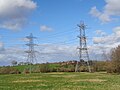 Electricity pylons near Woodside Farm - geograph.org.uk - 6087361.jpg 1,600 × 1,200; 369 KB
-
 End of the bridleway - geograph.org.uk - 5516449.jpg 480 × 640; 109 KB
-
-
 Farmhouse on unnamed lane near Cakebole House Farm - geograph.org.uk - 5121940.jpg 1,600 × 1,200; 650 KB
-

-
-
 Felled logs in Chaddesley Woods - geograph.org.uk - 6087349.jpg 1,600 × 1,200; 712 KB
-
 Field and poultry farm - geograph.org.uk - 3702710.jpg 800 × 451; 178 KB
-
 Field at Cakebole - geograph.org.uk - 3065836.jpg 1,024 × 680; 262 KB
-
 Field behind The Swan Inn, Chaddesley Corbett - geograph.org.uk - 6141429.jpg 1,600 × 1,200; 501 KB
-
 Field of barley - geograph.org.uk - 3055228.jpg 1,024 × 680; 238 KB
-
 Fields after harvesting, looking towards Rushock - geograph.org.uk - 5121932.jpg 1,600 × 1,200; 527 KB
-

-
 Fishing in Harvington Hall Lake - geograph.org.uk - 6501875.jpg 640 × 480; 94 KB
-
 Footbridge and weir on the Belne Brook at Hillpool - geograph.org.uk - 6085129.jpg 1,600 × 1,200; 673 KB
-
 Footpath off Cakebole Lane - geograph.org.uk - 3065830.jpg 680 × 1,024; 266 KB
-
 Footpath off Sandy Lane - geograph.org.uk - 3335453.jpg 2,112 × 2,816; 2 MB
-
 Footpath through Chaddesley Wood - geograph.org.uk - 4314641.jpg 1,024 × 680; 370 KB
-
 Footpath to Dorhall Farm from The Holloway - geograph.org.uk - 6087477.jpg 1,600 × 1,200; 342 KB
-
 Footpaths leading off Tanwood Lane - geograph.org.uk - 6502253.jpg 640 × 480; 106 KB
-
 Frere Felde Farm, Woodrow Lane - geograph.org.uk - 6084394.jpg 1,600 × 1,200; 547 KB
-
 Game over at Chaddesley Corbett cricket ground - geograph.org.uk - 5121891.jpg 1,600 × 1,200; 469 KB
-
 Gate to The Old Bakehouse on Tandy's Lane - geograph.org.uk - 6085025.jpg 1,200 × 1,600; 562 KB
-
 Glasshouses near Shenstone - geograph.org.uk - 3054528.jpg 1,024 × 680; 251 KB
-
 Green Acres, The Holloway, Chaddesley Corbett - geograph.org.uk - 6087502.jpg 1,600 × 1,200; 564 KB
-
 Harvington Cottages - geograph.org.uk - 951272.jpg 640 × 480; 73 KB
-
 Harvington Footpath - geograph.org.uk - 951278.jpg 640 × 480; 72 KB
-
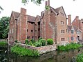 Harvington Hall - geograph.org.uk - 6501881.jpg 640 × 480; 100 KB
-
 Harvington Hall Lake - geograph.org.uk - 6501874.jpg 640 × 480; 67 KB
-
 Harvington Hall Lane at Redcross - geograph.org.uk - 6501883.jpg 640 × 480; 103 KB
-
 Harvington Hall moat - geograph.org.uk - 6501878.jpg 640 × 480; 123 KB
-
 Hills Automotive, Mustow Green - geograph.org.uk - 6494609.jpg 1,856 × 1,176; 1.09 MB
-

-

-
 House and village hall, Chaddesley Corbett - geograph.org.uk - 5121864.jpg 1,600 × 1,200; 566 KB
-
 House on Egg Lane, Drayton - geograph.org.uk - 6085906.jpg 1,600 × 1,200; 341 KB
-
 Houses next to Belne Brook, Hillpool - geograph.org.uk - 6085854.jpg 1,600 × 1,200; 429 KB
-
 Information board near main entrance to Chaddesley Woods - geograph.org.uk - 2518502.jpg 2,839 × 1,990; 522 KB
-
 Just off the path - field view - geograph.org.uk - 5516442.jpg 640 × 480; 60 KB
-
 Kidderminster Road, Chaddesley Corbett - geograph.org.uk - 6494611.jpg 1,838 × 1,142; 1.55 MB
-
 Lane junction near Bournes Green - geograph.org.uk - 2050052.jpg 640 × 480; 105 KB
-
 Lane to a farm from Dobes Lane, Chaddesley Corbett - geograph.org.uk - 5121876.jpg 1,600 × 1,200; 573 KB
-
 Lane to Hillpool with Sion House on the hill - geograph.org.uk - 6085033.jpg 1,600 × 1,200; 483 KB
-
 Lane to Tag Farm, where the footpath crosses it - geograph.org.uk - 6138890.jpg 1,600 × 1,200; 590 KB
-
 Laying water pipes - geograph.org.uk - 5730525.jpg 1,024 × 680; 229 KB
-
 Longmore Farm business entrance - geograph.org.uk - 5121898.jpg 1,600 × 1,200; 384 KB
-
 Longmore Farm sign by the pond - geograph.org.uk - 5121774.jpg 1,600 × 1,200; 495 KB
-
 Longmore Farm with road to stables - geograph.org.uk - 5121784.jpg 1,600 × 1,200; 386 KB
-
 Looking across the fields to new houses Harvington - geograph.org.uk - 6084277.jpg 1,600 × 1,200; 460 KB
-
 Looking over Tandy Lane - geograph.org.uk - 6084971.jpg 1,600 × 1,200; 372 KB
-
 Looking towards Friar's Farm - geograph.org.uk - 6084969.jpg 1,600 × 1,200; 331 KB
-
 Lower House Farm, Fox Lane, Chaddesley Corbett - geograph.org.uk - 5121803.jpg 1,600 × 1,200; 660 KB
-
 Lychgate and Lychgate House - geograph.org.uk - 5402555.jpg 3,273 × 2,083; 1.85 MB
-
 Lychgate and Lychgate House, Chaddesley Corbett - geograph.org.uk - 5402896.jpg 3,248 × 2,160; 2.5 MB
-
 Main street at Chaddesley Corbett - geograph.org.uk - 472270.jpg 640 × 480; 156 KB
-
 Minor road near Bournes Green - geograph.org.uk - 2523960.jpg 1,024 × 670; 263 KB
-
 Monarch's Way - geograph.org.uk - 951234.jpg 640 × 480; 64 KB
-
 Monarch's Way Stile - geograph.org.uk - 951213.jpg 480 × 640; 75 KB
-
 Mown grass - geograph.org.uk - 3055232.jpg 1,024 × 680; 215 KB
-
 New house on Tanwood Lane, Chaddesley Corbett - geograph.org.uk - 6086406.jpg 1,600 × 1,200; 323 KB
-
 Oak tree - geograph.org.uk - 3058605.jpg 680 × 1,024; 250 KB
-
 Oakfield Farm (1), Cakebole Lane - geograph.org.uk - 5102561.jpg 1,600 × 1,200; 510 KB
-
 Oakfield Farm (2), Cakebole Lane - geograph.org.uk - 5102564.jpg 1,600 × 1,200; 512 KB
-
 Oakfield Farm (3), Cakebole Lane - geograph.org.uk - 5102566.jpg 1,600 × 1,200; 505 KB
-
 Old School house Chaddesley Corbett - geograph.org.uk - 6501865.jpg 640 × 480; 106 KB
-
 On the A448 at Chaddesley Corbett - geograph.org.uk - 5912515.jpg 4,000 × 3,000; 2.6 MB
-
 Panorama view from the edge of Chaddesley Woods - geograph.org.uk - 6087347.jpg 1,600 × 709; 161 KB
-
 Path from Mount Segg to Deansford Lane - geograph.org.uk - 6113204.jpg 3,486 × 2,341; 1.14 MB
-
 Path junction in Chaddesley Wood - geograph.org.uk - 472035.jpg 640 × 480; 130 KB
-
 Path near the transmitter - geograph.org.uk - 5516446.jpg 480 × 640; 72 KB
-
 Pond at Cakebole - geograph.org.uk - 5121745.jpg 1,600 × 1,194; 352 KB
-
 Pond at Longmore Farm, Chaddesley Corbett - geograph.org.uk - 5121791.jpg 1,600 × 1,200; 590 KB
-
 Power lines and sheep - geograph.org.uk - 6084964.jpg 1,600 × 1,200; 346 KB
-
 Power lines by Frere Felde Farm - geograph.org.uk - 6084961.jpg 1,600 × 1,200; 281 KB
-
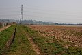
 Power lines crosses fields near to Drayton Road - geograph.org.uk - 6087426.jpg 1,600 × 1,200; 381 KB
-
 Priest's house connected to the church, Harvington - geograph.org.uk - 5529639.jpg 1,600 × 1,200; 382 KB
-

-
 Pylon behind Woodland Cottage - geograph.org.uk - 6139187.jpg 1,600 × 1,200; 567 KB
-
 Pylon near Cutpursey Coppice - geograph.org.uk - 472125.jpg 640 × 480; 143 KB
-
 Pylons near Barnettbrook - geograph.org.uk - 2289148.jpg 3,457 × 2,201; 2.39 MB
-
 Pylons near Cutpursey Coppice - geograph.org.uk - 472137.jpg 640 × 480; 118 KB
-
 Reinstated Way - geograph.org.uk - 951225.jpg 640 × 480; 42 KB
-
 Remains of an elm tree - geograph.org.uk - 2630379.jpg 640 × 426; 103 KB
-
 Road junction near Bournes Green - geograph.org.uk - 2523973.jpg 1,024 × 669; 275 KB
-
 Road junction near Bournes Green - geograph.org.uk - 2523979.jpg 1,024 × 676; 266 KB
-
 Road passing through Chaddesley Wood near Line Hill - geograph.org.uk - 6140551.jpg 1,600 × 1,200; 652 KB
-
 Road to Harvington Hall - geograph.org.uk - 3054501.jpg 1,024 × 680; 239 KB
-
 Road up to 'Works' - geograph.org.uk - 5121820.jpg 1,600 × 1,200; 541 KB
-
 Rowbwerrys Nursery - geograph.org.uk - 2489565.jpg 3,648 × 2,736; 2.78 MB
-
 Sandy Lane, near Blakedown - geograph.org.uk - 3335448.jpg 2,112 × 2,816; 2.07 MB
-
 Scar from water pipeline - geograph.org.uk - 6087433.jpg 1,600 × 1,200; 259 KB
-

-
 Sheep crossing bridge over Elmley Brook - geograph.org.uk - 5102575.jpg 1,600 × 1,200; 604 KB
-
 Sion House, Hillpool from Tandy's Lane - geograph.org.uk - 6085031.jpg 1,600 × 1,200; 426 KB
-
 Site of Lickhill to Frankley pipeline laying - geograph.org.uk - 5730532.jpg 1,024 × 680; 258 KB
-
 Small pond at Longmore Farm - geograph.org.uk - 5634432.jpg 800 × 508; 135 KB
-
 Snowdrops at Chaddesley Corbett - geograph.org.uk - 5292194.jpg 800 × 480; 144 KB
-
 Spencer House, Chaddesley Corbett - geograph.org.uk - 5402446.jpg 3,282 × 2,182; 1.83 MB
-
 St Cassian's Church Chaddesley Corbett - geograph.org.uk - 6501866.jpg 640 × 494; 101 KB
-
 Street in Chaddesley Corbett - geograph.org.uk - 5292196.jpg 800 × 611; 167 KB
-
 Swan Inn, Chaddesley Corbett - geograph.org.uk - 6331147.jpg 4,000 × 3,000; 2.42 MB
-
 Swancote Farm and Barns, Bluntington, Chaddesley Corbett - geograph.org.uk - 6087368.jpg 1,600 × 1,200; 398 KB
-
 Swancote Farm, Bluntington, Chaddesley Corbett - geograph.org.uk - 6141424.jpg 1,600 × 1,200; 281 KB


_leaving_Harvington,_near_Kidderminster,_Worcs_-_geograph.org.uk_-_5971616.jpg)
,_Harvington,_near_Kidderminster,_Worcs_-_geograph.org.uk_-_5971590.jpg)


_-_geograph.org.uk_-_2518480.jpg)


,_Cakebole_Lane_-_geograph.org.uk_-_5102561.jpg)
,_Cakebole_Lane_-_geograph.org.uk_-_5102564.jpg)
,_Cakebole_Lane_-_geograph.org.uk_-_5102566.jpg)


