Category:Church Lawton
English: Church Lawton is a small village and civil parish (sometimes known as Lawton) located in the unitary authority of Cheshire East and the ceremonial county of Cheshire in England. Its location is such that its eastern boundary forms part of the county boundary between Cheshire and Staffordshire and, because of its close proximity to Stoke-on-Trent, the parish has a Stoke-on-Trent postcode. The parish also contains the hamlet of Lawton Gate. According to the 2001 census, the population of the entire parish was 2,201.
village and civil parish in Cheshire East, England  | |||||
| Upload media | |||||
| Instance of | |||||
|---|---|---|---|---|---|
| Location | Cheshire East, Cheshire, North West England, England | ||||
 | |||||
Subcategories
This category has the following 5 subcategories, out of 5 total.
Media in category "Church Lawton"
The following 39 files are in this category, out of 39 total.
-
 A50 at Lawton Heath - geograph.org.uk - 3927118.jpg 3,326 × 2,002; 3.28 MB
-
-
 B5078 at Lawton Heath End - geograph.org.uk - 1961907.jpg 640 × 480; 61 KB
-
 Bluebells - geograph.org.uk - 821890.jpg 640 × 427; 125 KB
-
 Congleton Road North - geograph.org.uk - 2128737.jpg 640 × 480; 70 KB
-
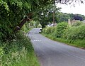
 Crewe Road, Church Lawton - geograph.org.uk - 3516012.jpg 640 × 438; 58 KB
-

-

-

-
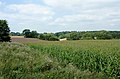
 Farmland north-east of Alsager, Cheshire - geograph.org.uk - 2866289.jpg 1,024 × 670; 441 KB
-
 Field of stubble - geograph.org.uk - 4296357.jpg 1,024 × 542; 190 KB
-

-
 Footpath leading to Lawton Manor - geograph.org.uk - 4579427.jpg 800 × 579; 184 KB
-
 Green Farm - Church Lawton - geograph.org.uk - 3990739.jpg 3,341 × 1,659; 2.68 MB
-
 Horseshoe Inn at Lawton Heath End - geograph.org.uk - 4582659.jpg 800 × 560; 108 KB
-
 House near Lawton Hall Farm - geograph.org.uk - 3990734.jpg 4,549 × 2,769; 6.03 MB
-
 Knowsley Lane crossing the canal - geograph.org.uk - 4579287.jpg 800 × 600; 143 KB
-
 Knowsley Lane near Hall Green - geograph.org.uk - 4568117.jpg 1,024 × 792; 301 KB
-
 Lawton Arms - geograph.org.uk - 3927110.jpg 2,855 × 1,924; 2.27 MB
-
 Lawton Arms in Alsager - geograph.org.uk - 4582679.jpg 800 × 599; 98 KB
-
 Liverpool Road West in Church Lawton - geograph.org.uk - 4582688.jpg 800 × 644; 150 KB
-
-
-
 Old Milepost by the A34 in Hall Green (geograph 5622740).jpg 1,050 × 1,565; 252 KB
-
 Painted oak on Sandbach Road North - geograph.org.uk - 4568139.jpg 2,000 × 3,008; 1.81 MB
-

-
 Path along Salt Line - geograph.org.uk - 4568155.jpg 2,000 × 3,008; 1.82 MB
-
 Railway cutting - geograph.org.uk - 4745160.jpg 640 × 426; 92 KB
-
 Railway line between Alsager and Kidsgrove - geograph.org.uk - 4749882.jpg 3,264 × 2,448; 2.99 MB
-
 Railway line towards Kidsgrove railway station - geograph.org.uk - 4568157.jpg 1,024 × 972; 305 KB
-

-
 Sandbach Road North, Church Lawton.jpg 3,692 × 2,472; 7.58 MB
-
 Sewage Works at Red Bull, Staffordshire - geograph.org.uk - 3124166.jpg 1,024 × 581; 513 KB
-
 Sewage works at Red Bull, Staffordshire - geograph.org.uk - 3124179.jpg 1,024 × 721; 532 KB
-
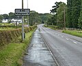
 The A34 Congleton Road North - geograph.org.uk - 4582716.jpg 800 × 577; 133 KB
-
 The Red Bull along Congleton Road South - geograph.org.uk - 4568144.jpg 1,024 × 830; 196 KB
-
 The Red Bull Hotel Pub, Church Lawton, Stoke on Trent - geograph.org.uk - 1949327.jpg 2,048 × 1,536; 538 KB
-

-
 Welcome to Cheshire - geograph.org.uk - 4568233.jpg 1,024 × 668; 167 KB


.jpg)


