Category:Church of Mont-Vully
| Object location | | View all coordinates using: OpenStreetMap |
|---|
 | |||||
| Upload media | |||||
| Instance of | |||||
|---|---|---|---|---|---|
| Part of | |||||
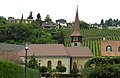
| Location | Môtier, Mont-Vully, See District, Canton of Fribourg, Switzerland | ||||
| Street address |
| ||||
| Heritage designation | |||||
 | |||||
Media in category "Church of Mont-Vully"
This category contains only the following file.
-
 Haut-Vully église Môtier.jpg 3,256 × 2,124; 1.66 MB